
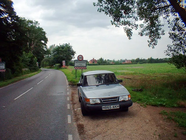
Bury Road in Hengrave
Bury Road in Hengrave in West Suffolk is a lit main road. The road has a sidewalk. It runs in a southeast-northwest direction and crosses The Links and The Green and ends at Mill Road, while the other end is a cul-de-sac. It connects Flempton and Hengrave. This road is part of the long-distance road "A1101". In the vicinity, there is among other things a tourist information. The nearest stop is Hengrave Hall. The bus line 16 stops here. Bury Road also exists in Elveden, Barnham, Brandon, Mildenhall and Icklingham.
- Road Type
- main road
- Speed Limit
- 30 mph
- Route
- southeast-northwest
Image
Roads nearby
Mill Road650 m
Bury RoadChurch
850 m
Mere Lane1,4 km
Chimney Mills1,4 km
Forge End1,5 km
Chestnut Close1,5 km
Aldridge Lane1,6 km
Hengrave Road1,6 km
Pound Meadow1,7 km
Dairy Drive1,7 km
Larks Gate1,7 km
The Green1,8 km
Pigeon Lane1,8 km
The DriftCulford
1,8 km
Rectory Meadow1,8 km
West Stow Road1,8 km
Benyon Gardens1,9 km
Tut HillThree Kings Roundabout
1,9 km
Cornwallis Close1,9 km
The Links1,9 km
Ingham RoadIcklingham Road
1,9 km
The StreetCulford Village Sign
2,2 km
Icklingham RoadCountry Park, West Stow Turning, West Stow Village Sign
2,3 km
Body of waters nearby
Stake Pond700 m
Moseleys Reservoir1,9 km
Flempton Pool2,0 km
Wilson's Flood2,2 km
Buildings nearby
Culford Telephone Exchange1,6 km
Hall Farm Barn1,7 km
Creative Education Centre1,8 km
Cafés nearby
The Coffee House1,6 km
Campsite nearby
West Stow Pods2,2 km
Commercial areas nearby
Flempton House1,5 km
Community centres nearby
Fornham All Saints Village Hall1,6 km
Fornham All Saints Community Centre1,8 km
Culford Village Hall2,2 km
Industrial areas nearby
C.J. Volkert Hengrave Depot1000 m
Fish Farm Industrial Estate2,0 km
Nature reserves nearby
Lackford Lakes1,9 km
Places of worship nearby
St John Lateran200 m
All Saints Church1,6 km
St Mary1,8 km
Saint Catherine of Alexandria1,8 km
Saint Mary's2,0 km
Pubs nearby
The Three Kings1,7 km
Residential areas nearby
Ingham Road Junction2,1 km
Restaurants nearby
Lucy's Restaurant1,6 km
Rivers nearby
Lark1000 m
Social facilities nearby
Thingoe Lodge1,5 km
Sports pitches nearby
headmaster's lodge tennis court1,7 km
 Public transport map Hengrave Legend
| Railway | |
| Bus | |
| Tram |
 Cycling map Hengrave Legend
| Cycle path | |
| Cycle lane on road | |
| Cycling on bus lane | |
| Bicycle street | |
| Cyclists allowed | |
| Cyclists allowed, good surface | |
| No cycling | |
| Cobblestones |
| Long-distance cycle route | (depending on scale) | |
| Long-distance cycle route |
 Walking map Hengrave Legend
| Path |
| Long-distance hiking trail | (depending on scale) | |
| Long-distance hiking trail | ||
| No pedestrians |