
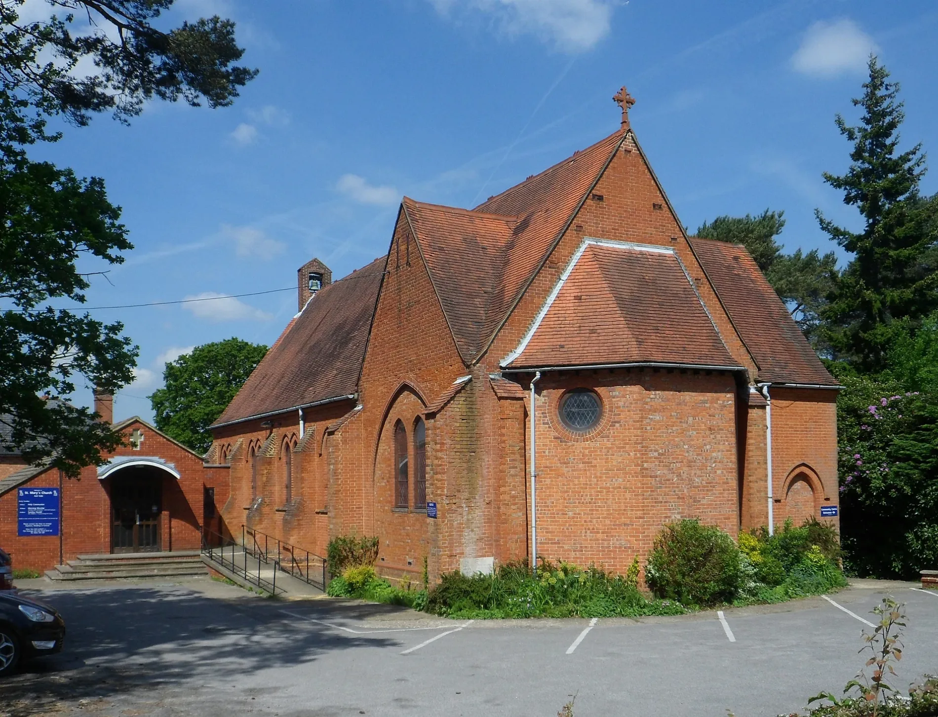
St Mary's Church in Ash, Surrey
St Mary's Church in Ash in Guildford is a Anglicana church (GU12 5JG). It is near Cuthbert Road and is also known as St Mary's Church, Ash Vale. The church belongs to the Diocese of Guildford.
- Postal Code
- GU12 5JG
- Amenity
- place of worship
- Building Type
- church
- Wheelchair Access
- yes
Image
Cafés
Ticket shops
Fast food restaurants
Bakeries
Motorcycle shops
Tourist information offices
Bus stops
Pharmacy
Platforms
Charity shops
E-cigarette shops
Convenience stores
Restaurants
Car dealerships
Newsagent's
Gift shops
Hairdressers
Bookmakers
Roads nearby
Penrose Gardens100 m
St. Mary's Road150 m
Waverley Gardens150 m
Wood Street150 m
Jubilee Drive150 m
Hutton Road200 m
Waverley Drive200 m
Edinburgh Close200 m
Springfield Road250 m
Scotland Farm Road250 m
Gables Close300 m
Pine Close300 m
Scotland Close300 m
Dorset Road350 m
Wentworth Crescent350 m
Firacre Road350 m
Heather Close350 m
Robin Close350 m
Chambers Road350 m
Cuthbert Road350 m
Orchard Close350 m
Richards Close350 m
Shackleton Close350 m
Enfield Road400 m
Rowcroft Close400 m
Elleray Court400 m
Newfield RoadAsh Vale
450 m
Heathvale Bridge Road450 m
Oaklea450 m
Prospect Road450 m
Gorselands Close450 m
Foxhurst Road500 m
Crescent Lane550 m
Vale RoadAshvale Grocer, Ash Vale Motorcycles, Shawfield Road, Heathvale Bridge Road, St. Marys Road, Napier Lane, La Vang Indian Gastronomy, Carriages Cafe, Ash Vale Railway Station, Arena Cars Ltd, Sanya Convenience Store
600 m
Milton Grange600 m
Northcote Road600 m
Wentworth Close600 m
Horseshoe Lane600 m
Kestrel Close600 m
Basingstoke Canal TowpathAsh Vale Junction, Waterways in the Sky
600 m
Chart House Road800 m
Body of waters nearby
Basingstoke Canal200 m
Community centres nearby
1st Ash Vale Scouts50 m
St. Mary's Community Centre50 m
Dental practices nearby
Ash Vale Dental Surgery500 m
Military areas nearby
Rifle Range No 1600 m
Rifle Range No 3700 m
Pubs nearby
The Swan300 m
Sports centres nearby
Camberley Martial Arts350 m
| Diocese | Diocese of Guildford |
|---|---|
| Located in | Ash |
| Country | United Kingdom |
 Public transport map Ash Legend
| Railway | |
| Bus | |
| Tram |
 Cycling map Ash Legend
| Cycle path | |
| Cycle lane on road | |
| Cycling on bus lane | |
| Bicycle street | |
| Cyclists allowed | |
| Cyclists allowed, good surface | |
| No cycling | |
| Cobblestones |
| Long-distance cycle route | (depending on scale) | |
| Long-distance cycle route |
 Walking map Ash Legend
| Path |
| Long-distance hiking trail | (depending on scale) | |
| Long-distance hiking trail | ||
| No pedestrians |