
Hambledon Village Shop in Hambledon, Surrey
Hambledon Village Shop in Hambledon in Waverley is a convenience store, The Cricket Green (GU8 4HF). Hambledon Village Shop is also known as Hambledon, Surrey. Ⓦ.
- Postal Code
- GU8 4HF
- Street
- The Cricket Green
- Amenity
- café
- Building Type
- retail building
- Shop
- convenience store
Image
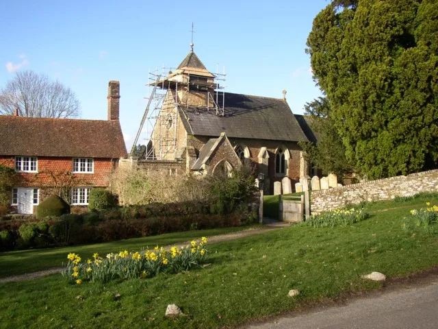
Tourist information offices
Bus stops
Benches
Roads nearby
Vann LaneHambledon Post Office
150 m
The Cricket Green200 m
Malthouse LaneHambledon
400 m
Warren Lane400 m
Beech Hill500 m
Hambledon Park500 m
Woodlands Road550 m
Lane End600 m
Wormley Lane700 m
Hambledon RoadCrossroads
700 m
New RoadLane End
950 m
Sweetwater Lane1,0 km
Roundals Lane1,1 km
Church LaneLime Kiln
1,2 km
Petworth RoadKing Edwards School, Gurdon's Lane, Enton Turning, Wheelerstreet, The Star, Witley SCC Depot, Rodborough School, The Star Inn, Crossways, T.E. Francis, Kay's Witley Village Stores, Upper Cut, Witley, War Memorial
1,2 km
Combe Lane1,3 km
Greensand Way1,3 km
Enton Lane1,3 km
Culmer Lane1,4 km
Feathercombe Lane1,6 km
Land Use nearby
Cuckoo Corner1000 m
Body of waters nearby
Sweetwater Pond1000 m
Buildings nearby
Vann Lane Piggeries1000 m
The Village Spirit Collective1,1 km
Car repair shops nearby
Phillips Of Wormley800 m
Commercial buildings nearby
Telephone Exchange1,1 km
Community centres nearby
Hambledon Village Hall250 m
Heaths nearby
Buss's Common900 m
Houses nearby
Orchard Farm750 m
Hurst Cottage1,2 km
Bonners1,4 km
Bonners Cottage1,4 km
Royton1,4 km
Hazels1,4 km
Barn Cottage1,4 km
Vannmoor Estate1,5 km
Industrial areas nearby
The Old Coal Yard1,1 km
Kindergartens nearby
Hambledon Nursery School1000 m
Parks nearby
Nutbourne Park1,5 km
Pavilions nearby
Hambledon Cricket Pavilion200 m
Places of worship nearby
St Peter's Church Hambledon1,1 km
Pubs nearby
The Merry Harriers1,0 km
Railway lines nearby
Portsmouth Direct Line1,4 km
Residential areas nearby
Nutbourne Cottages1,3 km
Schools nearby
St Dominic's School300 m
Sports pitches nearby
Hambledon Cricket Green200 m
Woodlands nearby
Blunden's Wood1,4 km
Haseldons1,6 km
Other nearby
Hill Top Farm Airstrip900 m
| Area | 11.1 km² |
|---|---|
| Located in | Waverley |
| Country | United Kingdom |
| Population | 770 |
 Public transport map Hambledon Legend
| Railway | |
| Bus | |
| Tram |
 Cycling map Hambledon Legend
| Cycle path | |
| Cycle lane on road | |
| Cycling on bus lane | |
| Bicycle street | |
| Cyclists allowed | |
| Cyclists allowed, good surface | |
| No cycling | |
| Cobblestones |
| Long-distance cycle route | (depending on scale) | |
| Long-distance cycle route |
 Walking map Hambledon Legend
| Path |
| Long-distance hiking trail | (depending on scale) | |
| Long-distance hiking trail | ||
| No pedestrians |