
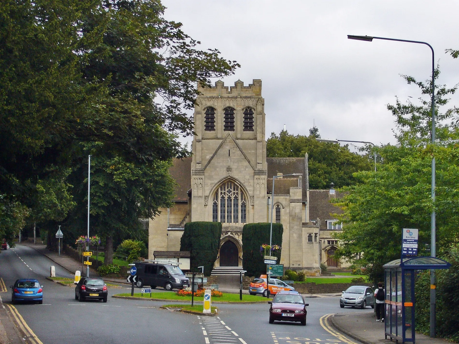
Four Oaks Methodist Church in Sutton Coldfield
Four Oaks Methodist Church in Sutton Coldfield in Birmingham is a Methodista church, Lichfield Road (B74 2UU).
- Postal Code
- B74 2UU
- Street
- Lichfield Road
- Amenity
- place of worship
- Building Type
- place of worship
Image
Hairdressers
Bus stops
Roads nearby
Lichfield RoadLichfield Rd / Mere Green, Lichfield Rd / Harland Rd, Lichfield Rd / Butlers Lane, Lichfield Rd / Hill Hook Rd, Pizza Traders, Lichfield Rd / Hillside Road, Lichfield Rd / Bishops Way, Lichfield Rd / Tamworth Rd, Lichfield Rd / Barleys, Lichfield Rd / Watford Gap Island, Lichfield Rd / Bishop Vesey School, Lichfield Road opposite College, Lichfield Rd / Blackroot Rd, Lichfield Rd / Four Oaks Rail Stn, Lichfield Rd / Jordan Rd, Lichfield Rd / Cremorne Rd, Anthony Edward Hair, Lichfield Rd / Little Sutton La, Royal Town Of Sutton Coldfield
50 m
Four Oaks Road100 m
Cedarwood100 m
Station DriveFour Oaks, Four Oaks Train Station
100 m
Pine Leigh150 m
Hampton Drive150 m
Hazelmere Drive150 m
Ridgewood Drive200 m
Woodfield Close200 m
Heather Court Gardens200 m
Ravenswood Close250 m
Wentworth Court250 m
Bowlas Avenue300 m
Hawkesford Close350 m
Wentworth Road350 m
Queenswood Road350 m
Dower Road400 m
Irnham Road400 m
Mountford Drive400 m
Jordan Close450 m
The Mansions Mews450 m
Cedar Bridge Croft450 m
Oaklands Road450 m
Cheltenham Mews450 m
Ley Hill Road500 m
Devereux Road500 m
Rocklands Drive550 m
Kenilworth Close550 m
Trinity Road550 m
Nathan Close550 m
Blackroot RoadHartopp Gate
600 m
Beaconsfield Road600 m
Norfolk Gardens650 m
Kingston Court650 m
Norfolk Road650 m
Hayward Road700 m
Buildings nearby
Four Oaks Methodist Church Hall50 m
Barbershop550 m
Car parks nearby
Four Oaks Station Car Park150 m
Clothing shops nearby
Mocha Botique550 m
Hairdresser's nearby
Hardings Hairdresser550 m
Opticians nearby
Andrew Martin & Associates - Optometrists550 m
Pubs nearby
The Green House450 m
Residential areas nearby
Orient Place200 m
Residential buildings nearby
Nicky's Kitchen350 m
Graydon Court550 m
Retail buildings nearby
Cream & Browne400 m
Schools nearby
Coppice Primary School300 m
Langley School400 m
| Located in | Sutton Coldfield |
|---|---|
| Country | United Kingdom |
 Public transport map Sutton Coldfield Legend
| Railway | |
| Bus | |
| Tram |
 Cycling map Sutton Coldfield Legend
| Cycle path | |
| Cycle lane on road | |
| Cycling on bus lane | |
| Bicycle street | |
| Cyclists allowed | |
| Cyclists allowed, good surface | |
| No cycling | |
| Cobblestones |
| Long-distance cycle route | (depending on scale) | |
| Long-distance cycle route |
 Walking map Sutton Coldfield Legend
| Path |
| Long-distance hiking trail | (depending on scale) | |
| Long-distance hiking trail | ||
| No pedestrians |