
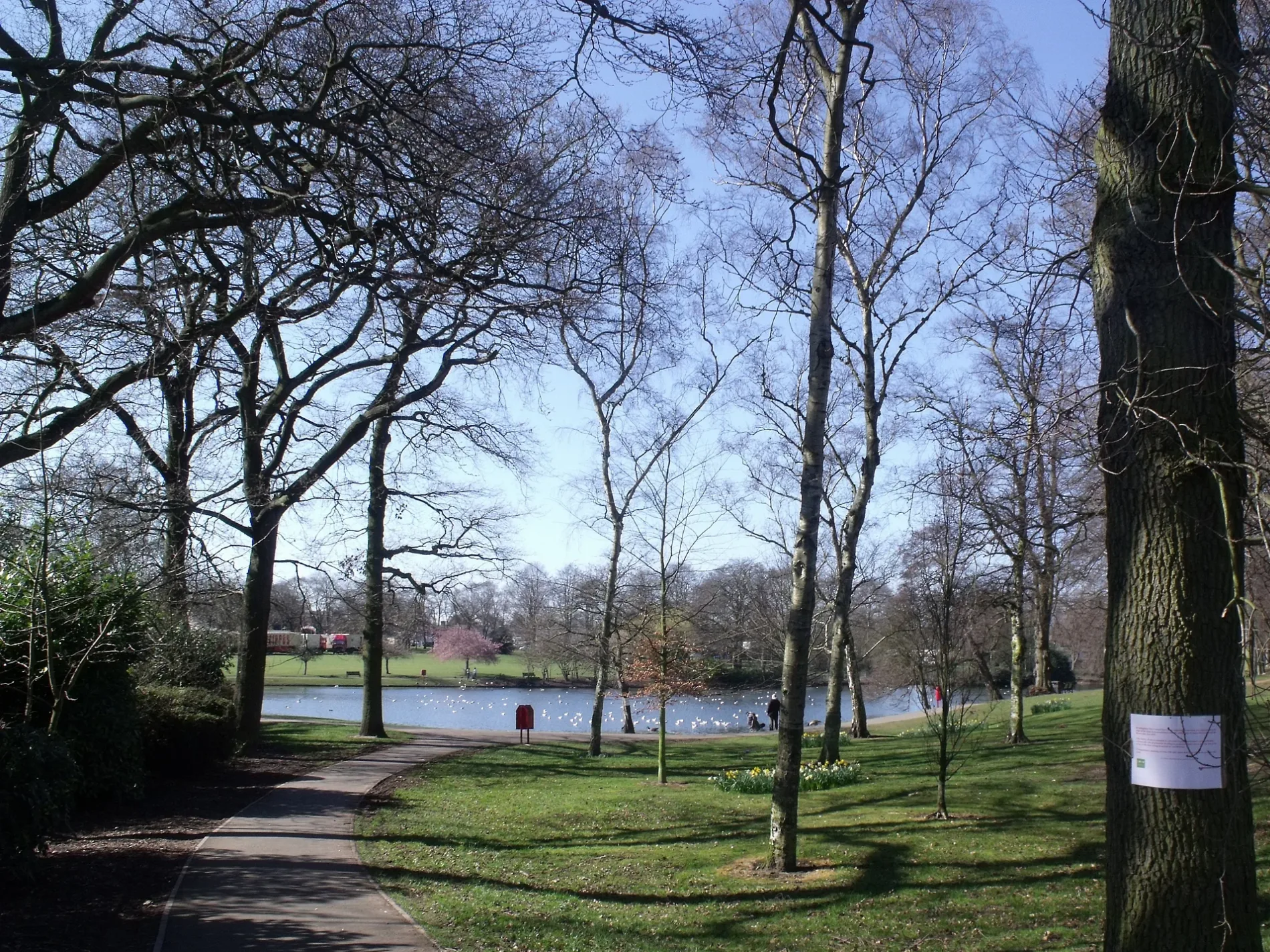
Swanshurst Park in Birmingham
Swanshurst Park in Birmingham is a park (Birmingham City Council). Swanshurst Park is near Charlecott Close. Ⓦ.
- Leisure
- park
- Operator
- Birmingham City Council
Image
Roads nearby
Milner Way150 m
The Hurst150 m
Leylan Croft200 m
Bibsworth Avenue250 m
Charlecott Close250 m
Willersey Road250 m
Heythrop Grove250 m
Swanshurst LaneSwanshurst Lane / Meadow View, Swanshurst Lane / Bibsworth Avenue, Swanshurst Lane / Wake Green Rd
300 m
Colebourne Road350 m
Thirlmere Drive350 m
Comber Croft400 m
The John Morris Jones Walkway400 m
Sandy Croft400 m
Brook LaneBrook Lane / Coldbath Rd, Hot Spot, Brook Lane / Swanshurst School, Brook Lane / Billesley Hall, Brook Lane / The Billesley
450 m
Wake Green RoadWake Green Rd / Gracewell Rd, Wake Green Rd / Sarehole Mill, Wake Green Rd / Church Rd, Wake Green Rd / Mayfield Court, Wake Green Rd / Billesley Lane, Wake Green Rd / Wake Green Rd, Gate A, Chemycare Pharmacy, Satori, Wake Green Rd / Mackenzie Rd, Cascading Mountain (Wake Green Interchange), Wake Green Rd / Yardley Wood Rd
450 m
Knutswood Close500 m
Coleside Avenue500 m
Cole Bank RoadCole Bank Rd / Sarehole Mill, Sarehole Mill, The Millstream Way, Cole Bank Rd / Sarehole Rd, Cole Bank Rd / Southam Rd
550 m
Sarehole RoadSarehole Rd / Southam Rd, Sarehole Rd / Robin Hood Lane, Sarehole Rd / Sarehole Mill
550 m
Robin Hood LaneRobin Hood Lane / Highfield Rd Island, Robin Hood Lane / Etwall Rd, Robin Hood Lane / Newey Rd, Robin Hood Lane / Webb Lane, Robin Hood Lane / Sherwood Rd, Tesco Express, Highfield Chippy, Robin Hood Golf Centre, Sherwood Motorcycles
550 m
Southam Road600 m
Robin Hood Crescent650 m
Webb Lane700 m
Cole Valley RoadCole Valley News
700 m
Body of waters nearby
Mill Pond500 m
Buildings nearby
Rigsfitness Gym300 m
Coleside Avenue Common Room500 m
Cafés nearby
The Hungry Hobb350 m
Convenience stores nearby
Spend & Save350 m
Fast food restaurants nearby
Szechuan House350 m
Pizza Picazzo350 m
Swan Fish Bar350 m
Hairdresser's nearby
Robertos350 m
halo350 m
Courtney400 m
Laundries nearby
Lucy's Laundry350 m
Museum nearby
Sarehole Mill500 m
Newsagent's nearby
Brook Lane Newsagent350 m
Office buildings nearby
Lowson Ward400 m
Parks nearby
The Shire Country Park550 m
The Dingles700 m
Railway lines nearby
Birmingham to Stratford Line600 m
Residential buildings nearby
Lance Court300 m
Brandon Court350 m
Retail buildings nearby
General Tool Hire350 m
HGCC Education Centre350 m
Streams nearby
Coldbath Brook450 m
River Cole600 m
Supermarkets nearby
The Co-operative Food350 m
| Located in | Birmingham |
|---|---|
| Country | United Kingdom |
 Public transport map Birmingham Legend
| Railway | |
| Bus | |
| Tram |
 Cycling map Birmingham Legend
| Cycle path | |
| Cycle lane on road | |
| Cycling on bus lane | |
| Bicycle street | |
| Cyclists allowed | |
| Cyclists allowed, good surface | |
| No cycling | |
| Cobblestones |
| Long-distance cycle route | (depending on scale) | |
| Long-distance cycle route |
 Walking map Birmingham Legend
| Path |
| Long-distance hiking trail | (depending on scale) | |
| Long-distance hiking trail | ||
| No pedestrians |