
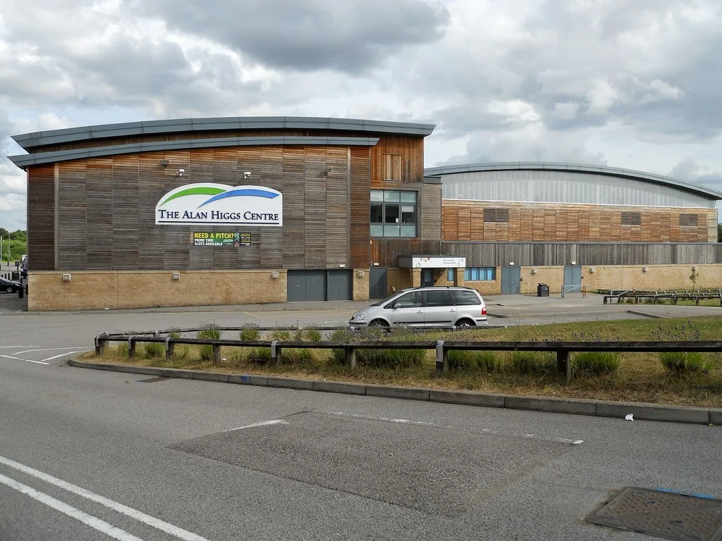
The Alan Higgs Centre in City of Coventry
The Alan Higgs Centre in Coventry is a building. The Alan Higgs Centre is near The Moorfield. Ⓦ.
- Building Type
- building
Image
Roads nearby
Jasmine Grove250 m
Barley Place300 m
Sowe Valley Footpath300 m
The Barley LeaThe Barley Lea / The Farmstead, The Barley Lea / Acorn St, The Barley Lea / Jasmine Grove
300 m
Dogberry Close350 m
Euston Crescent350 m
The Coppice350 m
The MoorfieldThe Moorfield / Mitchell Close, The Moorfield / The Barley Lea, The Moorfield / Roundhouse Rd
400 m
The Farmstead450 m
Langbank AvenueLangbank Ave / Garth Crescent, Langbank Ave / Corpus Christi School
450 m
The Greenfield500 m
The Lindfield550 m
Allard WaySpeed Camera
550 m
Treforest Road600 m
The Barley Place600 m
St Catherine's Close600 m
Quinn Close600 m
Michell Close650 m
The Vale650 m
The Bentree650 m
Wheler Road650 m
Fairfield Court700 m
Chatham Close700 m
Acorn StreetStoke Aldermoor
750 m
Hawker Close750 m
The Cornfield750 m
Whitworth AvenueBudgens
800 m
Luff Close800 m
Lowfield Road800 m
Princes Close850 m
Round House Road900 m
The Boxhill950 m
Siddeley Avenue950 m
Amenities nearby
Bright kids600 m
Apartment buildings nearby
Barley Lea House600 m
Buildings nearby
Klever Kids Pre-School600 m
RS Electronics700 m
Clinics nearby
Stoke Aldermoor Medical Centre650 m
Clothing shops nearby
Matalan700 m
Constructions nearby
Sphinx housing development850 m
Places of worship nearby
St Catherine's Church, Stoke Aldermoor650 m
Railway lines nearby
Rugby–Birmingham–Stafford Line (West Coast Main Line)150 m
West Coast Main Line200 m
Recreation grounds nearby
Pinley FieldsStoke Aldermoor Foodbank
600 m
Rivers nearby
River Sowe300 m
School buildings nearby
Aldermoor Farm Primary School750 m
Sports centres nearby
Alan Higgs Sports Centre200 m
Sports pitches nearby
Alan Higgs Skatepark150 m
Woodlands nearby
Rock Spinney350 m
| Country | United Kingdom |
|---|
 Public transport map Coventry Legend
| Railway | |
| Bus | |
| Tram |
 Cycling map Coventry Legend
| Cycle path | |
| Cycle lane on road | |
| Cycling on bus lane | |
| Bicycle street | |
| Cyclists allowed | |
| Cyclists allowed, good surface | |
| No cycling | |
| Cobblestones |
| Long-distance cycle route | (depending on scale) | |
| Long-distance cycle route |
 Walking map Coventry Legend
| Path |
| Long-distance hiking trail | (depending on scale) | |
| Long-distance hiking trail | ||
| No pedestrians |