
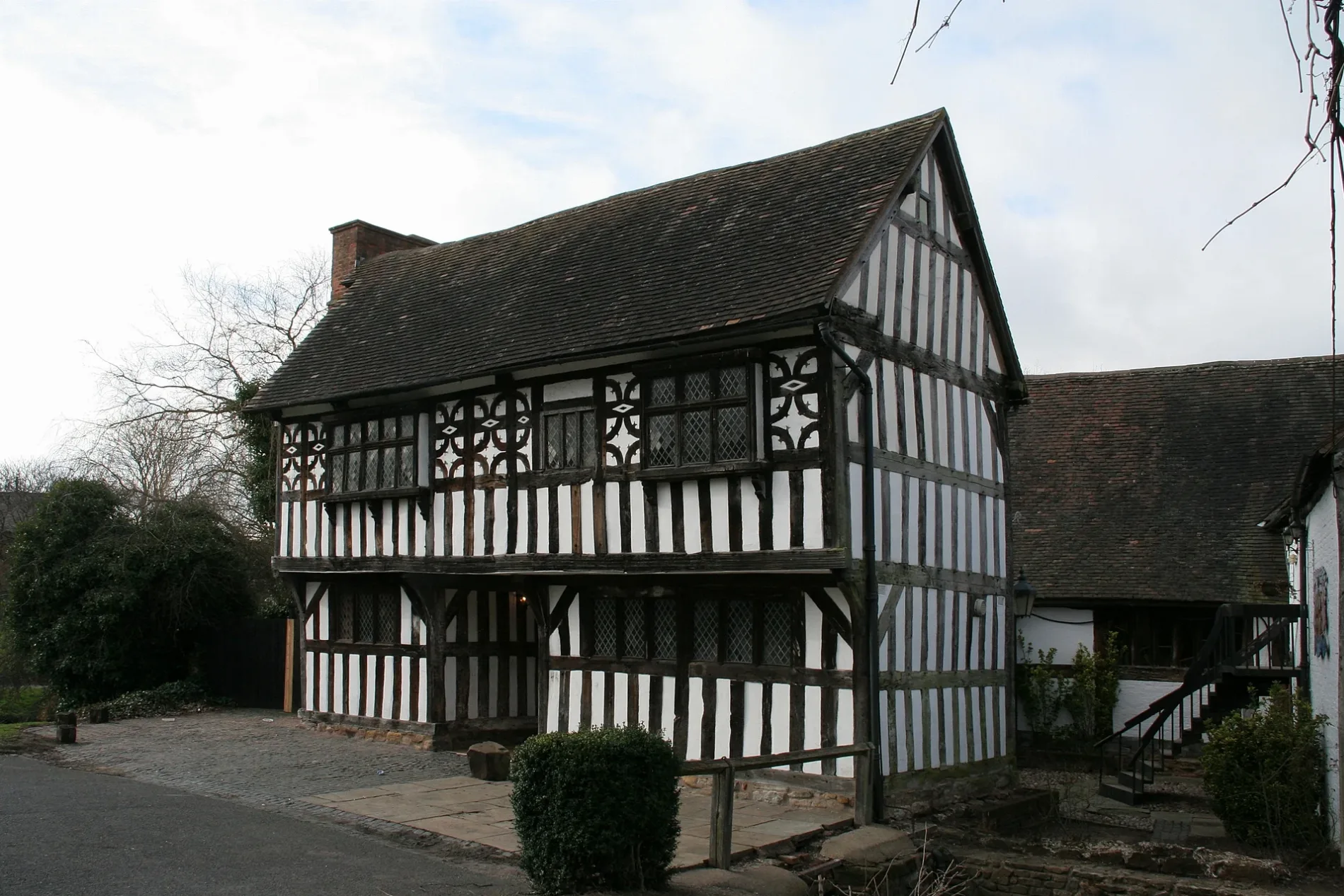
Bromwich Hall in Sandwell
Bromwich Hall in Sandwell is a manor house (listed building), Hall Green Road (B71 2EA). Ⓦ.
- Postal Code
- B71 2EA
- Street
- Hall Green Road
- Building Type
- building
Image
Newsagent's
Off-licences
Hairdressers
Pet shops
Bus stops
Fast food restaurants
Cafés
Restaurants
Convenience stores
Roads nearby
Crankhall LaneChina Garden, Crankhall Lane / Price Rd, Crankhall Lane / Woden Rd East, Drink Buster, Fryer Tuck, Crankhall Lane Post Office, Crankhall Lane / Hall Green Rd
150 m
Hall Green Wharf200 m
Crankhall Lane Bridge200 m
Hampton Court200 m
Westminster RoadHalo Hair, Naminos Pizza, Oscott Pets, Stone Cross Balti, Westminster Rd / Marsh Lane, Westminster Rd / Canterbury Rd
200 m
Beverley RoadBeverley Rd / Lincoln Rd, Beverley Rd / Walsall Rd, Bartrams, Jade Garden, Preeti Eyes Clinic, Recycle Smart, Rice 'n' Spice, Stone Cross Motor Spares, Ultra Vapour, Worton Kelly, snapdragon.com
250 m
Moorlands Road250 m
Crankhall Lane Basin Bridge250 m
Eldalade Way300 m
Roman Way350 m
Ripon Drive350 m
Booth Road350 m
Hall Green RoadHall Green Rd / Holy Cross Church, Hall Green Rd / Crankhall Lane, Betfred, Ideal Homecare, Hall Green Rd / The Golden Lion, Hydes Rd / Ryddings Lane, Quality Chicken, Ruby News, The Chip Box
350 m
Lincoln Road350 m
Manor RoadLondonderry Lane Post Office, Manor Rd / Lee Gardens, Manor Rd / Keir Rd, Manor Rd / Carisbrooke Rd, Manor Rd / Bartleet Road
350 m
Wells Close400 m
Melrose Avenue400 m
Crockford Road450 m
Griffiths Road450 m
Hydes RoadHydes Rd / Moorlands Rd, Hydes Rd / Hydes Rd, Hydes Rd / Shaftesbury Rd, Hydes Rd / Wodensborough High School, Hydes Rd / Holden Rd, Hydes Rd / Griffiths Rd
450 m
Bishop Road450 m
Warner Road550 m
Millfields RoadMillfield Rd / Rydding Lane, Millfield Rd / Chester Road
550 m
Johnson RoadMorrisons Daily
550 m
Bassett Road550 m
Hateley Heath Aqueduct600 m
Dorsett Road600 m
Conway Avenue600 m
Keir Road650 m
Windsor RoadWindsor Rd / Pembroke Road, Windsor Rd / Millfields Road
650 m
Rydding LaneRydding Lane / Gordon Avenue, Rydding Lane / Millfields Rd
700 m
Walton RoadWalton Rd / Price Rd
750 m
Winchester RoadCrookhay Lane / Winchester Rd
800 m
Freeman RoadFreeman Rd / St Francis Church
800 m
Woden Road SouthWoden Road South / Hydes Rd, Woden Road South / Chestnut Rd
850 m
Moor StreetMoor St / Bowater St, West Bromwich Leisure Centre
900 m
Richard Williams Road900 m
Allotment gardens nearby
Moorlands Allotments200 m
Body of waters nearby
Millfields Pool500 m
Canals nearby
Tame Valley Canal200 m
Acqueduct 2 (Hately Heath Aqueduct)600 m
Industrial buildings nearby
J H Lavender & Co250 m
Nature reserves nearby
Menzies Local Nature Reserve600 m
Parks nearby
Hall Green50 m
Places of worship nearby
St Francis of Assisii650 m
School buildings nearby
The Priory Primary School500 m
Sports pitches nearby
Churchhill Crown Green Bowling Club650 m
Streams nearby
Hobnail Brook600 m
Woodlands nearby
Black Country Millennium Forest900 m
| Located in | Sandwell |
|---|---|
| Country | United Kingdom |
| Location | West Bromwich |
 Public transport map Sandwell Legend
| Railway | |
| Bus | |
| Tram |
 Cycling map Sandwell Legend
| Cycle path | |
| Cycle lane on road | |
| Cycling on bus lane | |
| Bicycle street | |
| Cyclists allowed | |
| Cyclists allowed, good surface | |
| No cycling | |
| Cobblestones |
| Long-distance cycle route | (depending on scale) | |
| Long-distance cycle route |
 Walking map Sandwell Legend
| Path |
| Long-distance hiking trail | (depending on scale) | |
| Long-distance hiking trail | ||
| No pedestrians |