
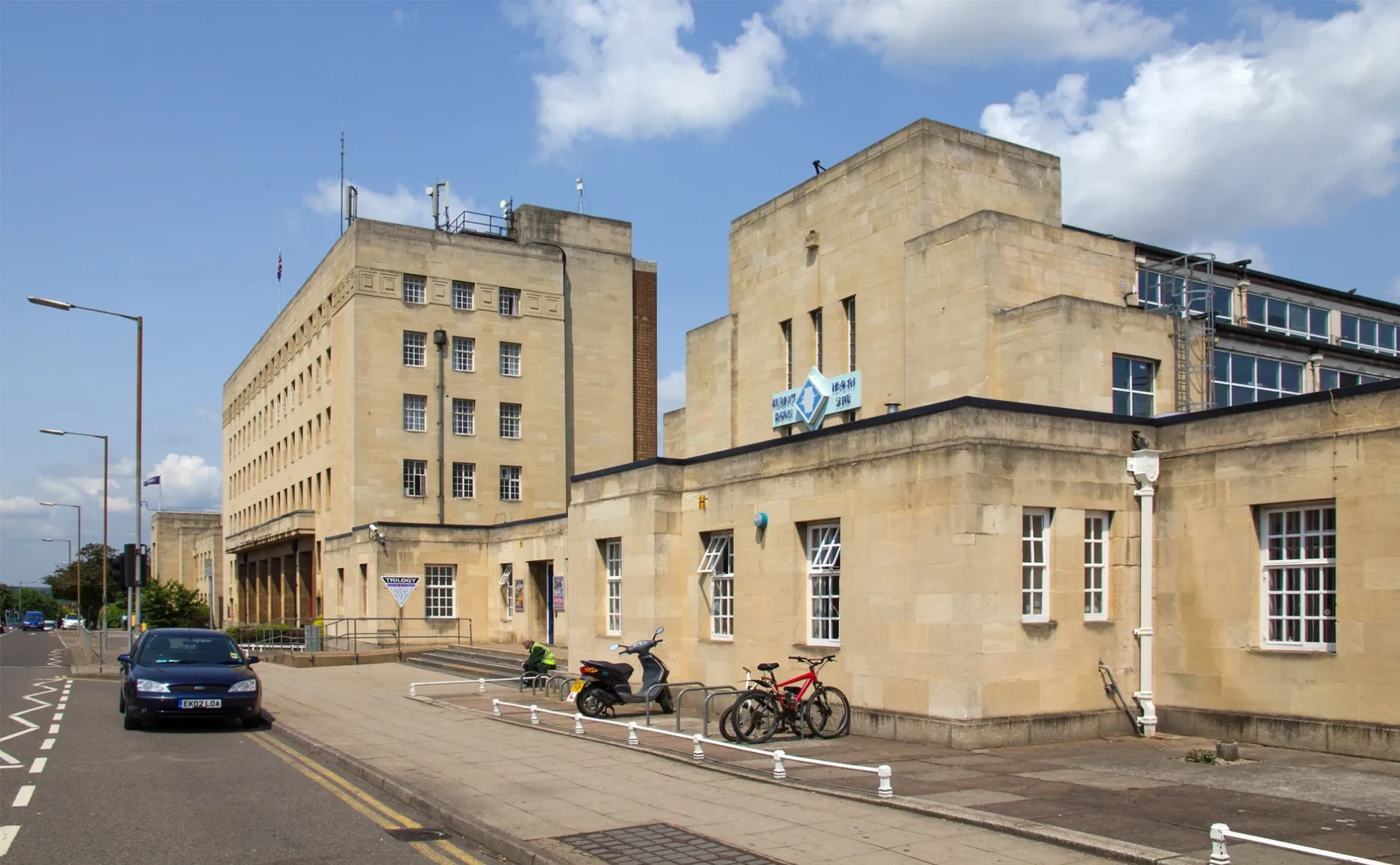
Mounts Baths in Northampton
Mounts Baths in West Northamptonshire, Northampton is a sports centre, Upper Mounts (NN1 3DN). Ⓦ.
- Postal Code
- NN1 3DN
- Street
- Upper Mounts
- Building Type
- building
- Leisure
- sports centre
Image
Restaurants
Police stations
Bus stops
Convenience stores
School
Pubs
Car repair shops
Courthouse
Bar
Fast food restaurants
Places of worship
Cafés
Fire station
Supermarkets
Hardware shops
Social facility
Roads nearby
Margaret Street50 m
Cranstoun StreetAmit Auto Drive
50 m
Robert StreetThe Market Sanctuary
100 m
Connaught Street100 m
Upper MountsMounts Fire Station, Campbell Square Police Station, Magistrates Court
100 m
Earl StreetBalti King, Earl Street Mini Market, Continental Supermarket & Halal Butcher
150 m
William Street200 m
Victoria StreetCoach Park
200 m
Church Lane200 m
Thomas StreetChrist Apostolic Church International Northampton Assembly
200 m
Baliff Street250 m
Bailiff StreetNorthampton Hope Centre, Bailiff Street Mini Market, Marco Polo Euro Market, Ping Chinese, Vocal & Instrumental Club
250 m
Oak Street250 m
Elm Street250 m
Newland250 m
Deal Street250 m
Campbell StreetMounts Health Centre Pharmacy, Golden Bowl Chinese Takeaway, Regent Hair Art
250 m
Latymer Court300 m
Deal Court300 m
Ash StreetThe Garibaldi Hotel, Douce, John Smith Centre
300 m
Regent SquareRegent Pharmacy, The Edge of Town, Regent Food and Wine, Mind, Up All Night, Marseille
350 m
Barrack RoadLazeez, Old China, Indian Mirchi, Little Europe, Calabash Hut, Chivitos Kebabs, Fish & Chips, Marriott Street, Langham Place Surgery, RAD Clinics Northampton
350 m
Lawrence Court350 m
Temple Bar350 m
Sheep Street400 m
Louise RoadThe Bat & Wickets
450 m
Lorne RoadRoyal Navy & Marine Assoc, Lorne Road Mini Market, Coral, Your favourites, Preemaxi, Imambargah Dua-e-Zahra AGHA UK
450 m
Broad Street450 m
Newland WalkHMV, River Island, Eurochange, The Body Shop, Cards Direct, WHSmith, Quiz, Muffin Break, Menkind, Cool Stuff, Pandora, iStore, The Xmas Store, Michael Jones, Auntie Anne's Pretzel
450 m
The ParadeBoots, H&M, Cancer Research, Eden Mobility, Betfred, Museum of Leathercraft
500 m
DraperyThe Bear, Al Fairoz Kebabish, Select Convenience, Fat Burgers, Tops Pizza, Royal Peri Peri, Cancer Research, Drapery Bay 16, Sam's Chicken, Taco Bell, Pretty Nails, Drapery Bay 19, KFC, Oriental Garden, The Kabin, Les Olives, Subway, O'Neills Bar, Naked, Phone Stop, Mobile Solution
500 m
Apartment buildings nearby
Northampton House250 m
Banks nearby
Santander500 m
Bars nearby
Zapato Lounge400 m
Building under constructions nearby
The Clock House250 m
Buildings nearby
Simon de Senlis200 m
Glass Northampton200 m
Charity shops nearby
RSPCA500 m
Convenience stores nearby
Best Pol Delicatessen400 m
Northampton Health Store500 m
Courthouses nearby
Crown and County Courts150 m
Doctor's practice nearby
Mounts Medical Centre300 m
Places of worship nearby
Church of the Holy Sepulchre300 m
AL-Jamat-Ul-Muslimin of Bangladesh450 m
Pubs nearby
The Charles Bradlaugh100 m
Northampton Working Mens Club350 m
Restaurants nearby
Wok Inn350 m
Shopping malls nearby
Market Walk450 m
Theatres nearby
The Roadmender450 m
| Heritage designation | Grade II listed building |
|---|---|
| Located in | Northampton |
| Country | United Kingdom |
 Public transport map Northampton Legend
 | Railway | |
| Bus | |
| Tram |
 Cycling map Northampton Legend
 | Cycle path | |
| Cycle lane on road | |
| Cycling on bus lane | |
| Bicycle street | |
| Cyclists allowed | |
| Cyclists allowed, good surface | |
| No cycling | |
| Cobblestones |
| Long-distance cycle route | (depending on scale) | |
| Long-distance cycle route |
 Walking map Northampton Legend
 | Path |
| Long-distance hiking trail | (depending on scale) | |
| Long-distance hiking trail | ||
| No pedestrians |