Mid Sussex

This page is the City map of Mid Sussex, a district in West Sussex, England, showing roads, paths and places across the region. Mid Sussex covers approximately 334.0 square kilometres and had about 149,716 residents in 2018. Population increased from 141,200 in 2012 to 154,930 in 2022. The district contains 24 subregions, ranging from East Grinstead and Haywards Heath to villages on the northern edge of the South Downs.

City map Mid Sussex
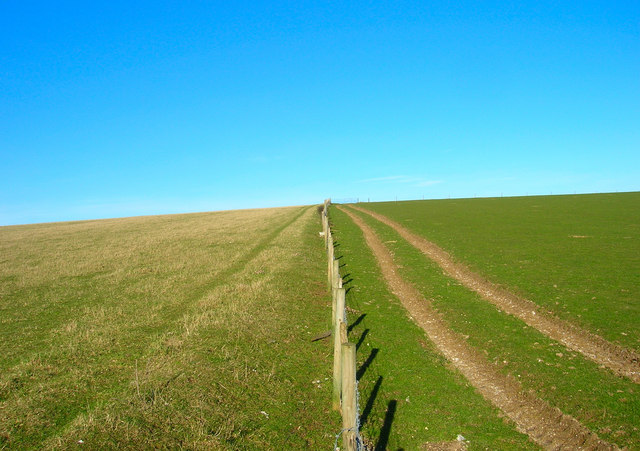
Simon Carey, CC BY-SA 2.0 – Wikimedia Commons

East Grinstead

East Grinstead is a town and civil parish in West Sussex, within Mid Sussex District. Its recorded population is 26,383, and its administrative area covers approximately 24.43 square kilometres.

The town lies in the northeastern part of West Sussex near the borders with Surrey, Kent and East Sussex. East Grinstead is one of the largest urban settlements in Mid Sussex and has an administrative level 10 boundary.

Ashurst Wood

Ashurst Wood is a village in West Sussex, England, located in the northeastern part of Mid Sussex. It has a recorded population of 1,805 and covers approximately 2.51 square kilometres.

The village is close to East Grinstead and lies near the county boundary with East Sussex. In the regional map, Ashurst Wood is represented as an administrative level 10 subregion within Mid Sussex District.

Worth

Worth is a civil parish in Mid Sussex, West Sussex, with a recorded population of 10,892. It includes settlements in the northern part of the district near Crawley and the A23 corridor.

The parish is part of the built-up area around Crawley, which lies immediately north of Mid Sussex in West Sussex. Worth has an administrative level 10 boundary in the regional map.

West Hoathly

West Hoathly is a village in West Sussex with a recorded population of 2,052. Its administrative area covers approximately 21.39 square kilometres.

The village is situated in the northern part of Mid Sussex, within the wooded High Weald landscape. West Hoathly is an administrative level 10 subregion and lies between settlements such as Ardingly and East Grinstead.

Horsted Keynes

Horsted Keynes is a village in West Sussex with approximately 1,500 residents. Its administrative area covers about 15.81 square kilometres.

The village lies in the northeastern part of Mid Sussex within the High Weald, a landscape extending across Sussex and Kent. Horsted Keynes has administrative level 10 status in the regional structure.

Turners Hill

Turners Hill is a village and civil parish in Mid Sussex District, West Sussex. It has a recorded population of 1,808 and covers approximately 13.90 square kilometres.

The parish is located between Crawley, East Grinstead and the central settlements of Mid Sussex. Its administrative level 10 area forms part of the High Weald region of southeastern England.

Lindfield Rural

Lindfield Rural is a civil parish in West Sussex with a recorded population of 3,642. The parish covers approximately 19.81 square kilometres in the central-northern part of Mid Sussex.

Its territory surrounds rural areas near Lindfield and Haywards Heath and lies within the High Weald landscape. Lindfield Rural is mapped as an administrative level 10 subregion.

Lindfield

Lindfield is a village and civil parish in Mid Sussex, West Sussex, with a recorded population of 6,089. Its administrative area covers approximately 2.24 square kilometres.

The village is located immediately north of Haywards Heath and close to the River Ouse catchment. Lindfield has administrative level 10 status and forms one of the more densely settled village areas in central Mid Sussex.

Haywards Heath

Haywards Heath is a town in West Sussex with a recorded population of 30,826. Its area covers approximately 9.75 square kilometres, making it one of the largest population centres in Mid Sussex.

The town lies in the centre of the district between Burgess Hill and East Grinstead. Haywards Heath is served by a railway station on the London–Brighton route and has administrative level 10 status in the regional map.

Ardingly

Ardingly is a village in West Sussex with a recorded population of 1,878. Its administrative area covers approximately 16.09 square kilometres in northern Mid Sussex.

The village is known for its position near Ardingly Reservoir and Wakehurst, the major botanical garden estate in West Sussex. Ardingly lies within the High Weald and is represented as an administrative level 10 subregion.

Burgess Hill

Burgess Hill is a town in West Sussex with a recorded population of 32,491. Its area covers approximately 9.47 square kilometres, making it the largest population centre listed among the Mid Sussex subregions.

The town lies in the southern half of the district between Haywards Heath and Hassocks. Burgess Hill is connected to the wider region by the London–Brighton railway corridor and has administrative level 10 status.

Ansty and Staplefield

Ansty and Staplefield is a civil parish in West Sussex with a recorded population of 2,765. It covers approximately 38.69 square kilometres, the largest recorded area among the listed Mid Sussex subregions.

The parish occupies land north of Cuckfield and Haywards Heath, extending across the High Weald. Ansty and Staplefield has administrative level 10 status within Mid Sussex District.

Cuckfield

Cuckfield is a village in West Sussex with a recorded population of 3,768. Its administrative area covers approximately 4.32 square kilometres.

The village lies west of Haywards Heath and near the upper valleys of the River Ouse catchment. Cuckfield is an administrative level 10 subregion in the central part of Mid Sussex District.

Hassocks

Hassocks is a village in West Sussex with a recorded population of 8,499. Its administrative area covers approximately 10.88 square kilometres.

The village lies at the foot of the South Downs, south of Burgess Hill and north of Brighton and Hove. Hassocks is connected to the London–Brighton railway line and has administrative level 10 status within Mid Sussex.

Hurstpierpoint and Sayers Common

Hurstpierpoint and Sayers Common is a civil parish in West Sussex with a recorded population of 7,843. It covers approximately 20.30 square kilometres on the southern side of Mid Sussex.

The parish extends from Hurstpierpoint towards Sayers Common and lies close to the northern escarpment of the South Downs. It is an administrative level 10 subregion between Hassocks and the boundary with Brighton and Hove.

Balcombe

Balcombe is a village in West Sussex with a recorded population of 1,903. Its administrative area covers approximately 21.05 square kilometres in the northern part of Mid Sussex.

The village lies near the River Ouse and Balcombe Viaduct, a notable railway structure carrying the London–Brighton line across the Ouse valley. Balcombe is surrounded by the wooded High Weald and has administrative level 10 status.

Slaugham

Slaugham is a village in West Sussex with a recorded population of 3,628. Its administrative area covers approximately 24.32 square kilometres in the western part of Mid Sussex.

The parish lies between Crawley and Haywards Heath and includes the historic Slaugham Place estate. Slaugham is located in the High Weald and forms an administrative level 10 subregion.

Bolney

Bolney is a village in Sussex with a recorded population of 1,347. Its administrative area covers approximately 14.79 square kilometres in western Mid Sussex.

The village lies south of Crawley and west of Haywards Heath, close to the A23 route linking London with Brighton. Bolney has administrative level 10 status within West Sussex.

Twineham

Twineham is a village in West Sussex with a recorded population of 348. Its administrative area covers approximately 7.84 square kilometres.

The village lies in the low-lying countryside between Burgess Hill and the River Adur valley. Twineham is an administrative level 10 subregion in the southern part of Mid Sussex District.

Albourne

Albourne is a village in West Sussex with a recorded population of 696. Its administrative area covers approximately 7.73 square kilometres.

The village lies near the northern foothills of the South Downs, west of Hassocks and close to the border with Brighton and Hove. Albourne is mapped as an administrative level 10 subregion.

Fulking

Fulking is a village in West Sussex with a recorded population of 295. Its administrative area covers approximately 6.28 square kilometres.

The village is situated directly below the South Downs escarpment, west of Poynings and near the boundary with Brighton and Hove. Fulking is one of the smaller administrative level 10 subregions in Mid Sussex.

Poynings

Poynings is a village in West Sussex with a recorded population of 303. Its administrative area covers approximately 6.66 square kilometres.

The village lies beneath the South Downs near Fulking and the Devil’s Dyke valley. Poynings forms an administrative level 10 subregion on the southern edge of Mid Sussex District.

Newtimber

Newtimber is a village in West Sussex with a recorded population of 109. Its administrative area covers approximately 6.95 square kilometres.

The village lies near the South Downs west of Pyecombe and close to the boundary with Brighton and Hove. Newtimber has administrative level 10 status and is the smallest listed subregion by population.

Pyecombe

Pyecombe is a village in West Sussex with a recorded population of 297. Its administrative area covers approximately 8.87 square kilometres.

The village is located at the northern edge of the South Downs, close to the A23 and the boundary with Brighton and Hove. Pyecombe is an administrative level 10 subregion in southern Mid Sussex.

Data sources: OpenStreetMap (ODbL), Wikidata (CC0) · Image: Wikimedia Commons

Mid Sussex – Facts

Inhabitants 149716
Area 334.0 km²
Subregions 24
Located in West Sussex
Country United Kingdom
Website https://www.midsussex.gov.uk/

Data source: Wikidata (CC0)