
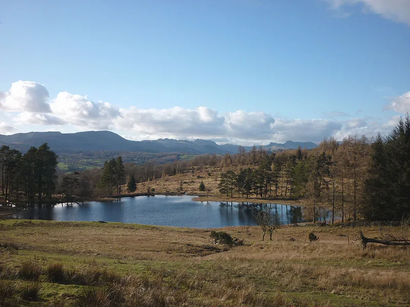
Wraymires tarn in Claife
Wraymires tarn in Westmorland and Furness, Claife is a body of water. Ⓦ.
- Nature
- body of water
Image
Guest house
Cafés
Stations
Bus stops
Chalet
Tourist information offices
Ice cream parlours
Roads nearby
Scar House Lane1,2 km
Pool Bridge1,3 km
Loanthwaite LaneLow Loanthwaite
1,4 km
North Lonsdale RoadHawkshead Surgery
1,5 km
Body of waters nearby
Wise Een Tarn200 m
Robinson's Tarn250 m
Hagg Pond400 m
Hodson's Tarn450 m
Summer House Pond450 m
Lilly Pond500 m
The Scale Tarn550 m
Highs Moss700 m
Green Tarns750 m
Smooth Beck Foot1000 m
Three Dubs Tarn1,1 km
Priest Pot1,1 km
Buildings nearby
Waterside House1,2 km
Gillbank1,2 km
Basecamp1,7 km
Caravan site nearby
The Croft1,4 km
Forests nearby
Hollin Band Plantation900 m
Places of worship nearby
Friends Meeting House1000 m
Sports pitches nearby
Hawkshead Crown Green Bowls Club1,5 km
Streams nearby
Smooth Beck300 m
Apple Tree Syke950 m
Ill Gill1,1 km
Wray Beck1,2 km
Black Beck1,3 km
Canker Beck1,5 km
Hollow Beck1,7 km
Belle Grange Beck1,8 km
Terraced houses nearby
Bragg Field Cottages1,5 km
Wetlands nearby
Ustick Moss950 m
Broad Mire Moss1,4 km
Nor Moss1,7 km
Woodlands nearby
Hagg Wood200 m
Highs Intake400 m
Wray Mires Intake450 m
Rigg Intake500 m
Fishpond Wood550 m
Rigg Wood600 m
Wray Mires Wood950 m
Water Side Woods950 m
Crag Wood1,4 km
Wood Close1,6 km
High Loanthwaite Coppice1,6 km
Latterbarrow Coppice1,7 km
Fleming Wood1,7 km
Belle Grange Crag1,8 km
| Length | 0.2 |
|---|---|
| Elevation | 183 m |
| Located in | England |
| Country | United Kingdom |
 Public transport map Claife Legend
| Railway | |
| Bus | |
| Tram |
 Cycling map Claife Legend
| Cycle path | |
| Cycle lane on road | |
| Cycling on bus lane | |
| Bicycle street | |
| Cyclists allowed | |
| Cyclists allowed, good surface | |
| No cycling | |
| Cobblestones |
| Long-distance cycle route | (depending on scale) | |
| Long-distance cycle route |
 Walking map Claife Legend
| Path |
| Long-distance hiking trail | (depending on scale) | |
| Long-distance hiking trail | ||
| No pedestrians |