
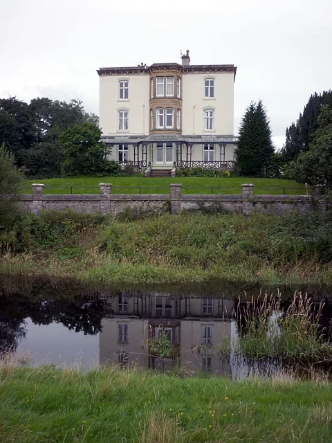
Castle Head in Grange-over-Sands
Castle Head in Westmorland and Furness, Grange-Over-Sands is a building (listed building). Castle Head is near Castle Head Bridge. Ⓦ.
- Building Type
- building
Image
Cafés
Platforms
Convenience stores
Bus stops
Car repair shops
Guest house
Hairdressers
Bathroom furnishing shops
Artwork
Roads nearby
Castle Head Bridge200 m
Lindale RoadHazelwood Court (S bound), Lyndene Drive (S bound), Hazelwood Court (N bound), Lyndene Drive (N bound), Berriedale Terrace, Lindale Road / Glenedyth, Grange Railway Station, Rail Station, Soroptimist Stone
550 m
Dixon Wood Close600 m
Kendal Road600 m
Lyndene DriveLyndene Drive (N bound)
600 m
Grange RoadBus Shelter (Stonebeck Cottages), The Coppice
650 m
Sheepbarrow Close700 m
Back Road800 m
Smithy HillLindale
800 m
Bell Hill Park900 m
School Hill900 m
Bell HillLingarth
950 m
Back O' The Fell Road1000 m
LingarthLingarth
1000 m
Hazelwood Court1000 m
Windermere RoadLyngarth, Lingarth
1,0 km
The Gill1,0 km
Lindale Hill1,1 km
Meathop Road1,2 km
Back Lane1,3 km
Cartmel Lane1,4 km
PromenadeLife in the Estuary at Grange-over-Sands, Newsagents, Grange-over-Sands, Morecambe Bay Partnership - Active Travel and Community Hub, Panorama of Skyline around Morecambe Bay from Grange-over-Sands Promenade
1,8 km
Station YardYewbarrow Garage
1,8 km
Railways nearby
Grange-Over-Sands1,8 km
Apartment buildings nearby
HPB Merlewood1,2 km
Buildings nearby
Animal Shelter250 m
Temple Of Vespa1,8 km
Car dealerships nearby
Lake District Audi650 m
Hadwins Volkwagen700 m
South Lakes BMW850 m
Churches nearby
St Paul's950 m
Community centres nearby
Lindale Village Hall900 m
Farmyards nearby
Holme Farm800 m
Forests nearby
Lime Kiln Wood600 m
Eggerslack Wood1,2 km
Golf courses nearby
Grange-over-Sands Golf Club900 m
Hotels nearby
Cumbria Grand Hotel1,2 km
Netherwood Hotel1,6 km
Grange Hotel1,8 km
Industrial areas nearby
Station Yard Industrial Estate1,7 km
Nature reserves nearby
Brown Robin1,6 km
Parks nearby
Yew Tree Green950 m
Pubs nearby
The Royal Oak1,2 km
Railway lines nearby
Furness Line1,6 km
Rivers nearby
River Winster1,3 km
Specialist shops nearby
J T Atkinson1,6 km
Streams nearby
Lin700 m
The Cut1,6 km
Veterinary practices nearby
Archway Veterinary Practice1000 m
| Located in | Grange-over-Sands |
|---|---|
| Country | United Kingdom |
 Public transport map Grange-Over-Sands Legend
| Railway | |
| Bus | |
| Tram |
 Cycling map Grange-Over-Sands Legend
| Cycle path | |
| Cycle lane on road | |
| Cycling on bus lane | |
| Bicycle street | |
| Cyclists allowed | |
| Cyclists allowed, good surface | |
| No cycling | |
| Cobblestones |
| Long-distance cycle route | (depending on scale) | |
| Long-distance cycle route |
 Walking map Grange-Over-Sands Legend
| Path |
| Long-distance hiking trail | (depending on scale) | |
| Long-distance hiking trail | ||
| No pedestrians |