
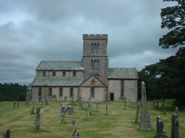
St. Michael's Church in Lowther, Cumbria
St. Michael's Church in Westmorland and Furness, Lowther is a Anglicana church. It is near Earl Henry's Drive and is also known as St Michael's Church, Lowther. The church belongs to the Diocese of Carlisle and is dedicated to Michael. St. Michael's Church also exists in Worcestershire, West Sussex, West Northamptonshire and Cumberland.
- Amenity
- place of worship
- Building Type
- church
Image
Bicycle hires
Bus stops
Roads nearby
Earl Henry's Drive500 m
Buckholme Drive700 m
Coopers Croft900 m
Harrison CroftThe Health Barn
1000 m
Skellands Ride1000 m
Helton RoadAskham Stores, Askham
1,0 km
Buckholme WoodNewtown, Estate Office
1,1 km
Emporer's Drive (Track)1,2 km
New Road1,2 km
Attraction nearby
Lowther Castle650 m
Stables of Lowther Castle700 m
Askham Hall750 m
Lakeland Bird of Prey Centre1,3 km
Body of waters nearby
Jack Croft's Pond1,0 km
Buildings nearby
Jubilee Summer House1,1 km
Caravan site nearby
The Punchbowl Caravan Park800 m
Community centres nearby
Askham Community Centre950 m
Farmyards nearby
Hall Farm800 m
Lowther Park Home Farm950 m
Keld Head Farm1,0 km
Townhead Farm1,3 km
Forests nearby
Ashleymoor Plantation950 m
Gardens nearby
Askham Hall Gardens550 m
Grass nearby
Old Walled Garden1,3 km
Industrial areas nearby
Low Sawmill350 m
Nature reserves nearby
Lowther Castle Park and Gardens950 m
Places of worship nearby
St. Peter's Church650 m
Playgrounds nearby
The Lost Castle1,4 km
Pubs nearby
The Punchbowl Inn750 m
The Queen's Head1000 m
Rivers nearby
River Lowther1,0 km
Streams nearby
Askham Beck1,5 km
Village greens nearby
The Green900 m
Green Croft950 m
Woodlands nearby
Heining Wood300 m
Church Wood300 m
Heining Scar450 m
Horseholme Wood550 m
Castlesteads Plantation700 m
Newtown Paddocks750 m
Mitchell Holme750 m
Barnet Wood800 m
Castle Strip850 m
Yanwath Wood900 m
Buckholme Slip1000 m
Terrace Strip1,1 km
Roughly Bank Plantation1,1 km
Skellands Strip1,2 km
Horsepasture Plantation1,3 km
| Dedicated to | Michael |
|---|---|
| Diocese | Diocese of Carlisle |
| Located in | Lowther |
| Country | United Kingdom |
 Public transport map Lowther Legend
| Railway | |
| Bus | |
| Tram |
 Cycling map Lowther Legend
| Cycle path | |
| Cycle lane on road | |
| Cycling on bus lane | |
| Bicycle street | |
| Cyclists allowed | |
| Cyclists allowed, good surface | |
| No cycling | |
| Cobblestones |
| Long-distance cycle route | (depending on scale) | |
| Long-distance cycle route |
 Walking map Lowther Legend
| Path |
| Long-distance hiking trail | (depending on scale) | |
| Long-distance hiking trail | ||
| No pedestrians |