
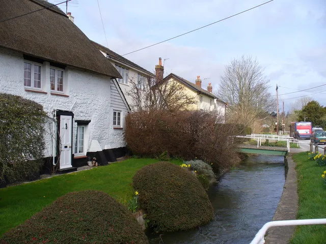
River Till in Berwick St. James
River Till in Wiltshire, Berwick St. James is a river. River Till also exists in Stapleford and Shrewton. Ⓦ.
- Waterway Type
- river
Image
Pubs
Roads nearby
Uppington Lane100 m
Landford Waie350 m
High StreetBerwick St James, Boot Inn
450 m
Duck Street600 m
North View650 m
Over StreetPelican Inn
1,3 km
Riverside Terrace1,3 km
Hill SideStapleford
1,4 km
Church Furlong1,5 km
Butts Hill1,6 km
Chapel Lane1,8 km
Stapleford RoadSerrington
1,8 km
Berwick RoadStapleford Berwick Turn
1,8 km
St Peter's Close1,9 km
New Street1,9 km
Chain Hill1,9 km
Warminster RoadPelican Inn
2,0 km
Brook CloseWinterbourne Stoke
2,2 km
Church Street2,2 km
Winterbourne Stoke Bypass2,2 km
Berwick Lane2,3 km
York Road2,7 km
Chain DroveDown Barn
3,1 km
Bonham Close3,4 km
Mount Pleasant3,4 km
Manor Farm Lane3,4 km
Langford RoadThe Royal Oak
3,5 km
Riverside CloseStoford, Swan @ Stoford
3,5 km
Grovely Road3,5 km
West StreetGreat Wishford
3,5 km
South Street3,6 km
Campsite nearby
Stonehenge Campsite & Glamping1,7 km
Farmyards nearby
Druid's Head Farm1,5 km
Manor Farm2,4 km
Houses nearby
Druid's Lodge2,6 km
Petrol stations nearby
Murco2,2 km
Places of worship nearby
St james250 m
St Mary1,6 km
St. Peter1,8 km
St Giles3,6 km
Railway lines nearby
Salisbury Branch3,3 km
Retail buildings nearby
The Bell Inn2,3 km
Rivers nearby
River Wylye2,8 km
Woodlands nearby
The Lawn1,4 km
Middle Covert1,4 km
Young Plantation1,7 km
The Penning2,2 km
The Rookery2,4 km
Henry's Plantation2,6 km
| Located in | Wiltshire |
|---|---|
| Country | United Kingdom |
| Mouth | River Wylye |
 Public transport map Berwick St. James Legend
| Railway | |
| Bus | |
| Tram |
 Cycling map Berwick St. James Legend
| Cycle path | |
| Cycle lane on road | |
| Cycling on bus lane | |
| Bicycle street | |
| Cyclists allowed | |
| Cyclists allowed, good surface | |
| No cycling | |
| Cobblestones |
| Long-distance cycle route | (depending on scale) | |
| Long-distance cycle route |
 Walking map Berwick St. James Legend
| Path |
| Long-distance hiking trail | (depending on scale) | |
| Long-distance hiking trail | ||
| No pedestrians |