
St Andrew in Laverstock
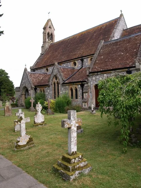
St Andrew in Wiltshire, Laverstock is a Anglicana church. It is near The Green and is also known as St Andrew's Church, Laverstock. The church belongs to the Diocese of Salisbury and is a listed building. St Andrew also exists in Salisbury, Melksham, Wootton Rivers, Newton Tony and Odstock.
- Amenity
- place of worship
- Building Type
- church
Image
Bus stops
Roads nearby
The Green100 m
Church RoadSt Andrews School, Classic Aroma, The Three Schools, Bishops Mead, Springfield
100 m
Woodland Way100 m
Westfield Close100 m
Duck LaneDuck Lane Bottom, Duck Inn, Down View Road
200 m
Dalewood Rise200 m
Laverstock Park West200 m
St Andrews250 m
Riverside RoadThe Green, William Close
250 m
Riverside Close250 m
Park RoadVillage Hall
300 m
Paddock Way300 m
Laverstock Park300 m
Silverwood Drive350 m
Willow Close350 m
Down View RoadDown View Road
350 m
Elm Close400 m
Hill RoadSt Andrews
400 m
Boundary Road400 m
Pilgrims Court400 m
The Avenue450 m
Pilgrims Way450 m
Burroughs Close450 m
Rosemary Close450 m
Vanessa AvenueRosemary Close
500 m
William Close500 m
Chestnut Close500 m
Linden Close550 m
Burroughs Hill550 m
Cow LaneLaverstock South Junction
550 m
Napier CrescentNapier Crescent
550 m
Cheverell AvenueLaverstock North Junction
600 m
Stockwood Close600 m
Redford Close600 m
Aston Mead600 m
Barrington RoadBishopdown Post Office, Crematorium
650 m
Mayfair RoadBeechcroft Road
650 m
Seth Ward DriveLovett Green
650 m
Beechcroft RoadLaverstock
700 m
London RoadSt Marks Church, Bishopdown Farm Roundabout, Hampton Park Roundabout, Bishopdown Park & Ride, Cheverell Avenue, London Road Cemetery, London Road
700 m
The Brambles700 m
Allotment gardens nearby
London Road Allotments550 m
Community centres nearby
Laverstock and Ford Village Hall200 m
Houses nearby
Bridleway500 m
Woodside650 m
Railway lines nearby
Laverstock North Junction to South Junction Curve500 m
West of England Line550 m
Redbridge to Tunnel Junction Line700 m
Supermarkets nearby
ALDI650 m
| Diocese | Diocese of Salisbury |
|---|---|
| Heritage designation | Grade II listed building |
| Located in | Laverstock |
| Country | United Kingdom |
 Public transport map Laverstock Legend
| Railway | |
| Bus | |
| Tram |
 Cycling map Laverstock Legend
| Cycle path | |
| Cycle lane on road | |
| Cycling on bus lane | |
| Bicycle street | |
| Cyclists allowed | |
| Cyclists allowed, good surface | |
| No cycling | |
| Cobblestones |
| Long-distance cycle route | (depending on scale) | |
| Long-distance cycle route |
 Walking map Laverstock Legend
| Path |
| Long-distance hiking trail | (depending on scale) | |
| Long-distance hiking trail | ||
| No pedestrians |