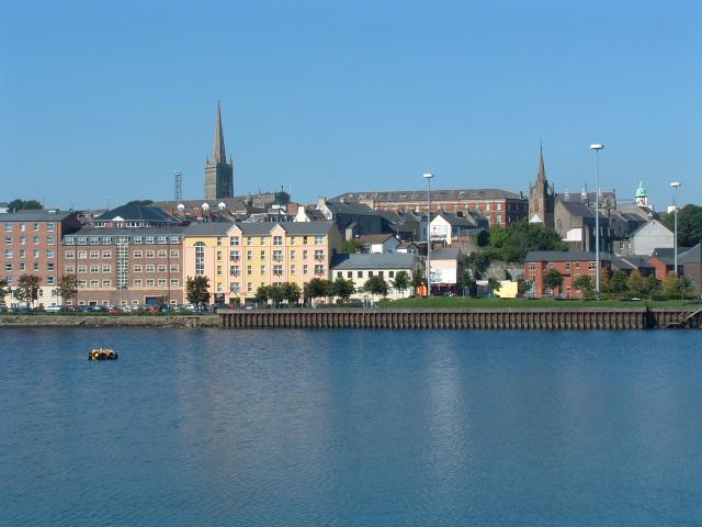
Northern Ireland / Tuaisceart Éireann

This page is the City map of Northern Ireland / Tuaisceart Éireann, with streets, paths and places across the region. Northern Ireland is part of the United Kingdom on the island of Ireland and covers approximately 14,130 square kilometres. Its population was 1,903,200 in 2021, compared with 1,810,863 in 2011, while the 2015 figure was about 1,852,168 people. Founded in 1921, the region is administered through 11 local government districts and numerous smaller localities. Northern Ireland also contains two documented long-distance cycle routes, including EuroVelo 1, the Atlantic Coast Route.

City map Northern Ireland / Tuaisceart Éireann
SwirlyLand, CC BY-SA 3.0 – Wikimedia Commons
City map Fermanagh and Omagh District
Biglobiglo, Public domain – Wikimedia Commons

Fermanagh and Omagh District

Fermanagh and Omagh District is one of Northern Ireland’s 11 local government districts and was established in 2015. It covers approximately 2,856.5 square kilometres and had a recorded population of 117,687. The district includes the towns of Enniskillen and Omagh, with Lough Erne and the Sperrin Mountains among its major geographical features.

Enniskillen lies between the Upper and Lower sections of Lough Erne, while the River Strule passes through Omagh before joining the River Mourne. The district occupies a large part of western Northern Ireland and borders County Donegal and County Monaghan in the Republic of Ireland.

Tildarg

Tildarg is mapped as a locality at admin level 10 in Northern Ireland. The name identifies a small settlement area rather than one of the region’s 11 local government districts. Its map context belongs to the network of roads, tracks and named places recorded within Northern Ireland.

Northern Ireland covers about 14,130 square kilometres, and Tildarg forms one of the smaller mapped localities within that territory. The locality is represented separately on the regional city map from the larger administrative districts.

Carnlea

Carnlea is a locality recorded at admin level 10 in Northern Ireland. It is a small named place within the region and is distinct from the 11 local government districts established for local administration in 2015. The regional map records Carnlea together with its surrounding streets, paths and rural connections.

Northern Ireland lies on the island of Ireland and forms part of the United Kingdom. Carnlea is therefore shown within a region whose principal urban centres include Belfast, Derry, Lisburn and Newry.

Ballynashee

Ballynashee is mapped as an admin level 10 locality in Northern Ireland. The locality is separate from district-level areas such as Belfast City District and Causeway Coast and Glens District. Its position is represented through the detailed network of local roads and paths shown on the regional city map.

Northern Ireland had 1,903,200 residents in 2021, and Ballynashee is one of the smaller named places included within that population area. The region extends across approximately 14,130 square kilometres between the Atlantic coast, the Irish Sea and the border with the Republic of Ireland.

West Division

West Division is a locality recorded at admin level 10 in Northern Ireland. The name identifies a mapped local area and does not refer to one of the 11 district councils created in 2015. The city map places West Division within Northern Ireland’s connected system of settlements and transport routes.

The region includes western towns such as Omagh, Enniskillen and Strabane, as well as the River Foyle and the Sperrin uplands. West Division is shown at a smaller geographic scale than the surrounding district administrations.

Collinward

Collinward is a locality with admin level 10 status in Northern Ireland. It is recorded as a named place within the region rather than as a county or local government district. The map distinguishes Collinward from larger places such as Belfast and Newry.

Northern Ireland was founded as a political region in 1921 and is part of the United Kingdom. Collinward belongs to the detailed local geography of this territory, whose landscape includes the Mourne Mountains, Lough Neagh and the Antrim Plateau.

Ballinderry

Ballinderry is mapped as an admin level 10 locality in Northern Ireland. It is a smaller named place within the regional settlement pattern and is not one of the 11 district-level administrative areas. The city map records Ballinderry alongside local roads, paths and nearby places.

The River Ballinderry flows through central Northern Ireland and reaches Lough Neagh, the largest freshwater lake in the British Isles by surface area. Ballinderry is therefore associated with a region that includes major waterways as well as urban areas such as Belfast and Derry.

Poobles

Poobles is a locality recorded at admin level 10 in Northern Ireland. The place is represented separately from the region’s district councils, including Mid Ulster District Council and Ards and North Down District Council. Its map entry identifies a small local area within Northern Ireland.

Northern Ireland has an area of approximately 14,130 square kilometres and a population of 1,903,200 recorded in 2021. Poobles forms part of this wider territory of towns, villages, countryside and coastal settlements.

Greencastle

Greencastle is a locality mapped at admin level 10 in Northern Ireland. Several places in Ireland and Northern Ireland share the name Greencastle, so the regional map distinguishes this locality by its position within Northern Ireland. It is recorded as a local place rather than as a district or county.

Northern Ireland includes coastal areas on the Atlantic Ocean and the North Channel, while its inland geography contains Lough Neagh and the Sperrin Mountains. Greencastle is shown within this regional framework of named places and connecting roads.

Ballygolan

Ballygolan is an admin level 10 locality in Northern Ireland. It is a small mapped place and is not classified as one of the 11 local government districts established in 2015. The city map displays Ballygolan with the surrounding local transport network.

The region contains the principal city of Belfast, the historic city of Derry and towns including Armagh, Bangor and Coleraine. Ballygolan belongs to the smaller-scale settlement geography surrounding these larger urban centres.

Drumnadrough

Drumnadrough is recorded as a locality at admin level 10 in Northern Ireland. Its status identifies a named local area rather than a district council, county or major city. The map includes Drumnadrough within the detailed pattern of streets, paths and rural routes.

Northern Ireland’s administrative region covers about 14,130 square kilometres and was established in 1921. Drumnadrough is one of the smaller places represented within this territory of the United Kingdom on the island of Ireland.

Lagmore

Lagmore is a locality mapped at admin level 10 in Northern Ireland. It lies within the wider Belfast urban area, where the Laganside and the River Lagan connect residential districts with the city centre. The locality is shown separately from Belfast City District on the regional map.

Belfast is Northern Ireland’s largest city and the administrative centre of Belfast City District. Lagmore forms part of the metropolitan geography extending west and south of the city, alongside places such as Dunmurry and Lisburn.

Old Forge

Old Forge is recorded as an admin level 10 locality in Northern Ireland. The name identifies a small mapped place and does not denote a separate local government district. Its entry belongs to the detailed regional map of roads, paths and settlements.

Northern Ireland includes historic industrial sites connected with linen, shipbuilding and metalworking, especially around Belfast and the River Lagan. Old Forge is represented within this wider landscape of named localities and transport links.

Altigarron

Altigarron is a locality at admin level 10 in Northern Ireland. It is a small named area within the regional settlement structure and is separate from the district councils that administer Northern Ireland. The city map records Altigarron at local scale.

The region’s uplands include the Sperrin Mountains in the west and the Mourne Mountains in County Down. Altigarron is shown within Northern Ireland’s wider network of rural places, roads and paths.

Tornaroy

Tornaroy is mapped as an admin level 10 locality in Northern Ireland. It is classified as a small local place rather than as a town, city or district. The regional city map represents Tornaroy with the surrounding named routes and settlements.

Northern Ireland had 1,810,863 residents in 2011 and 1,903,200 in 2021. Tornaroy is one of the localities included within this changing population area on the island of Ireland.

Killeaton

Killeaton is a locality recorded at admin level 10 in Northern Ireland. It is shown as a distinct small place within the region and is not one of the 11 local government districts. The map provides its local position in relation to nearby roads and paths.

Northern Ireland is bordered by the Republic of Ireland to the south and west, while Belfast Lough and the North Channel open to the east. Killeaton belongs to this geographically connected regional setting.

Guns Island

Guns Island is a townland in County Down, Northern Ireland, and is mapped at admin level 10. A townland is a traditional small territorial unit, and Guns Island is represented as a locality rather than as a district council. Its regional map entry places it within the historic landscape of County Down.

County Down contains the Mourne Mountains, Strangford Lough and the cities and towns of Newry, Bangor and Downpatrick. Guns Island is included in the detailed network of local roads and paths across this southeastern part of Northern Ireland.

Crossgar

Crossgar is a locality recorded at admin level 10 in Northern Ireland. The village lies in County Down, within the area administered by Newry, Mourne and Down District Council. Its map position connects the settlement with roads leading towards Downpatrick, Saintfield and Ballynahinch.

County Down includes the eastern slopes of the Mourne Mountains and the coastal waters of Strangford Lough. Crossgar is part of this southeastern Northern Irish landscape rather than a separate district-level administration.

Ballyoran

Ballyoran is mapped as an admin level 10 locality in Northern Ireland. It is a small named place within the region and is distinct from the larger local government districts established in 2015. The city map records Ballyoran with its local connections to surrounding settlements.

Northern Ireland extends from the Atlantic coast and County Londonderry to the eastern shores of County Down. Ballyoran is shown within this regional geography of roads, paths and named rural places.

Ballylenaghan

Ballylenaghan is a locality at admin level 10 in Northern Ireland. It lies in the Belfast urban region, near the foothills of the Castlereagh Hills and the eastern side of the city. The map distinguishes this small place from Belfast City District and the neighbouring Ards and North Down District.

Belfast Lough opens eastward into the North Channel, while the River Lagan runs through Belfast to the lough. Ballylenaghan belongs to the built-up and suburban geography surrounding Northern Ireland’s largest city.

Gransha

Gransha is recorded as an admin level 10 locality in Northern Ireland. The name is used for a small mapped area and is separate from the 11 local government districts. Its position is shown through the surrounding streets, paths and places on the regional city map.

Northern Ireland contains the River Foyle, which reaches Lough Foyle beside Derry, and the River Bann, which flows into the Atlantic Ocean. Gransha is included within this wider network of waterways and settlements.

Finnis

Finnis is a townland in County Down, Northern Ireland, recorded as an admin level 10 locality. The place belongs to the historic small-unit geography of County Down rather than to a separate district council. Its map entry identifies Finnis within the rural road and path network.

County Down is administered across districts including Newry, Mourne and Down and Ards and North Down. Finnis lies within a county known for the Mourne Mountains, Strangford Lough and the historic town of Downpatrick.

Ballydollaghan

Ballydollaghan is a locality mapped at admin level 10 in Northern Ireland. It is a small named place within the region and is not classified as one of the 11 local government districts. The city map records Ballydollaghan alongside local roads, paths and nearby settlements.

Northern Ireland’s population increased from 1,810,863 in 2011 to 1,903,200 in 2021. Ballydollaghan is included within this regional population area, which covers approximately 14,130 square kilometres.

Ballyhanwood

Ballyhanwood is an admin level 10 locality in Northern Ireland. It lies in the wider Belfast and County Down area, where small settlements adjoin the urban districts of Belfast and Ards and North Down. The map displays Ballyhanwood as a separate named locality.

The nearby regional landscape includes Belfast Lough, the Castlereagh Hills and the River Lagan. Ballyhanwood is therefore represented within the eastern Northern Irish road and settlement network rather than as an independent district.

Gilnahirk

Gilnahirk is a locality mapped at admin level 10 in Northern Ireland. It lies east of Belfast in the area between the city and the Castlereagh Hills. The city map records Gilnahirk separately from Belfast City District and the neighbouring locality of Ballyhanwood.

Belfast’s urban area follows the River Lagan to Belfast Lough, while the surrounding hills rise towards County Down. Gilnahirk forms part of this eastern metropolitan landscape of roads, paths and residential places.

Slatady

Slatady is recorded as an admin level 10 locality in Northern Ireland. It is a small named place within the region and is distinct from district-level areas such as Mid Ulster District Council and Derry and Strabane District. The map provides its position within the local road network.

Northern Ireland is part of the United Kingdom and occupies the northeastern part of the island of Ireland. Slatady is one of the smaller localities represented inside this 14,130-square-kilometre region.

Braniel

Braniel is a locality at admin level 10 in Northern Ireland. It is a residential area in east Belfast, near the Castlereagh Hills and the boundary with the wider Lisburn and Castlereagh area. The map shows Braniel as a local place rather than as a separate district.

The River Lagan runs west of Braniel through Belfast, and Belfast Lough lies to the northeast. Braniel belongs to the built-up eastern part of Northern Ireland’s largest urban centre.

Knocknagoney

Knocknagoney is an admin level 10 locality in Northern Ireland. It lies on the eastern side of Belfast near Belfast Lough and the urban area of Holywood. The regional map identifies Knocknagoney separately from Belfast City District and Ards and North Down District.

Belfast Lough connects the city with the North Channel and includes the harbour area that has supported Belfast’s maritime development. Knocknagoney is part of this eastern coastal and metropolitan geography.

Ballymiscaw

Ballymiscaw is a locality recorded at admin level 10 in Northern Ireland. It lies within the wider Belfast and Castlereagh urban area, close to the Castlereagh Hills. The city map represents Ballymiscaw as a named local place within the regional street and path network.

The River Lagan runs through Belfast and separates parts of the city from the hills and suburbs to the south and east. Ballymiscaw is associated with this metropolitan landscape and with the wider Lisburn and Castlereagh area.

Castlereagh

Castlereagh is a locality mapped at admin level 10 in Northern Ireland. It lies southeast of Belfast in the historic area surrounding the Castlereagh Hills and the River Lagan. The locality is distinct from Lisburn and Castlereagh District, the local government area established in 2015.

Castlereagh is connected to Belfast by roads and urban routes, while the nearby River Lagan flows north to Belfast Lough. The area combines suburban development with the open slopes of the Castlereagh Hills.

Breda

Breda is recorded as an admin level 10 locality in Northern Ireland. It lies in the eastern Belfast urban area near the Castlereagh Hills and is shown as a separate named place on the regional map. Breda is not a local government district or a county-level unit.

Belfast City District borders Lisburn and Castlereagh District to the south, while Belfast Lough lies to the northeast. Breda belongs to this connected urban geography of roads, paths and residential localities.

Galwally

Galwally is a locality at admin level 10 in Northern Ireland. It lies in south Belfast beside the River Lagan and near the slopes of the Castlereagh Hills. The map records Galwally as a distinct local area within the wider Belfast City District.

The River Lagan runs through south Belfast towards Belfast city centre and Belfast Lough. Galwally is therefore part of the urban corridor linking Belfast with Lisburn and the settlements of County Down.

Ballymaconaghy

Ballymaconaghy is mapped as an admin level 10 locality in Northern Ireland. It lies in the Belfast area near the Castlereagh Hills and is represented separately from the surrounding district administrations. The regional city map shows Ballymaconaghy with the roads and paths serving the locality.

The nearby River Lagan flows through Belfast, while the eastern side of the city reaches Belfast Lough. Ballymaconaghy forms part of the suburban landscape extending from Belfast into County Down.

City map Newry, Mourne and Down District Council
Ardfern, CC BY-SA 3.0 – Wikimedia Commons

Newry, Mourne and Down District Council

Newry, Mourne and Down District Council is one of Northern Ireland’s 11 local government districts established in 2015. It covers approximately 1,632.9 square kilometres and had a recorded population of 183,115. The district includes Newry, Downpatrick, Warrenpoint and the Mourne Mountains.

The River Clanrye flows through Newry before reaching Carlingford Lough, while the Mourne Mountains include Slieve Donard, Northern Ireland’s highest mountain at 850 metres. The district also contains parts of Strangford Lough and the eastern coast of County Down.

City map Ards and North Down District Council
Martyn Boyd, CC BY-SA 2.0 – Wikimedia Commons

Ards and North Down District Council

Ards and North Down District Council is one of the 11 local government districts established in Northern Ireland in 2015. Its area is approximately 460.8 square kilometres, and its recorded population is 165,415. The district includes Bangor, Newtownards, Donaghadee and the Ards Peninsula.

Strangford Lough separates much of the Ards Peninsula from the mainland, while Belfast Lough borders the northwestern part of the district. Mount Stewart, near Newtownards, is a notable historic estate within the district, which also includes the coastal town of Portaferry.

Belfast City District

Belfast City District is Northern Ireland’s principal urban local government area and contains the regional capital, Belfast. It is one of the 11 district-level areas created in 2015. Belfast lies at the head of Belfast Lough, where the River Lagan reaches the Irish Sea through the lough and the North Channel.

The city is historically associated with shipbuilding, including the construction of RMS Titanic at the Harland and Wolff yards. Belfast also contains attractions such as Belfast City Hall and the Titanic Quarter, while Cave Hill rises to the north of the urban area.

City map Armagh City, Banbridge and Craigavon District Council
HENRY CLARK, CC BY-SA 2.0 – Wikimedia Commons

Armagh City, Banbridge and Craigavon District Council

Armagh City, Banbridge and Craigavon District Council is one of Northern Ireland’s 11 local government districts established in 2015. It covers approximately 1,336.6 square kilometres and had a recorded population of 222,511. The district includes Armagh, Banbridge, Craigavon, Lurgan and Portadown.

Armagh is associated with Saint Patrick and contains both Saint Patrick’s Roman Catholic Cathedral and Saint Patrick’s Church of Ireland Cathedral. The River Bann flows through Portadown and Lough Neagh lies north of Craigavon, linking the district to Northern Ireland’s largest lake.

Mid-Ulster District Council

Mid Ulster District Council is one of Northern Ireland’s 11 local government districts and was established in 2015. It covers approximately 1,826.7 square kilometres and had a recorded population of 152,718. The district includes Cookstown, Dungannon, Magherafelt and parts of the Sperrin Mountains.

The River Blackwater forms part of the boundary between County Tyrone and County Armagh, while the Moyola River flows through the Magherafelt area. The district contains Beaghmore’s prehistoric stone circles near Cookstown and upland landscapes associated with the Sperrins.

City map Lisburn and Castlereagh District
Sukbhirsinghsangha, CC BY-SA 4.0 – Wikimedia Commons

Lisburn and Castlereagh District

Lisburn and Castlereagh District is one of Northern Ireland’s 11 local government districts established in 2015. It covers approximately 505.3 square kilometres and had a recorded population of 151,669. The district includes Lisburn, Carryduff, Hillsborough and the Castlereagh area southeast of Belfast.

The River Lagan passes through Lisburn and links the district with Belfast. Hillsborough Castle, the official royal residence in Northern Ireland, stands in the village of Hillsborough, while the district also contains the wooded Lagan Valley.

Antrim and Newtownabbey District

Antrim and Newtownabbey District is one of Northern Ireland’s 11 local government districts established in 2015. It covers approximately 572.0 square kilometres and had a recorded population of 148,100. The district includes Antrim, Newtownabbey, Crumlin and the northern shore of Belfast Lough.

Lough Neagh borders the western side of the district, while Belfast Lough and the River Lagan lie to the southeast. Antrim Castle Gardens and the nearby town of Antrim are notable parts of the district’s historic and urban geography.

City map Mid and East Antrim District
Lisa Jarvis, CC BY-SA 2.0 – Wikimedia Commons

Mid and East Antrim District

Mid and East Antrim District is one of Northern Ireland’s 11 local government districts established in 2015. It covers approximately 1,046.4 square kilometres and had a recorded population of 139,913. The district includes Ballymena, Carrickfergus, Larne and the eastern Antrim coast.

Carrickfergus Castle stands beside Belfast Lough, while Glenarm Castle and the Glens of Antrim lie farther north. The district reaches the North Channel near Larne and includes part of the Antrim Plateau.

City map Causeway Coast and Glens District
code poet on flickr., CC BY-SA 2.0 – Wikimedia Commons

Causeway Coast and Glens District

Causeway Coast and Glens District is one of Northern Ireland’s 11 local government districts established in 2015. It covers approximately 1,980.1 square kilometres and had a recorded population of 141,954. The district includes Coleraine, Ballymoney, Limavady and Ballycastle.

The Giant’s Causeway is a UNESCO World Heritage Site on the north coast, with approximately 40,000 interlocking basalt columns formed by ancient volcanic activity. The district also contains the River Bann estuary, the Glens of Antrim and the Carrick-a-Rede rope bridge near Ballintoy.

City map Derry and Strabane District
Michael Parry, CC BY-SA 2.0 – Wikimedia Commons

Derry and Strabane District

Derry and Strabane District is one of Northern Ireland’s 11 local government districts established in 2015. It covers approximately 1,238.5 square kilometres and had a recorded population of 152,383. The district includes the city of Derry, Strabane, Limavady and the Foyle estuary.

Derry’s historic walled city has walls dating from the early 17th century, and the River Foyle runs beside the city before reaching Lough Foyle. Strabane stands near the junction of the River Mourne and River Finn, close to the border with County Donegal.

Sandy Island

Sandy Island is recorded as an admin level 10 locality in Northern Ireland. The name identifies a small mapped place and is separate from the 11 local government districts established in 2015. Its entry is included in the regional city map with the surrounding local routes and named places.

Northern Ireland contains coastal islands and loughs, including Rathlin Island off County Antrim and islands within Strangford Lough. Sandy Island is represented at the smaller locality scale within the region’s approximately 14,130 square kilometres.

Data sources: OpenStreetMap (ODbL), Wikidata (CC0) · Image: Wikimedia Commons

Northern Ireland / Tuaisceart Éireann – Facts

Inhabitants 1852168
Area 14130 km²
Subregions 44
Inception 1921
Located in United Kingdom
Country United Kingdom
Native label Northern Ireland
Official name Northern Ireland
Described by source Brockhaus and Efron Encyclopedic Dictionary, Jewish Encyclopedia of Brockhaus and Efron, Small Brockhaus and Efron Encyclopedic Dictionary, Granat Encyclopedic Dictionary
Part of Ireland

Data source: Wikidata (CC0)

Roads in Northern Ireland / Tuaisceart Éireann

Important and frequently searched streets
Manse Court Ballycrummy Road Caledon House Gosheden Wood
Frequently searched regions
Ballyrussell Toberwine