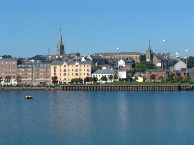
Derry City and Strabane

This page is the City map of Derry and Strabane District in Northern Ireland, or Tuaisceart Éireann, showing streets, paths and places across the region. The district covers approximately 1,238.5 square kilometres and had around 152,383 residents in 2024. Its population increased from 150,679 in 2018 to 152,383 in 2024. Derry and Strabane District is one of Northern Ireland’s 11 local government districts established in 2015, and the OpenStreetMap data divides it into 695 subregions.

City map Derry and Strabane District
Michael Parry, CC BY-SA 2.0 – Wikimedia Commons

Coolafinny

Coolafinny is a townland in County Londonderry, Northern Ireland. In the regional administrative data it has admin_level=10. The townland lies within Derry and Strabane District, which covers approximately 1,238.5 square kilometres. Its location is represented on this City map alongside streets, paths and other places.

Fallowlea

Fallowlea is a townland in County Londonderry, Northern Ireland. The place is recorded with admin_level=10 in the Derry and Strabane District data. It belongs to a district of approximately 1,238.5 square kilometres and around 152,383 residents. The City map identifies Fallowlea as a named place within this administrative area.

Gortagerty Lower

Gortagerty Lower is a townland in County Londonderry, Northern Ireland. It is mapped as an admin_level=10 subdivision of Derry and Strabane District. The district was established as one of Northern Ireland’s 11 local government districts in 2015. The City map places Gortagerty Lower within the district’s network of streets, paths and named locations.

Muff

Muff is a townland in County Londonderry, Northern Ireland. The OpenStreetMap regional data records it at admin_level=10. Muff is therefore one of the named subdivisions within Derry and Strabane District, an area of approximately 1,238.5 square kilometres. Its position is shown on the City map with the surrounding streets, paths and places.

Templemoyle

Templemoyle is recorded as an admin_level=10 subdivision of Derry and Strabane District in Northern Ireland. The place is included among the district’s mapped local areas. Derry and Strabane District had approximately 152,383 residents in 2024. The City map shows Templemoyle together with the roads, paths and other named places recorded in the region.

Upper Gortagherty

Upper Gortagherty is a townland in County Londonderry, Northern Ireland. It is identified in the regional data as an admin_level=10 area. The townland forms part of Derry and Strabane District, whose population rose from 150,679 in 2018 to 152,383 in 2024. Its named location appears on the City map within the district boundary.

Slievedoo

Slievedoo is recorded as a locality in Derry and Strabane District, Northern Ireland. Its administrative level in the supplied data is admin_level=10. The locality is part of a district covering approximately 1,238.5 square kilometres. The City map records Slievedoo as a named place among the region’s streets and paths.

Athabryanmore

Athabryanmore is a locality in Derry and Strabane District in Northern Ireland. It is mapped at admin_level=10 in the regional data. Derry and Strabane is one of 11 Northern Irish local government districts created in 2015. The City map identifies Athabryanmore within this administrative area.

Meenafergus

Meenafergus is a locality recorded at admin_level=10 in Derry and Strabane District, Northern Ireland. It is one of the named local areas represented in the district data. The district extends across approximately 1,238.5 square kilometres and had around 152,383 residents in 2024. Its position is shown on the City map with nearby streets and paths.

Tulnashane

Tulnashane is a locality within Derry and Strabane District in Northern Ireland. The supplied OpenStreetMap data assigns it admin_level=10. The district’s population increased by 1,704 people between 2018 and 2024, from 150,679 to 152,383. Tulnashane is shown as a named place on the City map.

Meenakeeran

Meenakeeran is a locality mapped at admin_level=10 in Derry and Strabane District, Northern Ireland. It belongs to the administrative region centred on the cities and settlements of Derry and Strabane. The district covers approximately 1,238.5 square kilometres. The City map records Meenakeeran alongside the region’s mapped streets, paths and places.

Fifth Corgary or First Croagh

Fifth Corgary or First Croagh is a locality in Derry and Strabane District, Northern Ireland. It is recorded at admin_level=10 in the supplied regional data. The district is one of 11 local government districts established in Northern Ireland in 2015. This named locality appears on the City map within the district boundary.

Sixth Corgary or Second Croagh

Sixth Corgary or Second Croagh is a locality mapped at admin_level=10 in Derry and Strabane District. The district is located in Northern Ireland, or Tuaisceart Éireann. It covers approximately 1,238.5 square kilometres and had around 152,383 residents in 2024. The City map displays this locality with the other named places of the region.

Ardarver

Ardarver is a locality within Derry and Strabane District in Northern Ireland. The OpenStreetMap data classifies it as admin_level=10. Derry and Strabane District recorded population growth from 150,679 people in 2018 to 152,383 in 2024. Ardarver is represented as a named place on the City map.

First Corgary

First Corgary is a locality recorded at admin_level=10 in Derry and Strabane District, Northern Ireland. It is one of the mapped local areas within the district’s approximately 1,238.5 square kilometres. The district was formed in 2015 as one of Northern Ireland’s 11 local government districts. The City map shows First Corgary as a named location.

Meenablagh or Fourth Corgary

Meenablagh or Fourth Corgary is a locality in Derry and Strabane District, Northern Ireland. It is identified in the regional data by admin_level=10. Around 152,383 people lived in the district in 2024. The City map records Meenablagh or Fourth Corgary within the district’s mapped streets, paths and places.

Mullyfamore

Mullyfamore is a locality in Derry and Strabane District in Northern Ireland. Its recorded administrative level is admin_level=10. The district extends across approximately 1,238.5 square kilometres in Tuaisceart Éireann. Mullyfamore is shown as a named place on the City map.

Mullyfabeg

Mullyfabeg is a locality mapped at admin_level=10 in Derry and Strabane District, Northern Ireland. It belongs to the same local government district as Derry and Strabane. The district’s population rose from 150,679 in 2018 to 152,383 in 2024. The City map identifies Mullyfabeg as a named local place.

Second Corgary

Second Corgary is a locality in Derry and Strabane District, Northern Ireland. The supplied data records it at admin_level=10. Derry and Strabane District was established in 2015 among Northern Ireland’s 11 local government districts. Second Corgary appears on the City map within the district’s administrative boundary.

Third Corgary

Third Corgary is a locality recorded at admin_level=10 in Derry and Strabane District. The district is in Northern Ireland, or Tuaisceart Éireann, and covers approximately 1,238.5 square kilometres. Its 2024 population was around 152,383. The City map marks Third Corgary as a named place in the region.

Tullycarr

Tullycarr is a locality within Derry and Strabane District in Northern Ireland. It is included in the regional data as an admin_level=10 area. The district contains 695 mapped subregions in the supplied OpenStreetMap data. Tullycarr is one of those named places shown on the City map.

Altamullan

Altamullan is a locality mapped at admin_level=10 in Derry and Strabane District, Northern Ireland. The district belongs to the United Kingdom and is located in Tuaisceart Éireann. It covers approximately 1,238.5 square kilometres. Altamullan is recorded as a named location on the City map.

Clagharnagh

Clagharnagh is a locality in Derry and Strabane District, Northern Ireland. The supplied regional data identifies it as admin_level=10. Around 152,383 people lived in the district in 2024, compared with 150,679 in 2018. The City map shows Clagharnagh within the district’s mapped area.

Essan

Essan is a locality recorded at admin_level=10 in Derry and Strabane District. It lies within Northern Ireland, or Tuaisceart Éireann. The district was created in 2015 as one of 11 local government districts. Essan is represented as a named place on the City map.

Meenagrogan

Meenagrogan is a locality within Derry and Strabane District in Northern Ireland. Its administrative classification in the supplied data is admin_level=10. The district covers approximately 1,238.5 square kilometres and includes 695 subregions in the OpenStreetMap dataset. The City map records Meenagrogan among those named local areas.

Srachcumber

Srachcumber is a locality mapped at admin_level=10 in Derry and Strabane District, Northern Ireland. The district is one of the 11 local government districts established in Northern Ireland in 2015. Its population reached approximately 152,383 in 2024. Srachcumber is shown as a named place on the City map.

Aghalougher

Aghalougher is a locality in Derry and Strabane District, Northern Ireland. It is recorded at admin_level=10 in the supplied regional data. Derry and Strabane District covers approximately 1,238.5 square kilometres. The City map identifies Aghalougher within this administrative region.

Aghalunny

Aghalunny is a locality mapped at admin_level=10 in Derry and Strabane District. The district is located in Northern Ireland, or Tuaisceart Éireann. Between 2018 and 2024, its population increased from 150,679 to 152,383. Aghalunny is a named location on the City map.

Aghyarin

Aghyarin is a locality within Derry and Strabane District in Northern Ireland. The OpenStreetMap data assigns it admin_level=10. The district includes 695 subregions and covers approximately 1,238.5 square kilometres. Aghyarin is shown on the City map as one of its named local places.

Ballymongan

Ballymongan is a locality recorded at admin_level=10 in Derry and Strabane District. It is situated in Northern Ireland, or Tuaisceart Éireann. Derry and Strabane District was established in 2015 as one of 11 local government districts. The City map marks Ballymongan within the district boundary.

Crighdenis

Crighdenis is a locality in Derry and Strabane District, Northern Ireland. It has the administrative classification admin_level=10 in the supplied data. Around 152,383 residents were recorded for the district in 2024. Crighdenis is included as a named place on the City map.

Crighshane

Crighshane is a locality mapped at admin_level=10 in Derry and Strabane District. The district lies in Northern Ireland and extends over approximately 1,238.5 square kilometres. Its population grew by 1,704 people between 2018 and 2024. The City map records Crighshane as a named local area.

Golandun Dolan

Golandun Dolan is a locality within Derry and Strabane District, Northern Ireland. The supplied data identifies it at admin_level=10. Derry and Strabane District is one of 11 local government districts created in Northern Ireland in 2015. Golandun Dolan appears as a named place on the City map.

Golandun McHugh

Golandun McHugh is a locality recorded at admin_level=10 in Derry and Strabane District. It is located in Northern Ireland, or Tuaisceart Éireann. The district had around 152,383 residents in 2024 and covers approximately 1,238.5 square kilometres. The City map shows Golandun McHugh among the district’s named places.

Gortnagross

Gortnagross is a locality in Derry and Strabane District, Northern Ireland. Its recorded administrative level is admin_level=10. The regional dataset contains 695 subregions within Derry and Strabane District. Gortnagross is one of the named locations represented on the City map.

Magherakeel

Magherakeel is a locality mapped at admin_level=10 in Derry and Strabane District. The district is part of Northern Ireland, or Tuaisceart Éireann. Its population increased from 150,679 in 2018 to approximately 152,383 in 2024. Magherakeel is shown as a named place on the City map.

Meenamullan

Meenamullan is a locality within Derry and Strabane District in Northern Ireland. The OpenStreetMap data classifies it as admin_level=10. Derry and Strabane District covers approximately 1,238.5 square kilometres. The City map records Meenamullan alongside the region’s streets, paths and other places.

Shanaghy

Shanaghy is a locality recorded at admin_level=10 in Derry and Strabane District. It belongs to Northern Ireland, or Tuaisceart Éireann. The district was established in 2015 and is one of 11 local government districts in Northern Ireland. Shanaghy is identified on the City map as a named local place.

Tievenameenta

Tievenameenta is a locality in Derry and Strabane District, Northern Ireland. It is mapped at admin_level=10 in the supplied regional data. Around 152,383 people lived in the district in 2024. The City map displays Tievenameenta within the district’s approximately 1,238.5 square kilometres.

Meenclogher

Meenclogher is a locality recorded at admin_level=10 in Derry and Strabane District. The district is located in Northern Ireland and forms part of the United Kingdom. Its population rose from 150,679 in 2018 to 152,383 in 2024. Meenclogher appears as a named location on the City map.

Carracoghan

Carracoghan is a locality within Derry and Strabane District, Northern Ireland. The supplied data assigns it admin_level=10. The district contains 695 subregions and covers approximately 1,238.5 square kilometres. Carracoghan is recorded among those local places on the City map.

Common

Common is a locality mapped at admin_level=10 in Derry and Strabane District. It lies in Northern Ireland, or Tuaisceart Éireann. Derry and Strabane District is one of the 11 local government districts established in 2015. The City map identifies Common within the district’s administrative area.

Legatonegan

Legatonegan is a locality in Derry and Strabane District, Northern Ireland. Its administrative classification is admin_level=10. The district had approximately 152,383 residents in 2024 and extends across approximately 1,238.5 square kilometres. Legatonegan is shown as a named place on the City map.

Lislaird

Lislaird is a locality recorded at admin_level=10 in Derry and Strabane District. The region is situated in Northern Ireland, or Tuaisceart Éireann. Between 2018 and 2024, the district population increased by 1,704 people. The City map marks Lislaird as a named local area.

Magheranageeragh

Magheranageeragh is a locality within Derry and Strabane District in Northern Ireland. The supplied data records it at admin_level=10. Derry and Strabane District includes 695 subregions in the OpenStreetMap regional structure. Magheranageeragh is one of the named places shown on the City map.

Mullanabreen

Mullanabreen is a locality mapped at admin_level=10 in Derry and Strabane District. It is located in Northern Ireland, or Tuaisceart Éireann. The district covers approximately 1,238.5 square kilometres and had around 152,383 residents in 2024. The City map identifies Mullanabreen within the regional boundary.

Trienamongan

Trienamongan is a locality in Derry and Strabane District, Northern Ireland. It is recorded at admin_level=10 in the supplied data. Derry and Strabane District was established in 2015 as one of Northern Ireland’s 11 local government districts. Trienamongan appears as a named place on the City map.

Crilly's Hill

Crilly's Hill is a locality mapped at admin_level=10 in Derry and Strabane District. The district is part of Northern Ireland, or Tuaisceart Éireann. Its population grew from 150,679 in 2018 to approximately 152,383 in 2024. Crilly's Hill is shown as a named location on the City map.

Killeter

Killeter is a locality within Derry and Strabane District in Northern Ireland. The supplied regional data identifies it as admin_level=10. The district covers approximately 1,238.5 square kilometres and includes the urban areas of Derry and Strabane. Killeter is represented as a named place on the City map.

Speerholme

Speerholme is a locality recorded at admin_level=10 in Derry and Strabane District. It is located in Northern Ireland, or Tuaisceart Éireann. Around 152,383 people lived in the district in 2024. Speerholme is included among the named localities shown on the City map.

Gortgranagh

Gortgranagh is a locality in Derry and Strabane District, Northern Ireland. It has the administrative classification admin_level=10. The district was established in 2015 and is one of Northern Ireland’s 11 local government districts. The City map records Gortgranagh as a named place within the region.

Carnoughter

Carnoughter is a locality mapped at admin_level=10 in Derry and Strabane District. The district lies in Northern Ireland and covers approximately 1,238.5 square kilometres. Its population increased by 1,704 people between 2018 and 2024. Carnoughter is shown on the City map as a named local area.

Garvagh Blane

Garvagh Blane is a locality in Derry and Strabane District, Northern Ireland. It is recorded at admin_level=10 in the supplied OpenStreetMap data. Derry and Strabane District had approximately 152,383 residents in 2024. The City map identifies Garvagh Blane within the district boundary.

Garvagh Pullans

Garvagh Pullans is a locality mapped at admin_level=10 in Derry and Strabane District. It belongs to Northern Ireland, or Tuaisceart Éireann. The district extends over approximately 1,238.5 square kilometres and contains 695 subregions in the supplied data. Garvagh Pullans is shown as a named place on the City map.

Garvagh

Garvagh is a locality recorded at admin_level=10 in Derry and Strabane District, Northern Ireland. The supplied facts identify it as a named place rather than providing a separate town or city population. Derry and Strabane District is one of Northern Ireland’s 11 local government districts established in 2015. The City map shows Garvagh within the regional administrative area.

Laghtfoggy

Laghtfoggy is a locality in Derry and Strabane District, Northern Ireland. It is classified as admin_level=10 in the supplied regional data. The district’s population was approximately 152,383 in 2024, up from 150,679 in 2018. Laghtfoggy is represented as a named place on the City map.

Laghtmorris

Laghtmorris is a locality mapped at admin_level=10 in Derry and Strabane District. It is located in Northern Ireland, or Tuaisceart Éireann. The district covers approximately 1,238.5 square kilometres. The City map records Laghtmorris alongside the streets, paths and other named places of the region.

Carndreen

Carndreen is a locality within Derry and Strabane District in Northern Ireland. Its administrative level in the supplied data is admin_level=10. Derry and Strabane District includes 695 subregions and had around 152,383 residents in 2024. Carndreen appears as a named place on the City map.

Dreenan

Dreenan is a locality recorded at admin_level=10 in Derry and Strabane District. The district is situated in Northern Ireland, or Tuaisceart Éireann. It was established in 2015 as one of Northern Ireland’s 11 local government districts. Dreenan is shown as a named location on the City map.

Lisnacloon

Lisnacloon is a locality in Derry and Strabane District, Northern Ireland. The supplied data identifies it as admin_level=10. The district extends across approximately 1,238.5 square kilometres and had around 152,383 residents in 2024. The City map records Lisnacloon as a named place within the region.

Data sources: OpenStreetMap (ODbL), Wikidata (CC0) · Image: Wikimedia Commons

Derry and Strabane District – Facts

Inhabitants 152383
Area 1238.5 km²
Subregions 695
Located in Northern Ireland
Country United Kingdom
Website http://www.derrycityandstrabanedistrict.com/

Data source: Wikidata (CC0)

Roads in Derry City and Strabane

Important and frequently searched streets
Gosheden Wood