
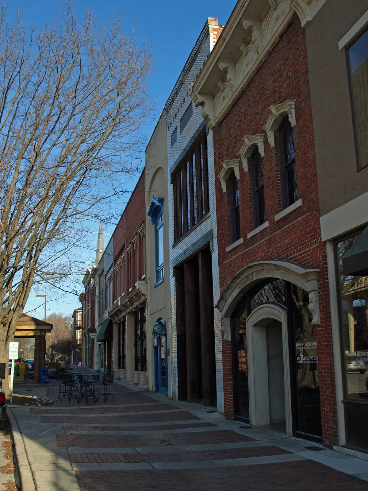
Gates Avenue Southeast in Huntsville, Alabama
Gates Avenue Southeast in Huntsville is an asphalted unclassified road. It runs in a northeast-southwest direction starting from Lincoln Street Southeast and crosses Greene Street Southeast, Franklin Street Southeast and Madison Street and ends at Gates Avenue Southwest. This street is part of 1 Bicycle route. Nearby you can find a tea shop and a tourist information.
- Road Type
- unclassified road
- Route
- northeast-southwest
Image
Streets nearby
Gates Avenue Southwest200 ft
Madison Street200 ft
Williams Avenue SouthwestTravelers II, Big Spring West, Mrs. Nadine Meslon Yeager
400 ft
South Side SquareSmall Bull sculpture
400 ft
Williams Avenue Southeast400 ft
Franklin Street SoutheastThe Orthopaedic Center, Saint Marks Church
400 ft
Fountain Circle Southwest500 ft
Southside Square500 ft
West Side SquareHuntsville, Westside Square
550 ft
Eustis Avenue SoutheastGreen Bus Brewing
550 ft
East Side Square0.1 mi
North Side SquareThe Poppy and Parliament
0.1 mi
Spring Street Southwest0.1 mi
Greene Street SoutheastFirst Methodist Church
0.1 mi
Washington Street SoutheastJimmy John's, Miller's Tavern, Whiskey Bottom Saloon
0.2 mi
Randolph Avenue Southeast0.2 mi
Big Spring Park GreenwayThe Cozy Cow
0.2 mi
Lincoln Street SoutheastCentral Presbyterian Church
0.2 mi
Japanese Red Bridge0.2 mi
Neal Avenue Southeast0.2 mi
Manning Drive Southwest0.2 mi
Gallatin Street Southwest0.2 mi
Dr. Joseph E. Lowery Boulevard SouthwestTravelers
0.3 mi
Lowe Avenue Southwest0.3 mi
Banks nearby
Wells Fargo300 ft
Buildings nearby
Huntsville Inspection Department0.1 mi
Hotel Russell Erskine0.2 mi
Blount Hospitality House0.3 mi
Courthouses nearby
Madison County Courthouse550 ft
US Courthouse0.3 mi
Doctor's offices nearby
Alabama Women's Wellness Center0.3 mi
Hardware stores nearby
Harrison Brothers Hardware400 ft
Hotels nearby
106 Jefferson Huntsville, Curio Collection by Hilton0.2 mi
Museums nearby
Constitution Hall Park100 ft
Early Works Museum250 ft
Weeden House0.1 mi
Huntsville Museum of Art0.2 mi
Parking lots nearby
Garage O0.2 mi
Parks nearby
Bicentennial Park400 ft
Places of worship nearby
Church of the Nativity0.1 mi
Randolph Church0.2 mi
First Presbyterian Church0.2 mi
Pubs nearby
Voodoo Lounge250 ft
BeeZr0.1 mi
Jack Brown's Beer & Burger Joint0.2 mi
Restaurants nearby
Sam & Greg's Pizzeria/ Gelateria300 ft
Cotton Row300 ft
Commerce Kitchen400 ft
Town halls nearby
Huntsville City Hall250 ft
Public transit map Huntsville Legend
| Railway | |
| Bus | |
| Streetcar |
Bicycle map Huntsville Legend
| Bike path | |
| Bike lane on roadway | |
| Cycling allowed on bus lane | |
| Bicycle street | |
| Open to cyclists | |
| Open to cyclists, good path | |
| Cycling prohibited | |
| Cobblestone |
| Long-distance bike route | (depending on scale) | |
| Long-distance bike route |
Pedestrian map Huntsville Legend
| Path |
| Long-distance hiking trail | (depending on scale) | |
| Long-distance hiking trail | ||
| Pedestrians prohibited |