This page is the City map of Alaska, a map with streets, paths, and places across the largest state of the United States. Alaska covers approximately 1,717,856 square kilometres and had 733,391 residents in 2020, compared with 710,231 in 2010. The state was admitted to the United States in 1959 and extends from the Arctic Ocean to the Pacific Ocean and the Bering Sea. Major geographic features include the Alaska Range, the Yukon River, the Aleutian Islands, and Denali, North America's highest mountain. One long-distance cycle route is recorded in Alaska.
Wrangell is a consolidated city-borough in Southeast Alaska on Wrangell Island, within the Alexander Archipelago. The community had 2,127 residents according to the supplied regional data and covers approximately 8,966,715,387 square metres. Wrangell was established in 1834, and its elevation is listed as 21 metres.
The city lies near the Stikine River delta and the Stikine River enters the nearby coastal waters through a broad network of channels. Wrangell is connected with the Inside Passage and is part of the forested island landscape of the Tongass National Forest.
Ketchikan Gateway Borough occupies part of Southeast Alaska along the Inside Passage, with Ketchikan as its principal community. The borough had 13,948 residents and covers approximately 4,545,000,000 square metres. Ketchikan lies on Revillagigedo Island near Tongass Narrows, a major marine passage between islands and the mainland.
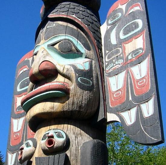
The borough includes coastal rainforest and islands of the Alexander Archipelago, where the Tongass National Forest covers extensive areas. Ketchikan is known for its collection of Tlingit, Haida, and Tsimshian totem poles, including displays associated with Saxman Native Village and Totem Bight State Historical Park.
Prince of Wales-Hyder is a southeastern Alaska administrative region that includes Prince of Wales Island, the fourth-largest island in the United States. The region belongs to the Alexander Archipelago and is surrounded by channels of the Inside Passage. Communities include Craig, Klawock, Hydaburg, and Coffman Cove.
Much of the land lies within the Tongass National Forest, where temperate rainforest covers mountainous terrain and coastal valleys. Hyder is located at the head of the Portland Canal beside the British Columbia boundary, while the western part of the region faces the Gulf of Alaska.
Aleutians East Borough extends along the eastern Aleutian Islands and the Alaska Peninsula. Important communities include Sand Point on Popof Island, Cold Bay on the Alaska Peninsula, and King Cove. The borough is bordered by the North Pacific Ocean to the south and the Bering Sea to the north.
The region contains volcanic islands, narrow coastal settlements, and active fishing ports. The Alaska Peninsula and nearby islands form part of the Pacific Ring of Fire, while the Izembek National Wildlife Refuge protects wetlands near Cold Bay and supports large populations of migratory birds.
Anchorage is a consolidated city-borough and the largest city in Alaska, with 291,247 residents in the supplied data. It covers approximately 5,035,063,041 square metres and has a listed elevation of 31 metres. The city was established in 1914 at the head of Cook Inlet, between the Chugach Mountains and the waters of Knik Arm and Turnagain Arm.
Anchorage is connected with the Alaska Range, the Kenai Peninsula, and the interior by major roads and rail lines. Nearby natural landmarks include Chugach State Park, Ship Creek, and the mudflats of the west-facing coast, while the Alaska Native Heritage Center documents the cultures of Alaska's Indigenous peoples.
Bristol Bay Borough lies on the eastern side of Bristol Bay in southwestern Alaska and includes the communities of Naknek, King Salmon, and South Naknek. The borough had 844 residents and covers approximately 2,299,000,000 square metres. Naknek is situated near the mouth of the Naknek River, which flows into Bristol Bay.
Bristol Bay is one of the world's major sockeye salmon fisheries, with the Naknek, Kvichak, and Egegik river systems supporting large salmon runs. King Salmon is also a gateway to Katmai National Park and Preserve, whose volcanic landscape includes the Valley of Ten Thousand Smokes.
Denali Borough covers approximately 33,086,000,000 square metres along the Alaska Range and the Nenana River corridor. It had 1,619 residents in the supplied data, and the borough was established in 1990. The region includes the community of Healy and the northern access area of Denali National Park and Preserve.
Denali, also called Mount McKinley, rises to 6,190 metres and is the highest mountain in North America. The Nenana River flows through the borough toward the Tanana River, while Denali National Park protects tundra, glaciers, and wildlife such as grizzly bears, caribou, moose, and Dall sheep.
Fairbanks North Star Borough is centred on Fairbanks in the interior of Alaska and had 95,655 residents according to the supplied data. The borough covers approximately 19,280,000,000 square metres and was established in 1964. Fairbanks stands on the Chena River, a tributary of the Tanana River.
The region lies north of the Alaska Range and has a subarctic continental climate with strong seasonal contrasts. The University of Alaska Fairbanks operates the Museum of the North, while nearby Fort Wainwright and the Alaska Highway connect the city with other interior settlements.
Unknown employee of the United States government, Public domain – Wikimedia Commons
Haines Borough is located in northern Southeast Alaska at the head of the Lynn Canal, a long fjord connected with the Inside Passage. The town of Haines lies on the Chilkat Peninsula between the Chilkat and Chilkoot mountain ranges. The Chilkat River and Chilkoot River flow through the surrounding valleys.
The region includes the Alaska Chilkat Bald Eagle Preserve, where bald eagles gather along the Chilkat River during autumn. Haines is also connected by road to Haines Junction in Yukon through the Haines Highway, which crosses the Coast Mountains.
Juneau is Alaska's capital and a consolidated city-borough on the mainland coast of Southeast Alaska. The city lies beside the Gastineau Channel and is enclosed by the Coast Mountains, with Douglas Island directly across the channel. Juneau includes the Mendenhall Valley and the Mendenhall Glacier, which descends from the Juneau Icefield.
The Juneau Icefield feeds more than 30 major glaciers, including Mendenhall Glacier and Taku Glacier. The city is not connected to Alaska's road network by a continuous highway, and access is provided by air and marine routes through the Inside Passage.
Kodiak Island Borough includes Kodiak Island and neighbouring islands in the Gulf of Alaska. Kodiak is the principal city and lies on the northeastern coast of Kodiak Island, which is separated from the Alaska Peninsula by Shelikof Strait. The Kodiak Archipelago contains steep mountains, fjords, and large coastal bays.
Kodiak National Wildlife Refuge covers much of Kodiak Island and protects habitat for the Kodiak bear, a brown bear subspecies found on Kodiak, Afognak, and Shuyak islands. The region's coastal waters support commercial fishing for salmon, crab, and other species, while the Karluk and Kodiak rivers drain major island valleys.
Lake and Peninsula Borough extends across the Alaska Peninsula and a large section of southwestern Alaska. It includes communities such as Iliamna, King Salmon, Port Alsworth, and Chignik, as well as the large Iliamna Lake. Lake Iliamna is the largest lake in Alaska and the second-largest freshwater lake wholly within the United States.
The borough borders Bristol Bay and contains parts of Lake Clark National Park and Preserve and Katmai National Park and Preserve. The Alaska Peninsula is crossed by volcanic peaks, including Mount Iliamna and Mount Redoubt, and its rivers carry salmon toward Bristol Bay.
Matanuska-Susitna Borough lies north of Anchorage between the Talkeetna Mountains and the Alaska Range. It had 101,095 residents in the supplied data, with Palmer and Wasilla among its largest communities. The borough contains the Matanuska, Susitna, and Knik river valleys.
The Matanuska River flows west toward Knik Arm, while the Susitna River runs south from the Alaska Range to Cook Inlet. Denali State Park occupies the northern part of the borough and provides views toward Denali, while agricultural land around Palmer developed in the Matanuska Valley.
North Slope Borough occupies the northernmost part of Alaska between the Brooks Range and the Arctic Ocean. The regional centre is Utqiagvik, formerly Barrow, located on the coast of the Beaufort Sea. Other communities include Prudhoe Bay, Point Hope, Wainwright, and Nuiqsut.
The Colville River is the largest river on Alaska's North Slope and flows north into the Arctic Ocean. The region contains tundra, permafrost, coastal lagoons, and the National Petroleum Reserve-Alaska, while the Arctic National Wildlife Refuge begins east of the borough.
Northwest Arctic Borough covers the Kobuk River basin and the coastal area around Kotzebue Sound in northwestern Alaska. Kotzebue is the principal community, and other settlements include Ambler, Kiana, Noatak, Selawik, and Shungnak. The borough lies north of the Seward Peninsula and west of the Brooks Range.
The Kobuk River flows west through the borough, passing the Great Kobuk Sand Dunes in Kobuk Valley National Park. The Noatak River drains the Noatak National Preserve, one of the largest undisturbed river basins in the United States, while the region's communities are connected mainly by air and seasonal waterways.
Petersburg Borough lies in Southeast Alaska on Mitkof Island within the Alexander Archipelago. Petersburg is situated between the Wrangell Narrows and Frederick Sound, near the mainland and the larger islands of the Inside Passage. The borough includes coastal mountains, islands, and channels shaped by glacial erosion.
Petersburg developed as a fishing and marine-processing centre, and the surrounding waters provide access to the rich fishing grounds of Frederick Sound. LeConte Glacier lies to the north near the town of Petersburg and is the southernmost tidewater glacier in North America.
Sitka is a consolidated city-borough on the west coast of Baranof Island in Southeast Alaska. The supplied data lists 8,458 residents, an area of approximately 12,461,482,347 square metres, and an elevation of 8 metres. Sitka was established in 1799 and lies between the Pacific Ocean and the forested mountains of the Tongass National Forest.
Sitka was the capital of Russian America until the transfer of Alaska to the United States in 1867. Historic sites include Sitka National Historical Park, St. Michael's Cathedral, and the Russian Bishop's House, while Mount Edgecumbe rises across Sitka Sound on Kruzof Island.
Skagway is a consolidated city-borough at the northern end of the Lynn Canal in Southeast Alaska. The community had 1,164 residents, covers approximately 24,601,947 square metres, and has a listed elevation of 10 metres. Skagway was established in 1897 during the Klondike Gold Rush.
The town lies at the mouth of the Skagway River below the White Pass, a historic route toward the Yukon. The Klondike Gold Rush National Historical Park preserves buildings and trails associated with the 1898 rush, including sections of the Chilkoot Trail and the White Pass route.
Yakutat is a city-borough on the Gulf of Alaska coast, west of the Canadian border and north of Glacier Bay. The settlement lies near Yakutat Bay, where the Situk, Alsek, and Dangerous rivers reach the coast. The region combines coastal lowlands with the St. Elias Mountains and extensive glacial terrain.
Yakutat Bay provides access to Hubbard Glacier, one of Alaska's largest tidewater glaciers, and to the coastal waters near Glacier Bay National Park. The Situk River is known for salmon habitat, while the nearby Malaspina Glacier spreads across the foothills of the St. Elias Range.
Kenai Peninsula Borough covers approximately 64,114,000,000 square metres and had 58,799 residents in the supplied data. The borough occupies the Kenai Peninsula south of Anchorage, with Kenai, Soldotna, Homer, Seward, and Nikiski among its principal communities. The region is bordered by Cook Inlet, Kachemak Bay, and the Gulf of Alaska.
The Kenai River flows from Kenai Lake to Cook Inlet and is internationally known for salmon fishing, while the Russian River is another major salmon stream. The borough contains Kenai Fjords National Park near Seward, the Harding Icefield, and large sections of the Kenai National Wildlife Refuge.
The Unorganized Borough covers the parts of Alaska that are not included in one of the state's organized boroughs or unified municipalities. It includes remote areas of the Yukon-Kuskokwim Delta, the interior, the Alaska Peninsula, and parts of the North Slope. Communities in these areas include Bethel, Nome, Dillingham, and Galena.
The region contains major rivers such as the Yukon, Kuskokwim, and lower Copper River, as well as landscapes including the Seward Peninsula and the Yukon Delta National Wildlife Refuge. Alaska's Unorganized Borough is administered differently from organized boroughs, with local services distributed among cities, state agencies, and tribal governments.




 Public transit map Alaska Legend
  Bicycle map Alaska Legend
  Pedestrian map Alaska Legend