
Eric Marcus Municipal Airport in Ajo, AZ 85321
Eric Marcus Municipal Airport in Ajo, AZ 85321 (Pima County) is an airfield. Ⓦ.
- Operator
- Pima County
Image
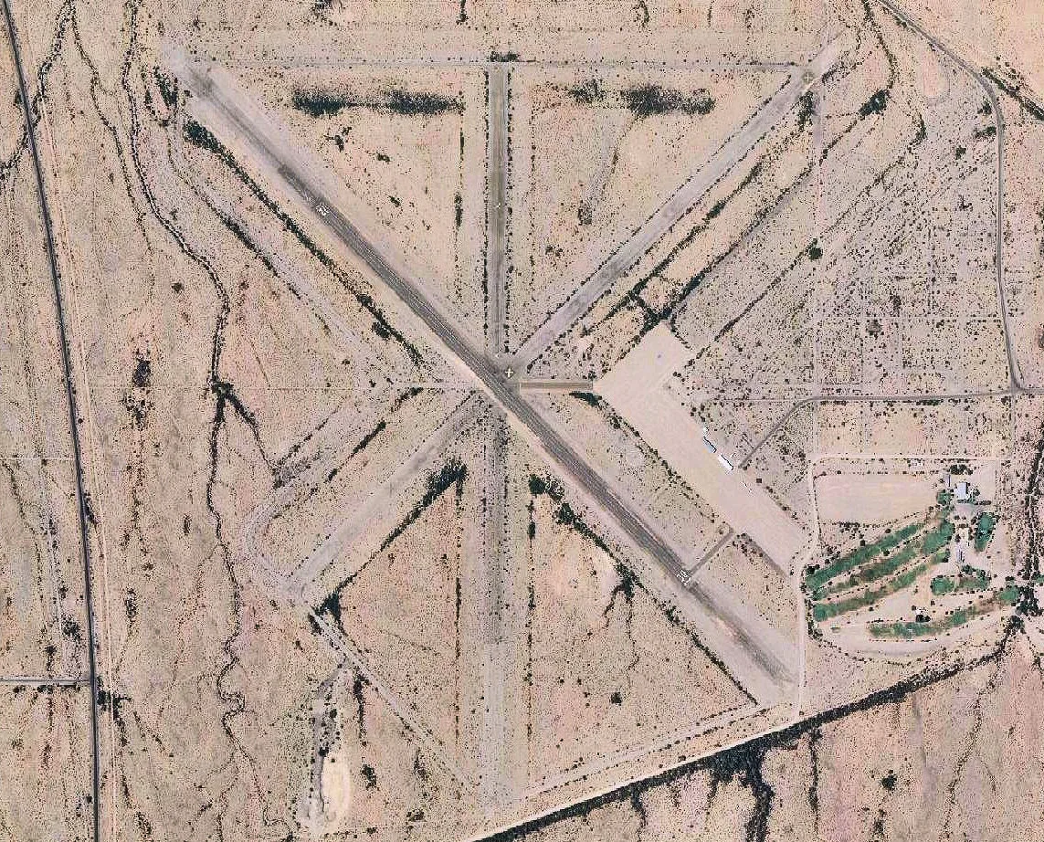
Streets nearby
Airport Golf Course0.3 mi
Mead RoadChilds
0.9 mi
Well Road1.1 mi
Cole Road1.4 mi
Denison Road1.7 mi
West Hayworth Road1.7 mi
West Lewis Road2.0 mi
West Walker Road2.3 mi
West Fees Road2.5 mi
Fees Road2.6 mi
West Nelson Road2.7 mi
North Rosser Road2.9 mi
West Keener Road2.9 mi
West Schwartz Road3.1 mi
North Elliott Road3.3 mi
West Snyder Road3.4 mi
West Briggs Road3.6 mi
Ajo Well Road No 13.8 mi
North Ajo Gila Bend Highway3.9 mi
West McMahon RoadAce Hardware, Olsens Marketplace
3.9 mi
Rasmussen Road4.0 mi
Palm Street4.0 mi
West 11th Street4.1 mi
West 10th Street4.1 mi
North Roberts Road4.2 mi
Maple Street4.2 mi
Olive Street4.2 mi
West Rasmussen Road4.2 mi
North Berry Road4.2 mi
West 8th Street4.2 mi
West 9th Street4.3 mi
Roberts Road4.3 mi
North 2nd AvenueShell, Roadrunner Java
4.3 mi
West 7th Street4.3 mi
North StreetMoqah Coffee & Beyond, Marti's Bistro, 19th Hole Bar & Grille
4.4 mi
Gila Bend-Lukeville HighwayBarry M Goldwater East Gate 15
4.4 mi
North Whale Mountain Road4.4 mi
West 6th Street4.4 mi
Buildings nearby
Ajo Golf Course0.3 mi
Cemeteries nearby
Childs Cemetery3.4 mi
Community centers nearby
Ajo Community Center4.4 mi
Disused railways nearby
Tucson, Cornelia and Gila Bend Railroad0.8 mi
Gas stations nearby
Chevron3.9 mi
Golf courses nearby
Ajo Country Club and Golf Course0.3 mi
Hotels nearby
La Siesta Motel & RV Resort3.2 mi
Parks nearby
Bud Walker Park4.3 mi
Places of worship nearby
Ajo Church of God4.0 mi
Streams nearby
Tenmile Wash3.6 mi
Waters nearby
North Dam Tailings Pond4.2 mi
| Elevation | 1458 |
|---|---|
| Located in | Pima County |
| Country | United States |
| Website | https://www.pima.gov/852/Eric-Marcus-Municipal-Airport-Ajo-AZ |
 Public transit map Pima County Legend
| Railway | |
| Bus | |
| Streetcar |
 Bicycle map Pima County Legend
| Bike path | |
| Bike lane on roadway | |
| Cycling allowed on bus lane | |
| Bicycle street | |
| Open to cyclists | |
| Open to cyclists, good path | |
| Cycling prohibited | |
| Cobblestone |
| Long-distance bike route | (depending on scale) | |
| Long-distance bike route |
 Pedestrian map Pima County Legend
| Path |
| Long-distance hiking trail | (depending on scale) | |
| Long-distance hiking trail | ||
| Pedestrians prohibited |