
Arkansas

Arkansas
This City map of Arkansas shows the state’s streets, roads, paths and places across approximately 137,733 square kilometres in the United States. Arkansas had 3,011,524 residents in 2020, compared with 2,915,918 in 2010, and the state was founded in 1836. The landscape includes the Ozark and Ouachita mountains, the Arkansas River and the Mississippi River. The map covers 88 mapped subregions, including counties, towns and cities.
Alexander

Alexander is an administrative-level-8 locality in Arkansas, United States. It lies within the state’s network of local towns and settlements shown on the regional map.
The locality is connected to the wider Arkansas road structure and can be viewed together with nearby communities and counties.
To the mapTillar

Tillar is an administrative-level-8 locality with a recorded population of 221. The community is located in Arkansas, where the Mississippi Alluvial Plain covers broad lowland areas in the eastern part of the state.
The map identifies Tillar among Arkansas’s smaller settlements and shows its relationship with surrounding roads, places and county boundaries.
To the mapAlpena

Alpena is a town in Arkansas with 374 residents and an elevation of 348 metres. Its recorded area is 3,470,602 square metres, and its local government dates from 1908.
The town lies in the northern part of Arkansas, near the Ozark uplands. The regional map places Alpena among the roads and settlements of the surrounding county landscape.
To the mapFairfield Bay

Fairfield Bay is a city in Arkansas with a recorded population of 2,108 and an elevation of 265 metres. Its mapped area is 39,685,277 square metres.
The city is situated in the Ozark region of north-central Arkansas. Its location can be read together with nearby roads, forested uplands and settlements on the state map.
To the mapDamascus

Damascus is a settlement in Arkansas with 382 residents and an elevation of 212 metres. The mapped area is 4,874,714 square metres.
The community belongs to the local settlement structure of central Arkansas. The map shows Damascus in relation to nearby streets, routes and administrative areas.
To the mapElm Springs

Elm Springs is an administrative-level-8 locality in Arkansas. It is located in the northwestern part of the state, an area associated with the Ozark Plateau and the expanding urban region around Benton and Washington counties.
The map records Elm Springs as a separate settlement and connects it with the surrounding network of local roads and places.
To the mapHardy
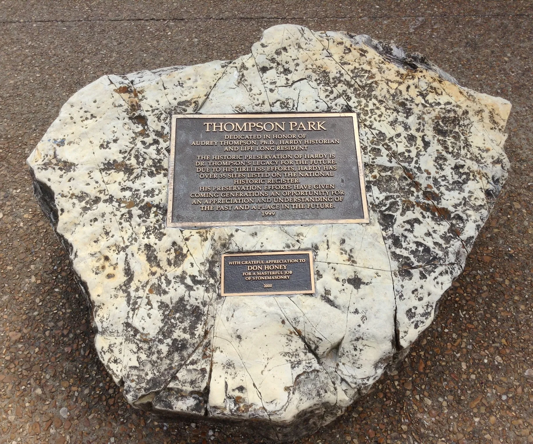
Hardy is an administrative-level-8 locality in northern Arkansas. The town lies in the Spring River area, where waterways and wooded uplands characterize the landscape of the Ozark foothills.
Its position on the regional map can be compared with nearby settlements in Sharp and Fulton counties. Streets, paths and local connections are represented within the Arkansas map.
To the mapCherokee Village

Cherokee Village is a city in Sharp County, Arkansas, with 4,780 residents. Its recorded area is 53,602,006 square metres, and its elevation is 211 metres.
The city is located in the Ozark foothills of northeastern Arkansas. The map shows Cherokee Village together with local roads, developed areas and nearby communities.
To the mapPolk County

Polk County is an Arkansas county created in 1844, with 19,221 residents and an area of 2,234 square kilometres. It occupies the southwestern corner of the state along the Ouachita Mountains.
Mena is the county seat, and the Ouachita River crosses the wider county region. The map shows Polk County’s roads, settlements and mountain terrain.
To the mapBenton County

Benton County was established in 1836 and has 284,333 residents across approximately 2,280 square kilometres. It is located in northwestern Arkansas along the Missouri and Oklahoma borders.
Bentonville is the county seat, while Rogers and Bella Vista are major communities. The county belongs to the Ozark landscape and contains parts of the urban corridor around the Interstate 49 route.
To the mapBoone County
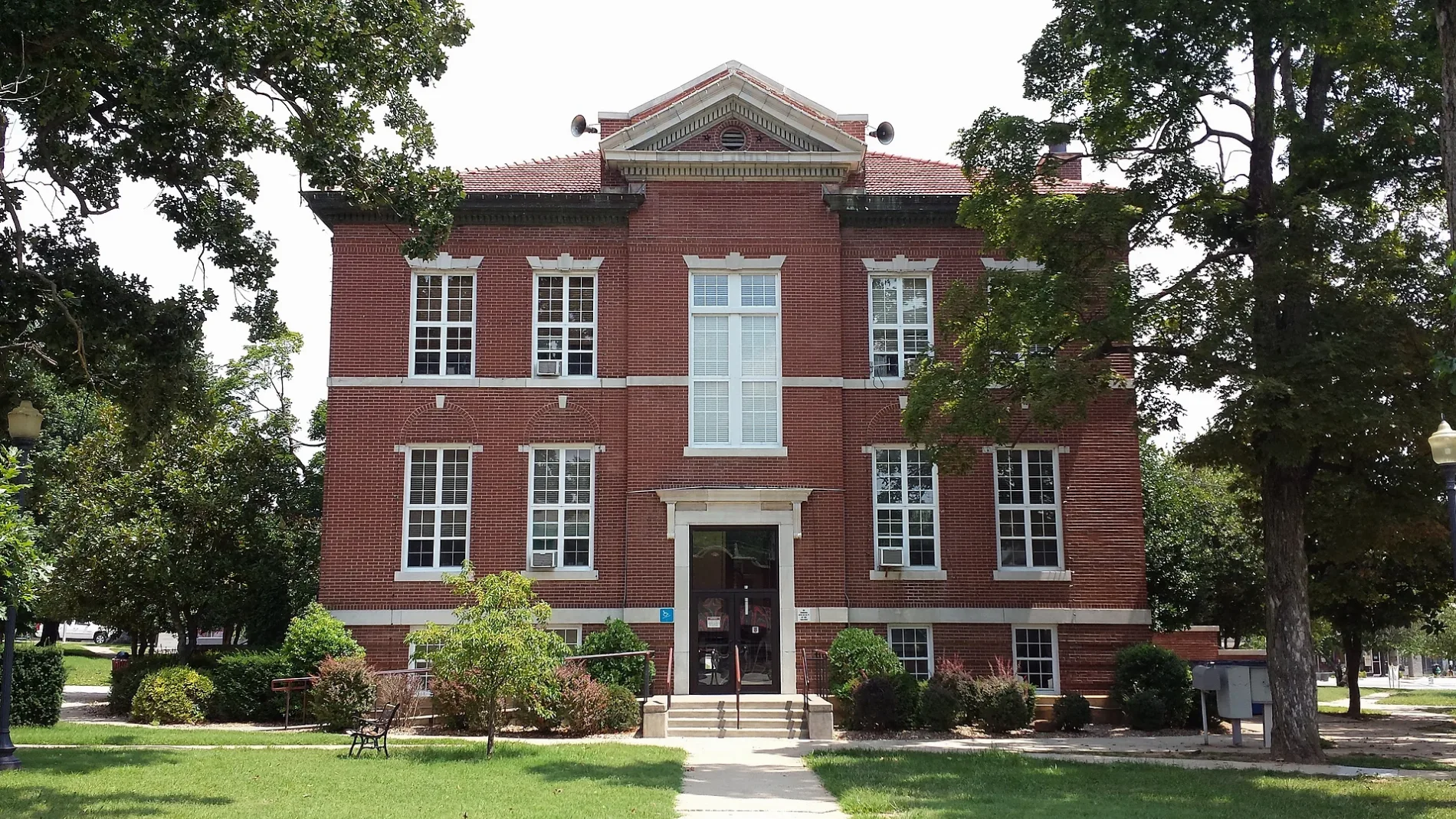
Boone County was created in 1869 and has 37,373 residents in an area of about 1,559 square kilometres. Harrison is the county seat and the principal city.
The county lies in the northern Ozarks near the Buffalo National River. Its map includes Harrison, smaller communities and roads crossing the wooded hills and valleys.
To the mapCarroll County

Carroll County was established in 1833 and has 28,260 residents across approximately 1,655 square kilometres. The county is in northwestern Arkansas within the Ozark Plateau.
Berryville is the county seat, while Eureka Springs is a notable historic city in the county. The map shows the county’s settlements, roads and rugged upland terrain.
To the mapBaxter County

Baxter County was founded in 1873 and has 41,627 residents in approximately 1,520 square kilometres. Mountain Home is the county seat and the largest local centre.
The county includes the White River and lies near Bull Shoals Lake and Norfork Lake. These waterways and the surrounding Ozark hills are visible in the county’s geographic setting.
To the mapClay County

Clay County was created in 1873 and has 14,552 residents across approximately 1,661 square kilometres. It occupies the northeastern corner of Arkansas along the Missouri border.
Corning and Piggott are the principal towns. The county is part of the lowlands near the St. Francis River, and the map shows its agricultural areas and connecting roads.
To the mapCraighead County

Craighead County was established in 1859 and has 111,231 residents in approximately 1,847 square kilometres. Jonesboro is the county seat and the largest city in northeastern Arkansas.
The county lies between the Crowley’s Ridge upland and the Mississippi Alluvial Plain. The map includes Jonesboro, Lake City, local highways and the surrounding agricultural landscape.
To the mapCrawford County

Crawford County was founded in 1820 and has 60,133 residents across approximately 1,565 square kilometres. Van Buren is the county seat, while Alma and the western part of Fort Smith are important local centres.
The Arkansas River crosses the county from west to east. The county’s position at the edge of the Ozark Mountains is reflected in the roads, river valleys and settlements shown on the map.
To the mapCrittenden County

Crittenden County has 48,963 residents and lies in eastern Arkansas beside the Mississippi River. West Memphis is the county seat and a major transportation centre opposite Memphis, Tennessee.
The county belongs to the Mississippi Alluvial Plain, with low terrain and extensive agricultural land. The map shows West Memphis, Marion, Interstate 40 and routes leading toward the Mississippi River.
To the mapCross County

Cross County was established in 1862 and has 16,833 residents across approximately 1,612 square kilometres. Wynne is the county seat and its principal community.
The county lies in eastern Arkansas near Crowley’s Ridge and the St. Francis River basin. Its map includes agricultural land, county roads and the settlement of Wynne.
To the mapFranklin County

Franklin County was created in 1837 and has 17,097 residents in approximately 1,605 square kilometres. Ozark is the county seat, and Charleston is another historic community.
The Arkansas River passes through the county, which extends into the Boston Mountains of the Ozarks. The map shows river crossings, mountain roads and settlements around Ozark and Charleston.
To the mapFulton County

Fulton County was established in 1842 and has 12,075 residents across approximately 1,607 square kilometres. Salem is the county seat.
The county is located in northern Arkansas near the Missouri border and the Spring River. Its roads and settlements are mapped within the wooded upland landscape of the Ozarks.
To the mapGreene County

Greene County was founded in 1833 and has 45,736 residents in approximately 1,501 square kilometres. Paragould is the county seat and the largest city.
The county lies in northeastern Arkansas near Crowley’s Ridge and the St. Francis River lowlands. The regional map shows Paragould, smaller towns and roads across the agricultural plain.
To the mapIndependence County

Independence County was established in 1820 and has 37,938 residents across approximately 1,998 square kilometres. Batesville is the county seat and a historic centre on the White River.
The county extends from the White River valley into the foothills of the Ozarks. The map records Batesville, local highways and settlements along the river and upland roads.
To the mapIzard County

Izard County was created in 1825 and has 13,577 residents in approximately 1,513 square kilometres. Melbourne is the county seat.
The county lies in north-central Arkansas among the Ozark hills and near the Strawberry and White rivers. Its map shows rural roads, wooded uplands and communities surrounding Melbourne.
To the mapJackson County

Jackson County was established in 1829 and has 16,755 residents across approximately 1,661 square kilometres. Newport is the county seat and the principal city.
The county is located along the White River in eastern Arkansas. Its lowland setting connects the roads and settlements of Newport with surrounding agricultural areas.
To the mapLawrence County

Lawrence County was founded in 1815 and has 16,216 residents in approximately 1,534 square kilometres. Walnut Ridge is the county seat, and Hoxie is a nearby community.
The county lies in northeastern Arkansas near the Black River and Crowley’s Ridge. The map shows the two towns, county roads and the transition between upland and lowland terrain.
To the mapLee County

Lee County was created in 1873 and has 8,600 residents across approximately 1,604 square kilometres. Marianna is the county seat.
The county lies in the Mississippi Alluvial Plain, west of the Mississippi River. Its map records Marianna, agricultural roads and the low-lying landscape of eastern Arkansas.
To the mapLogan County

Logan County was established in 1871 and has 21,131 residents in approximately 1,895 square kilometres. Paris is the county seat, while Booneville is another important local centre.
The county extends across the Arkansas River Valley toward Mount Magazine, the highest point in Arkansas at 839 metres. The map shows mountain roads, river-valley settlements and communities such as Paris and Booneville.
To the mapMadison County

Madison County was founded in 1836 and has 16,521 residents across approximately 2,168 square kilometres. Huntsville is the county seat.
The county occupies part of the Boston Mountains in northwestern Arkansas. The map shows Huntsville, winding mountain roads and valleys connected with the larger Ozark region.
To the mapMarion County

Marion County was established in 1836 and has 16,826 residents in approximately 1,658 square kilometres. Yellville is the county seat.
The county lies in the northern Ozarks along the Buffalo National River and near Bull Shoals Lake. Its map combines river valleys, wooded uplands and rural roads around Yellville.
To the mapMississippi County

Mississippi County was created in 1833 and has 40,685 residents across approximately 2,382 square kilometres. Blytheville and Osceola are the principal cities.
The county occupies the northeastern corner of the Mississippi Alluvial Plain beside the Mississippi River. The map shows extensive agricultural land, levee roads and transport links around Blytheville and Osceola.
To the mapMonroe County

Monroe County was founded in 1829 and has 6,799 residents in approximately 1,609 square kilometres. Clarendon is the county seat.
The county lies in the lower Arkansas Delta near the White River and the Cache River. Its map shows Clarendon, rural roads and the flat agricultural terrain of eastern Arkansas.
To the mapNewton County

Newton County was established in 1842 and has 7,225 residents across approximately 2,132 square kilometres. Jasper is the county seat.
The county is centered on the rugged Boston Mountains and includes portions of the Buffalo National River region. The map shows steep valleys, forest roads and the settlement of Jasper.
To the mapPhillips County
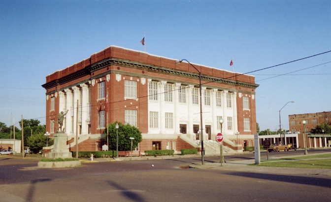
Phillips County was created in 1820 and has 16,568 residents in approximately 1,884 square kilometres. Helena-West Helena is the county seat and a historic Mississippi River community.
The county lies in the Arkansas Delta beside the Mississippi River and Crowley’s Ridge. The map records Helena-West Helena, agricultural roads and river-related lowlands.
To the mapPoinsett County

Poinsett County was established in 1838 and has 22,965 residents across approximately 1,977 square kilometres. Harrisburg is the county seat.
The county is part of the eastern Arkansas Delta, with agricultural land around the St. Francis River basin. The map shows Harrisburg, local highways and the flat terrain of the Mississippi Alluvial Plain.
To the mapPrairie County

Prairie County was founded in 1846 and has 8,282 residents in approximately 1,750 square kilometres. DeValls Bluff and Des Arc are the county’s principal communities.
The county extends across the Grand Prairie and lies near the White River. Its map shows flat agricultural land, county roads and settlements connected with the central Arkansas Delta.
To the mapRandolph County
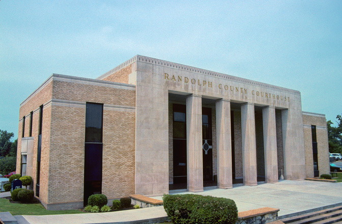
Randolph County was established in 1835 and has 18,571 residents across approximately 1,699 square kilometres. Pocahontas is the county seat.
The county lies in northeastern Arkansas along the Black River and Current River region. The map shows Pocahontas, river valleys and roads leading through the northern Ozark transition zone.
To the mapSt. Francis County

St. Francis County was created in 1827 and has 23,090 residents in approximately 1,664 square kilometres. Forrest City is the county seat.
The county lies beside Crowley’s Ridge and the Mississippi Alluvial Plain. Its map includes Forrest City, Interstate 40, agricultural roads and settlements along the ridge and lowlands.
To the mapSearcy County

Searcy County was established in 1838 and has 7,828 residents across approximately 1,728 square kilometres. Marshall is the county seat.
The county is located in the Ozark Mountains and includes sections of the Buffalo National River. The map shows Marshall, wooded ridges, river valleys and rural mountain roads.
To the mapSebastian County

Sebastian County was founded in 1851 and has 127,799 residents in approximately 1,414 square kilometres. Fort Smith is the county seat and the largest city.
The county lies on the Arkansas River along the Oklahoma border. The map shows Fort Smith, Greenwood, the river corridor and transport routes through the western Arkansas River Valley.
To the mapSharp County
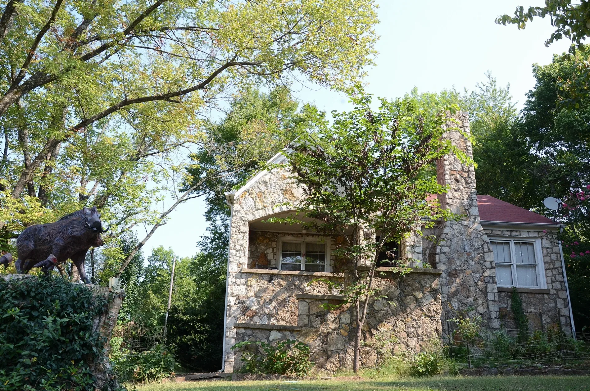
Sharp County was created in 1868 and has 17,271 residents across approximately 1,570 square kilometres. Ash Flat is the county seat.
The county lies in northern Arkansas near the Spring River and the foothills of the Ozarks. Cherokee Village is a major local settlement, and the map shows its roads and surrounding uplands.
To the mapStone County

Stone County was established in 1873 and has 12,359 residents in approximately 1,578 square kilometres. Mountain View is the county seat.
The county lies in the Ozark Mountains and is known for the Blanchard Springs Caverns area and the White River region. The map shows Mountain View, wooded hills and roads crossing the upland terrain.
To the mapVan Buren County

Van Buren County was founded in 1833 and has 15,796 residents across approximately 1,876 square kilometres. Clinton is the county seat.
The county extends from the Ozark uplands toward Greers Ferry Lake and the Little Red River. The map shows Clinton, reservoir-side roads and wooded valleys in north-central Arkansas.
To the mapWashington County

Washington County has 225,477 residents and lies in northwestern Arkansas along the Oklahoma border. Fayetteville is the county seat and the main urban centre.
The county includes the University of Arkansas campus in Fayetteville and large sections of the Ozark Plateau. The map shows Fayetteville, Springdale, Interstate 49 and the surrounding roads and settlements.
To the mapWhite County

White County was established in 1835 and has 76,822 residents across approximately 2,700 square kilometres. Searcy is the county seat and largest city.
The county lies in central Arkansas between the Ozark foothills and the Arkansas Delta. The Little Red River crosses the region, and the map shows Searcy, Beebe, Bald Knob and connecting roads.
To the mapWoodruff County

Woodruff County was created in 1862 and has 6,269 residents. Augusta is the county seat and lies near the White River.
The county belongs to the eastern Arkansas Delta, where flat agricultural land surrounds the White River and Cache River. The map shows Augusta, rural roads and the county’s lowland settlement pattern.
To the mapLittle River County

Little River County was established in 1867 and has 12,026 residents across approximately 1,463 square kilometres. Ashdown is the county seat.
The county lies in southwestern Arkansas near the Red River and the Texas and Oklahoma borders. Its map shows Ashdown, forested areas, local roads and the river lowlands.
To the mapScott County

Scott County was founded in 1833 and has 9,836 residents in approximately 2,326 square kilometres. Waldron is the county seat.
The county occupies part of the Ouachita Mountains in western Arkansas. The map shows Waldron, winding mountain routes and valleys extending toward the Arkansas River region.
To the mapSevier County

Sevier County was created in 1828 and has 15,839 residents across approximately 1,506 square kilometres. De Queen is the county seat.
The county is located in southwestern Arkansas near the Red River and the Ouachita uplands. The map shows De Queen, local settlements, forest roads and the region’s border connections.
To the mapArkansas County
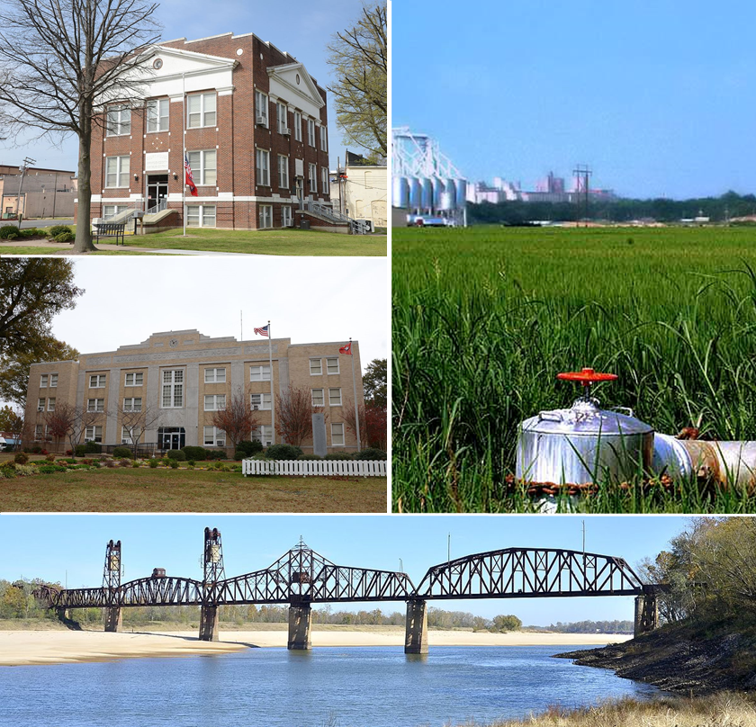
Arkansas County was established in 1813 and has 17,149 residents across approximately 2,678 square kilometres. Stuttgart is the county seat, while DeWitt is another major community.
The county stretches across the Arkansas Delta and the Grand Prairie near the Arkansas River. The map shows rice-growing agricultural land, Stuttgart, DeWitt and roads crossing the flat terrain.
To the mapLonoke County

Lonoke County was created in 1873 and has 74,015 residents in approximately 2,078 square kilometres. Lonoke is the county seat, and Cabot is the largest city.
The county lies northeast of Little Rock between the Arkansas Delta and central Arkansas. The map shows Interstate 40, Cabot, Lonoke and roads connecting the county with the capital region.
To the mapCleburne County

Cleburne County was established in 1883 and has 24,711 residents across approximately 1,533 square kilometres. Heber Springs is the county seat.
The county includes Greers Ferry Lake and the Little Red River in north-central Arkansas. The map shows Heber Springs, reservoir shorelines and roads through the surrounding Ozark foothills.
To the mapConway County

Conway County was founded in 1825 and has 20,715 residents in approximately 1,468 square kilometres. Morrilton is the county seat.
The county lies along the Arkansas River between the Ouachita and Ozark regions. Petit Jean State Park is located nearby on Petit Jean Mountain, while the map shows Morrilton and the river-valley road network.
To the mapFaulkner County

Faulkner County was established in 1873 and has 123,498 residents across approximately 1,720 square kilometres. Conway is the county seat and the largest city.
The county lies in central Arkansas between Little Rock and the Ozark foothills. The University of Central Arkansas is in Conway, and the map shows Interstate 40, Conway and surrounding communities.
To the mapPope County

Pope County was created in 1829 and has 63,381 residents in approximately 2,152 square kilometres. Russellville is the county seat and a major Arkansas River Valley city.
The county includes parts of the Ozark and Boston Mountain landscapes, with the Arkansas River running along its southern side. The map shows Russellville, Arkansas Tech University and roads across the river valley.
To the mapJohnson County

Johnson County was established in 1833 and has 25,749 residents across approximately 1,768 square kilometres. Clarksville is the county seat.
The county lies in the Arkansas River Valley beneath the Ozark Mountains. The map shows Clarksville, Interstate 40, Lake Ludwig and roads leading toward the Boston Mountains.
To the mapYell County

Yell County was founded in 1840 and has 20,263 residents. Danville is the county seat, while Dardanelle and Russellville are important communities near the county’s eastern side.
The county includes Mount Magazine and portions of the Ouachita and Arkansas River landscapes. The map shows mountain roads, the Arkansas River corridor and settlements around Danville and Dardanelle.
To the mapGarland County

Garland County was established in 1873 and has 100,180 residents across approximately 1,903 square kilometres. Hot Springs is the county seat and the principal city.
Hot Springs National Park surrounds the historic thermal springs of Hot Springs, and Lake Hamilton lies south of the city. The map shows the Ouachita Mountains, local roads and the urban area around Hot Springs.
To the mapGrant County

Grant County was created in 1869 and has 17,958 residents in approximately 1,639 square kilometres. Sheridan is the county seat.
The county lies south of Little Rock in the West Gulf Coastal Plain and Ouachita transition area. The map shows Sheridan, rural roads, forested land and connections toward central Arkansas.
To the mapJefferson County

Jefferson County was established in 1829 and has 67,260 residents across approximately 2,366 square kilometres. Pine Bluff is the county seat and the largest city.
The county lies along the Arkansas River and includes lowlands of the Arkansas Delta. The map shows Pine Bluff, the river corridor, agricultural areas and roads connecting central and southeastern Arkansas.
To the mapMontgomery County

Montgomery County was founded in 1842 and has 8,484 residents in approximately 1,849 square kilometres. Mount Ida is the county seat.
The county lies in the Ouachita Mountains and includes Lake Ouachita and parts of the Ouachita National Forest. The map shows Mount Ida, mountain roads, forest landscapes and reservoir shorelines.
To the mapData sources: OpenStreetMap (ODbL), Wikidata (CC0) · Image: Wikimedia Commons
| Named after | Quapaw |
|---|---|
| Year built | 1836 |
| Area | 137733 km² |
| Elevation | 198 m |
| Located in | United States |
| Country | United States |
| Body of water | Mississippi River |
| Population | 3011524 |
| Website | https://portal.arkansas.gov/ |
| Nickname | The Natural State |
| Native name | Arkansas |
| Official name | State of Arkansas |

 Public transit map Arkansas Legend
 | Railway | |
| Bus | |
| Tram |
 Bicycle map Arkansas Legend
 | Bike path | |
| Bike lane on roadway | |
| Cycling allowed on bus lane | |
| Bicycle street | |
| Open to cyclists | |
| Open to cyclists, good path | |
| Cycling prohibited | |
| Cobblestone |
| Long-distance bike route | (depending on scale) | |
| Long-distance bike route |
 Pedestrian map Arkansas Legend
 | Path |
| Long-distance hiking trail | (depending on scale) | |
| Long-distance hiking trail | ||
| Pedestrians prohibited |