
New Haven–Springfield Line in West Hartford, Connecticut
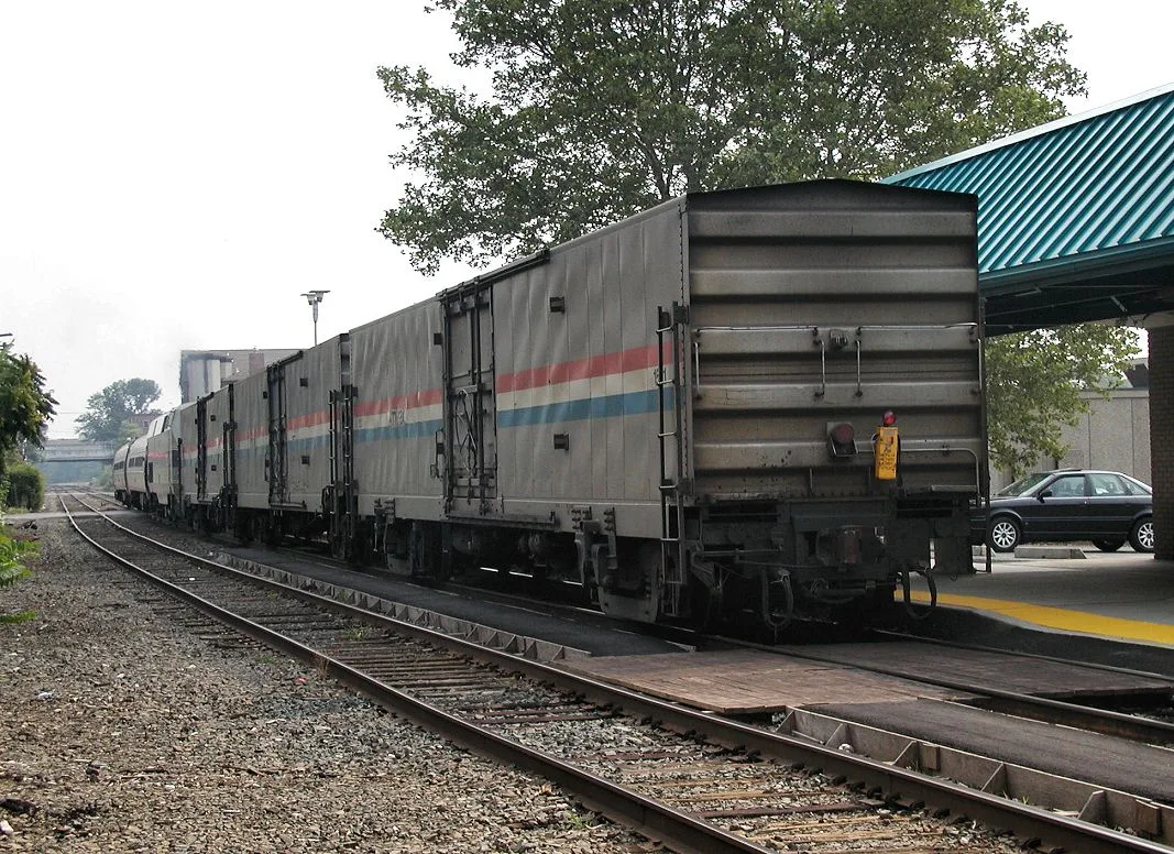
New Haven–Springfield Line in West Hartford is a railway (Amtrak, Route number MRS, 1435 mm, Main line). The train routes Vermonter, Valley Flyer, Northeast Regional and Hartford Line run here. It crosses a bridge. New Haven–Springfield Line also exists in Newington, Hartford, New Britain, Windsor Locks and Berlin. Ⓦ.
- Speed Limit
- 110 mph
- Operator
- Amtrak
Image
Variety stores
Pubs
Bike shops
Supermarkets
Gas stations
Restaurants
Stations
- train routes Hartford Line, Northeast Regional, Valley Flyer, Vermonter
Hardware stores
Music stores
Fast food restaurants
Auto repair shops
Banks
Furniture stores
Streets nearby
Carney Road150 ft
CTfastrak BuswayFlatbush Avenue Station, Elmwood Station, WOOD, Raymour & Flanigan, Dollar General
150 ft
Railroad Place150 ft
New Park AvenueThe Corner Pug, BiCi Co West
200 ft
Rose Avenue0.2 mi
Trout Brook TrailFernridge Place, Butler Equipment
0.2 mi
Woodlawn Street0.2 mi
Hurlbut Street0.2 mi
Cambridge Street0.2 mi
South Street0.3 mi
Sherman Street0.3 mi
Page Avenue0.3 mi
Cody Street0.3 mi
New Britain AvenueWebsterBank, Shake Shack, Hot Table Panini, Pokeworks, Jerry's Artorama, Elmwood, Family Dollar, Digital Sound Auto Repair, Domino's, Frank Pepe's West Hartford, Subway, The Hungry Crab, Bombay Olive, Dunkin'
0.3 mi
Newington Road0.3 mi
Custer Street0.3 mi
Brixton Road0.4 mi
Prescott Street0.4 mi
Quaker Lane SouthQuaker Ln S Little Free Library Charter #37246, Park Lane Pizza
0.4 mi
Shield Street0.4 mi
Burgoyne Street0.4 mi
Grassmere Avenue0.4 mi
School House Drive0.4 mi
Lynn Court0.4 mi
Grove Street0.4 mi
Southwood Drive0.5 mi
Jansen Court0.5 mi
Woodmere Road0.5 mi
Abandoned railways nearby
Industrial spur0.3 mi
Auto parts stores nearby
O'Reilly Auto Parts0.3 mi
Car dealerships nearby
AutoMax0.2 mi
Cemeteries nearby
Beth Jacob Cemetery0.3 mi
Community centers nearby
Elmwood Community Center0.3 mi
Drugstores nearby
CVS Pharmacy0.3 mi
Fire stations nearby
West Hartford Fire Department Station 30.1 mi
Furniture stores nearby
Ashley HomeStore450 ft
Interior decorators nearby
Kellie Burke Interiors150 ft
Libraries nearby
Faxon Branch Public Library0.2 mi
Parks nearby
Southwood Park0.5 mi
Pharmacies nearby
Walgreens0.4 mi
Places of worship nearby
Saint Bridget Roman Catholic Church0.2 mi
Elmwood Community Church0.3 mi
Lighthouse Tabernacle0.5 mi
Post offices nearby
Shield Street Post Office0.4 mi
Railways nearby
Fernwood Yard0.4 mi
Rivers nearby
Piper Brook0.4 mi
Tire dealers nearby
Town Fair Tire0.3 mi
Other nearby
Trout Brook Flood Control Wall0.2 mi
Trout_Brook_Flood_Control_Wall0.2 mi
| Official opening | 1844 |
|---|---|
| Length | 99.8 |
| Located in | Connecticut, Massachusetts |
| Country | United States |
| Part of | Amtrak |
Public transit map West Hartford Legend
| Railway | |
| Bus | |
| Streetcar |
Bicycle map West Hartford Legend
| Bike path | |
| Bike lane on roadway | |
| Cycling allowed on bus lane | |
| Bicycle street | |
| Open to cyclists | |
| Open to cyclists, good path | |
| Cycling prohibited | |
| Cobblestone |
| Long-distance bike route | (depending on scale) | |
| Long-distance bike route |
Pedestrian map West Hartford Legend
| Path |
| Long-distance hiking trail | (depending on scale) | |
| Long-distance hiking trail | ||
| Pedestrians prohibited |