
Florida East Coast Railway in Miami Shores, Florida
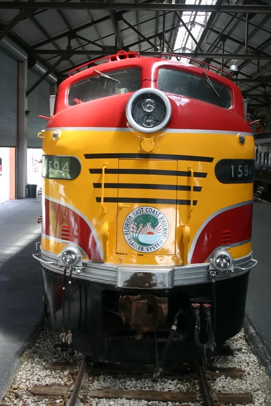
Florida East Coast Railway in Miami Shores is a railway (Florida East Coast Railway, Route number FEC, 1435 mm, Main line). The train routes Brightline: Miami → Orlando and Brightline: Orlando → Miami run here. It crosses a bridge. Florida East Coast Railway is also known as FEC. Florida East Coast Railway also exists in Hialeah, North Miami, North Miami Beach, Miami and El Portal. Ⓦ.
- Speed Limit
- 79 mph
- Operator
- Florida East Coast Railway
Bus stops
Streets nearby
Northeast 10th Court0.2 mi
Northeast 105th Street0.2 mi
Northeast 10th Place0.3 mi
Northeast 9th AvenueMiami Shores Community Church Day Care
0.3 mi
Northeast 9th Court0.3 mi
Northeast 4th Avenue RoadMiami Shores Presbyterian Church Day Care Center
0.3 mi
Northeast 10th Avenue0.3 mi
Northeast 104th StreetAdvent Lutheran Church Child Care Center
0.4 mi
Northeast 110th Street0.4 mi
Northeast 103rd Street0.4 mi
Peachtree Drive0.4 mi
Northeast 11th Avenue0.4 mi
Northeast 11th Court0.4 mi
Northeast 99th Street0.4 mi
Biscayne BoulevardBiscayne Boulevard & Northeast 104th Street, Biscayne Boulevard & Northeast 10100 Block, Biscayne Boulevard & Northeast 106th Street, Biscayne Boulevard & Northeast 87th Street, Biscayne Boulevard & Northeast 96th Street, Pizza Hut, Saint Martha Church, Biscayne Boulevard & Northeast 93rd Street, Biscayne Boulevard & Northeast 99th Street, Biscayne Boulevard & Northeast 95th Street, Biscayne Boulevard & Northeast 91st Street
0.4 mi
Northeast 100th Street0.4 mi
Northeast 106th Street0.4 mi
Northeast 102nd Street0.4 mi
Northeast 111th Street0.4 mi
Northeast 107th StreetMiami Country Day School
0.4 mi
Northeast 6th AvenueNortheast 6th Avenue @ Northeast 107th Street, Northeast 6th Avenue @ Northeast 109th Street, Northeast 6th Avenue @ Northeast 166th Street, Northeast 6th Avenue @ Northeast 181st Street, Northeast 6th Avenue @ APPROX # 17911, Northeast 6th Avenue @ Northeast 177th Street, Northeast 6th Avenue @ Northeast 154th Street, Northeast 6th Avenue @# 15156, Northeast 6th Avenue @ # 15101, Northeast 6th Avenue @ # 15600, Northeast 6th Avenue @ Northeast 147th Street, Northeast 6th Avenue @ Northeast 160th Street, Northeast 6th Avenue @ Northeast 149th Street, Northeast 6th Avenue @ Northeast 165th Street, Northeast 6th Avenue @ Northeast 163rd Street, Northeast 6th Avenue @ Northeast 162nd Street, Northeast 6th Avenue @ Northeast 159th Street, Northeast 6th Avenue @ Northeast 157th Street, Northeast 6th Avenue @ Northeast 157th Terrace, Northeast 6th Avenue @ Northeast 110th Terrace, Northeast 6th Avenue @ Northeast 111th Street
0.4 mi
Northeast 101st Street0.4 mi
Grand Concourse0.5 mi
Northeast 7th Avenue0.5 mi
Northeast 98th StreetBethany Church of Miami
0.5 mi
Quayside Terrace0.5 mi
Northeast 112th Street0.5 mi
Northeast 8th Court0.5 mi
Northeast 8th Avenue0.5 mi
Northeast 13th Avenue0.6 mi
Northeast Quay Plaza0.6 mi
Northeast 12th AvenueToddler's Inn, Northeast 12th Avenue & Northeast 167th Street, Northeast 12th Avenue & Northeast 165th Street
0.6 mi
Northeast 108th Street0.6 mi
West Biscayne Canal Road0.6 mi
Northeast 110th TerraceUnity Center of Practical Christianity, Miami Shores Preparation School
0.6 mi
Northeast Quay Boulevard0.6 mi
Northeast 113th Street0.6 mi
Northeast Quayside Terrace0.6 mi
Griffing BoulevardBiscayne Park Police Station, Northeast 6th Avenue @ Northeast 114th Street
0.6 mi
Northeast 114th Street0.7 mi
Northeast 115th Street0.7 mi
Northeast 113th Terrace0.7 mi
Apartment buildings nearby
Towers of Quayside Tower II0.6 mi
Banks nearby
Chase0.5 mi
Golf courses nearby
Miami Shores Country Club0.3 mi
Parks nearby
Miami Shores Recreation Complex0.4 mi
Burke Recreation Center0.5 mi
Railways nearby
Florida East Coast Railway0.7 mi
Supermarkets nearby
ALDI0.5 mi
Variety stores nearby
Dollar Tree0.7 mi
| Year built | 1899 |
|---|---|
| Official opening | 1885 |
| Length | 565 |
| Located in | Florida |
| Country | United States |
| Connects with | Jacksonville Terminal Subdivision, Miami Subdivision |
| Website | https://fecrwy.com/ |
Public transit map Miami Shores Legend
| Railway | |
| Bus | |
| Streetcar |
Bicycle map Miami Shores Legend
| Bike path | |
| Bike lane on roadway | |
| Cycling allowed on bus lane | |
| Bicycle street | |
| Open to cyclists | |
| Open to cyclists, good path | |
| Cycling prohibited | |
| Cobblestone |
| Long-distance bike route | (depending on scale) | |
| Long-distance bike route |
Pedestrian map Miami Shores Legend
| Path |
| Long-distance hiking trail | (depending on scale) | |
| Long-distance hiking trail | ||
| Pedestrians prohibited |