
South Garland Avenue in Orlando, Florida
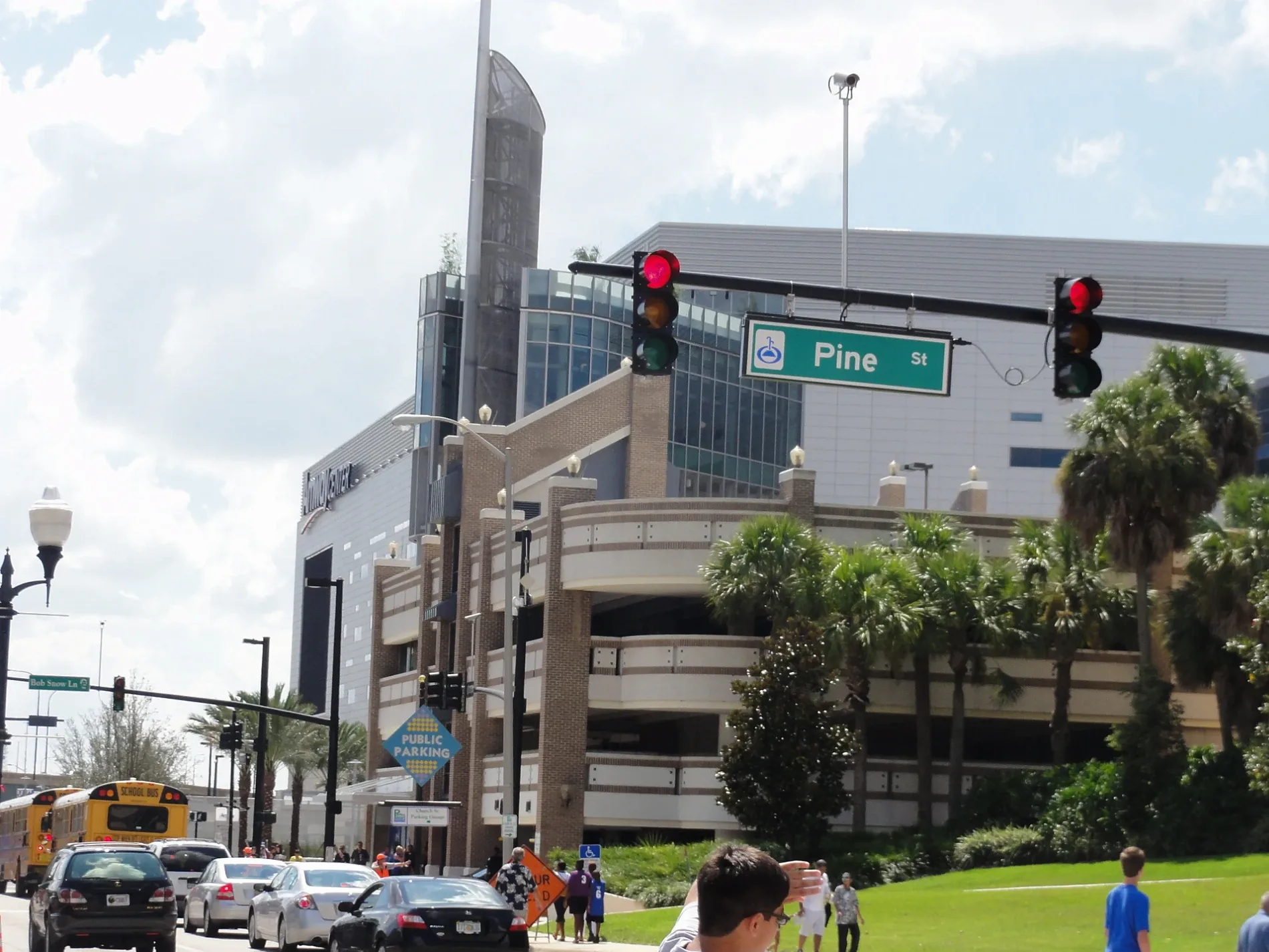
South Garland Avenue in Orlando is a three-lane, asphalted local road. The street has a sidewalk. It runs as a one-way street in a south-north direction starting from West South Street and crosses West Church Street, West Pine Street, Lymmo and West Central Boulevard and ends at North Garland Avenue.
- Road Type
- local road
- Lanes
- 3
- Route
- north-south
Image
Fast food restaurants
Stations
- bus lines 38, 300, 350, Lymmo Lime Line
Hair salons
Theaters
Cafes
Bars
Clothing stores
Restaurants
Bus stops
- bus lines 38, 300, 350, Lymmo Lime Line
Platforms
- bus lines 38, 300, 350, Lymmo Lime Line
Banks
Streets nearby
I-4 Express150 ft
West Pine StreetLove Fellowship Christian Church, Downtown CREDO, Mercantile Bank, Downtown Pour House
350 ft
West Central BoulevardCentral Business District, West Central Boulevard and South Orange Blossom Trail, West Central Boulevard and Fred L. Maxwell Boulevard, West Central Boulevard and Maryland Avenue, Westfield, West Central Boulevard and South Tampa Avenue, West Central Boulevard and Halbe Avenue, West Central Boulevard and Wilbe Avenue, West Central Boulevard and North Westmoreland Drive, West Central Boulevard and North Division Avenue, West Central Boulevard and North Parramore Avenue, West Central Boulevard and Pershing Place
450 ft
Hughey AvenueNORTH ORLANDO
550 ft
West Church StreetWest Church Street and South John Young Parkway, West Church Street and South Tampa Avenue, West Church Street and South Texas Avenue, West Church Street and Lee Avenue, West Church Street and South Cottage Hill Road, West Church Street and South Ohio Avenue, Hamburger Mary's, West Church Street and South Terry Avenue, West Church Street and South Rio Grande Avenue, West Church Street and South Norton Avenue, Advance Auto Parts, Caffè Ritazza, KRES CHOPHOUSE, HightT Orlando, CFS Coffee For The Soul, Birria1983, The BAO Spot, West Church Street and South Orange Blossom Trail, West Church Street and South Westmoreland Drive, Artisan's Table
550 ft
South Hughey Avenue0.2 mi
South Orange AvenueOrlando, Nature's Table Cafe, Ego Lab, Siegel's, Gitto's Pizza, Jimmy John's, Dan's Sandwich Shoppe & Midnite Pizza, Roho Art Café, SAK Comedy Lab, The Pita Pit, Thrive Cocktail Lounge, Latin Square Cuisine, Solita Tacos & Margaritas, Pretty Please, City Beautiful Pediatric Dentistry, South Orange Avenue and West Harding Street, Wawa, PDQ, Hungry Pants, South Orange Avenue and Michigan Street, South Orange Avenue and Lake Beauty Drive, South Orange Avenue and East Hollenbeck Street, South Orange Avenue and Sturtevant Street, South Orange Avenue and Fernwood Street, Delaney's Tavern, The Delaney Hotel, South Orange Avenue and East Crystal Lake Street, CAT Scale, South Orange Avenue and West Jersey Street, South Orange Avenue and West Illiana Street, Fresh Kitchen, Bank of America, Chevron, Orlando Fire Department Station 5, South Orange Avenue and East Kaley Street, South Orange Avenue and East Muriel Street, V/O Med Spa, Option Care Health, South Orange Avenue and Grant Street, T-Mobile, Domino's, Dunkin'
0.2 mi
East Central BoulevardLymmo - Grapefruit Line, Totoya Sushi Lounge, Lake Eola Station, Foxtail Coffee, Cedar of Lebanon, Publix, Centered, Osphere Neighborhood Grill and Bar, Sperry Fountain, The UPS Store, Eola Wine Company, Lauren Nicole, Menchie's, Pizza@ Lake Eola, World of Beer, Lake Eola Florist, Champ's
0.2 mi
East Church StreetChase, Harmony Healthcare Orlando, Neveyah Sushi & Thai, Lymmo - Grapefruit Line, CJ the Barber at Royal Shave Club
0.2 mi
West South StreetWest South Street and South Orange Blossom Trail, Los Carnales Tires, West South Street and South Lee Avenue, West South Street and McFall Avenue, West South Street and Albany Avenue, West South Street and Woods Avenue, West South Street and Lime Avenue, South Division Avenue and South Hughey Avenue
0.3 mi
East Jackson StreetEden's Fresh Co., Dunkin', AdventHealth Medical Group - South Street
0.3 mi
Artworks nearby
The Sea Urchin0.2 mi
Tower of Light0.3 mi
Banks nearby
Popular0.2 mi
Bars nearby
Cheyenne Saloon0.1 mi
Buildings nearby
Fairwinds Credit Union400 ft
Soundbar0.1 mi
Kress Building0.1 mi
Divine & Estes, P.A.0.2 mi
One South Orange0.2 mi
SunTrust Center0.2 mi
Saint Lawrence Title0.2 mi
Law Offices of Mark L. Horwitz0.2 mi
King, Blackwell, Zehnder & Wermuth, P.A.0.2 mi
Citrus Center0.2 mi
BB&T Tower0.2 mi
Lincoln Plaza0.2 mi
PNC Bank0.3 mi
Buildings under construction nearby
The Edge0.1 mi
Colleges nearby
The Chicone Building0.2 mi
Construction sites nearby
Westcourt Orlando450 ft
Convenience stores nearby
Plaza Market & Spirits0.2 mi
Fast food restaurants nearby
Panino's Pizza & Grill0.2 mi
Fire stations nearby
City of Orlando Fire Station One400 ft
Galleries nearby
CityArts Factory0.2 mi
Hotels nearby
AC Hotel by Marriott Orlando Downtown0.2 mi
Grand Bohemian Hotel Orlando, Autograph Collection0.3 mi
Office buildings nearby
Downtown Academic Center0.1 mi
Parking lots nearby
Central Boulevard Garage0.1 mi
55 West Garage0.1 mi
Washington Street Garage0.1 mi
SunTrust Center Garage0.2 mi
Lincoln Plaza Garage0.2 mi
Residential buildings nearby
55 West0.1 mi
Restaurants nearby
Mojo Bar and Grill250 ft
Ceviche Tapas Bar & Restaurant300 ft
Tattoo studios nearby
Stigma0.2 mi
Town halls nearby
Orlando City Hall0.3 mi
Train stations nearby
Church Street Station550 ft
Public transit map Orlando Legend
| Railway | |
| Bus | |
| Streetcar |
Bicycle map Orlando Legend
| Bike path | |
| Bike lane on roadway | |
| Cycling allowed on bus lane | |
| Bicycle street | |
| Open to cyclists | |
| Open to cyclists, good path | |
| Cycling prohibited | |
| Cobblestone |
| Long-distance bike route | (depending on scale) | |
| Long-distance bike route |
Pedestrian map Orlando Legend
| Path |
| Long-distance hiking trail | (depending on scale) | |
| Long-distance hiking trail | ||
| Pedestrians prohibited |