
Florida East Coast Railway in Boynton Beach, Florida
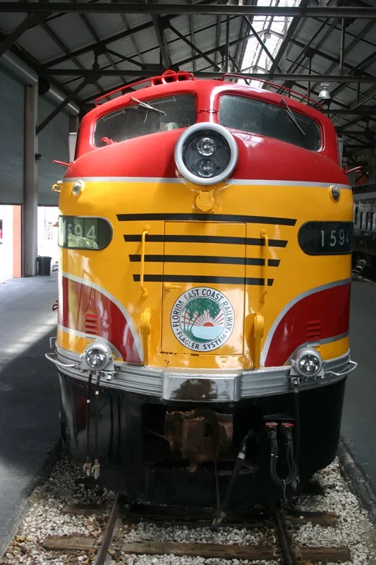
Florida East Coast Railway in Boynton Beach is a railway (Florida East Coast Railway, Route number FEC, 1435 mm, Main line). The train routes Brightline: Miami → Orlando and Brightline: Orlando → Miami run here. It crosses a bridge. Florida East Coast Railway is also known as FEC. Florida East Coast Railway also exists in Jupiter, Delray Beach, Palm Beach Gardens, Riviera Beach and Boca Raton. Ⓦ.
- Speed Limit
- 79 mph
- Operator
- Florida East Coast Railway
Bus stops
Artworks
Cafes
Streets nearby
North Railroad Avenue300 ft
Dixie HighwayFederal Highway at Gateway Boulevard, Federal Highway at Northeast 15th Avenue, Federal Highway at Potter Drive, Federal Highway at Lake Street, Hypoluxo South, Federal Highway at Northeast 15th Place
350 ft
Murano Bay Drive400 ft
Marano Bay Drive400 ft
North Road400 ft
West Road500 ft
Shore Drive0.1 mi
Northeast 4th Street0.1 mi
Northwest Road0.1 mi
South Road0.1 mi
Ocean Inlet Drive0.1 mi
Railroad Avenue0.2 mi
Willard Way0.2 mi
Federal HighwayFederal Highway at Southeast 10th Avenue, Federal Highway at Boynton Beach Boulevard, Federal Highway at Gulfstream Boulevard, Federal Highway at Turner Road, Federal Highway at Gulfstream Mall East Entrance, Walgreens, Federal Highway at Southeast 20th Court, Federal Highway at Riverwalk Plaza South Entrance, Federal Highway at Jaycee Park, Federal Highway at Southeast 23rd Avenue, McDonald's, Federal Highway at Southeast 21st Avenue, Federal Highway at Castilla Lane, Federal Highway at Northeast 1st Avenue, Federal Highway at Northeast 9th Avenue, Boynton Beach Dentistry, Federal Highway at Northeast 12th Avenue, Federal Highway at Martin Luther King Boulevard/10th Avenue, Federal Highway at Northeast 6th Avenue, Federal Highway at Southeast 1st Avenue, Federal Highway at Sterling Village Main Entrance, Federal Highway at 5th Avenue, Federal Highway at North Old Dixie Highway, Federal Highway at Southeast 28th Circuit, Federal Highway at Colonial Club, Federal Highway at Woolbright Road, Boynton Beach Fire / Rescue Station 4
0.2 mi
15th Court Northeast0.2 mi
Northeast 15th Place0.2 mi
Northeast 4th Court0.2 mi
Manor Drive0.2 mi
Marine Road0.2 mi
Central Road0.2 mi
Martin Luther King Avenue0.2 mi
Northeast 10th Avenue0.2 mi
Northeast 13th Avenue0.2 mi
Northeast 2nd Street0.2 mi
Palmetto Greens Linear Park0.2 mi
Marine Drive0.2 mi
3rd Street Northeast0.2 mi
Rider Road0.2 mi
Northeast 14th Avenue0.2 mi
Northeast Road0.3 mi
Seaview Circle0.3 mi
Northeast 15th Avenue0.3 mi
2nd Street Northeast0.3 mi
Martin Luther King Jr Boulevard0.3 mi
Mariners Way0.3 mi
East Drive0.3 mi
Northeast 8th Avenue0.3 mi
Northeast 11th Avenue0.3 mi
Northeast 6th Street0.3 mi
Northeast 2nd Court0.3 mi
16th Avenue Northeast0.4 mi
Northeast 9th Avenue0.4 mi
Northeast 7th Avenue0.4 mi
3rd Court Northeast0.4 mi
Northeast 1st StreetCar Wash
0.4 mi
4th Street Northeast0.4 mi
Boynton Bay Court0.4 mi
Northeast 5th Street0.4 mi
South Circle Drive0.4 mi
| Year built | 1899 |
|---|---|
| Official opening | 1885 |
| Length | 565 |
| Located in | Florida |
| Country | United States |
| Connects with | Jacksonville Terminal Subdivision, Miami Subdivision |
| Website | https://fecrwy.com/ |
Public transit map Boynton Beach Legend
| Railway | |
| Bus | |
| Streetcar |
Bicycle map Boynton Beach Legend
| Bike path | |
| Bike lane on roadway | |
| Cycling allowed on bus lane | |
| Bicycle street | |
| Open to cyclists | |
| Open to cyclists, good path | |
| Cycling prohibited | |
| Cobblestone |
| Long-distance bike route | (depending on scale) | |
| Long-distance bike route |
Pedestrian map Boynton Beach Legend
| Path |
| Long-distance hiking trail | (depending on scale) | |
| Long-distance hiking trail | ||
| Pedestrians prohibited |