
Pullen Street in Savannah, Georgia
Pullen Street in Savannah is an asphalted residential street. It runs as a one-way street in a southeast-northwest direction starting from West Bay Street and ends at Warner Street.
- Road Type
- residential street
- Route
- southeast-northwest
Image
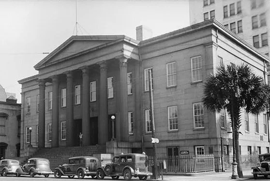
Doctor's offices
Dentist offices
Theaters
Convenience stores
Shoe stores
Bus stops
Clinics
Restaurants
Gas stations
Museums
Artworks
Stations
Streets nearby
Warner Street350 ft
North Fahm Street0.1 mi
Atlantic Coastal HighwaySCAD Sign
0.1 mi
West Bryan StreetPie Society, City Market Art Center, Savannah's Candy Kitchen, 22 Square, Whitaker Street Garage
0.2 mi
West River StreetCharleston Shoe Co., Electric Moon, District Smokehouse, District Seafood, Poseidon Spa, Stone & Webster, Kessler Diva, River Street Mercantile, Rhett, Bao Bab Lounge, Earthbound Trading Co., Books on Bay, Dub’s Pub, Byrd's Famous Cookies, Savannah Smiles Dueling Pianos, Black Rifle Coffee, Riverside Biergarten, Riverside Burger, Graffito Pizza, Rusty Rudders Tap House, Two Cracked Eggs, Nine Line, 13 Secrets, Missing Pieces, Savannah Bee Company, Kevin Barry's Irish Pub, Top Deck Bar & Restaurant, Rocks on the Roof, Coastal 15
0.2 mi
Mc Guire Street0.2 mi
Indian Street0.2 mi
Wadley Street0.2 mi
Fahm StreetJ.C. Lewis Primary Health Vision Center, J.C. Lewis Primary Health Care Center, J.C. Lewis Behavioral Healthcare Center, J.C. Lewis Dental Center
0.2 mi
West Warner Street0.2 mi
Ann Street0.2 mi
Yates Street0.2 mi
West Bay StreetBP, Savannah Clothing Company, Chevron, Five Guys, Starbucks, Great Dane, Shell, Moon River Cafe, Churchill's Gastropub & Taphouse
0.2 mi
Quaker StreetSCAD Sign
0.3 mi
Martin Luther King Junior BoulevardSilence is Golden, Saint Philip African Methodist Episcopal Church, balloon store, Mount Zion Baptist church, Fade City, MLK & 39th SB, MLK & 37th SB
0.3 mi
Olive Street0.3 mi
West Youmans StreetH, I, J, K, L, M, N, F, E, D, C, B, A, G
0.3 mi
East River StreetGretsch Museum, Bob's Your Uncle, Savannah's Sea Shell Shop, River Street Riverboat Company, City Hall Landing - City of Savannah, Bernie's Restaurant and Bar, The Mad Hatter, Barracuda Bob's Bar & Grill, Cassandra's Jewelry Savannah, The Warehouse Bar & Grille, True Grits, Tubby's Seafood, Washed Ashore, Wet Willie's Savannah, African-American Monument, Olympia Cafe, Cinnamon Bear Country Store, Fabulous Finds Under $20, Gallery 209, Savannah's Candy Kitchen, Del Sol Savannah, Five & Dime General Store, One Eyed Lizzy's, The Peanut Shop of Savannah, Artsy's Gallery and Frame Shop, Savannah Harley-Davidson, Something Different, 1996 Olympic Yachting Cauldron, District Live
0.3 mi
Zubley Street0.3 mi
West Boundary StreetAmigos, Oglethorpe Trolley, Stoner’s Pizza
0.3 mi
Orange Street0.3 mi
West Congress StreetÓrale Tacos + Tequila, Boomy's, The Rail Pub, Stephen Kasun Fine Art Gallery, Savannah Cigars, Molly MacPherson's Scottish Pub & Grill, Congress Street Up, B&D Burgers Bar and Grill, Barrelhouse South, The Bamboo Room Tiki Bar
0.3 mi
West Oglethorpe AvenueJoe Murray Rivers, Jr. Intermodal Transit Center
0.3 mi
Alton StreetRepeal 33 Bar & Restaurant
0.3 mi
Abandoned railways nearby
Savannah District0.2 mi
Apartment buildings nearby
Ann Street Lofts0.3 mi
Bars nearby
Service Brewing Company0.2 mi
Buildings nearby
Social Foundry550 ft
Housing Authority of Savannah0.2 mi
Savannah Bus Terminal0.3 mi
Hotels nearby
Comfort Inn200 ft
Holiday Inn Savannah Historic District0.3 mi
The Ann Savannah, Apartments by Marriott Bonvoy0.3 mi
Museums nearby
Ships of the Sea Mairitme Museum0.3 mi
Parking lots nearby
Hive Parking0.3 mi
Parks nearby
Yamacraw Park0.1 mi
Places of worship nearby
First Bryan Baptist Church0.2 mi
Post offices nearby
United States Post Office0.1 mi
Residential areas nearby
Yamacraw Village250 ft
Restaurants nearby
Corleone's0.3 mi
The Grey0.3 mi
Streams nearby
Springfield Canal0.2 mi
Technical colleges nearby
Fahm Hall300 ft
Alexander Hall0.2 mi
Adler Hall0.2 mi
Hamilton Hall Annex0.2 mi
Hamilton Hall0.2 mi
Herstand Hall0.3 mi
Other nearby
Riverside Substation0.3 mi
 Public transit map Savannah Legend
| Railway | |
| Bus | |
| Streetcar |
 Bicycle map Savannah Legend
| Bike path | |
| Bike lane on roadway | |
| Cycling allowed on bus lane | |
| Bicycle street | |
| Open to cyclists | |
| Open to cyclists, good path | |
| Cycling prohibited | |
| Cobblestone |
| Long-distance bike route | (depending on scale) | |
| Long-distance bike route |
 Pedestrian map Savannah Legend
| Path |
| Long-distance hiking trail | (depending on scale) | |
| Long-distance hiking trail | ||
| Pedestrians prohibited |