
Stonewall Avenue East in Fayetteville, Georgia
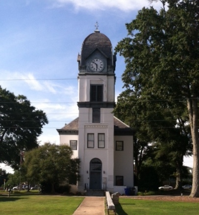
Stonewall Avenue East in Fayetteville is a three-lane, asphalted main road (Road number GA 54). It runs as a one-way street in a west-east direction starting from Stonewall Avenue West and crosses Glynn Street South, Jack D. Dettmering, Lee Street, Church Street, Jeff Davis Drive, Jeff Davis Drive South, Booker Avenue and Holly Avenue and ends at East Lanier Avenue. This street is part of the highway "54" as well as the Bicycle route "US:GA 15". Nearby you can find a public clock and a social facility.
- Road Type
- main road
- Lanes
- 3
- Speed Limit
- 35 mph
- Route
- east-west
Image
Streets nearby
Jeff Davis DriveDental One Associates
250 ft
East Lanier Avenue400 ft
Booker AvenueEast Fayette Elementary School
500 ft
Jeff Davis Drive South0.1 mi
Holly Avenue0.1 mi
Hill Street0.2 mi
Jeff Davis Drive NorthJeff Davis Dental & Orthodontics
0.2 mi
Hightower Drive0.2 mi
Church StreetEdgefield Baptist Church
0.2 mi
Stephens Street0.2 mi
sidewakFayetteville
0.2 mi
Jimmie Mayfield Boulevard0.2 mi
Jack D. Dettmering0.2 mi
South Jeff Davis Drive0.2 mi
sidewalkFirst UM Preschool, South OMS, Fayette County Chamber of Commerce, Great Expressions Dental Center, Twisted Taco, Courthouse Tavern, Gremlin Growers, Rising Star Montessori Academy, Rising Star Preschool
0.2 mi
Lee Street0.2 mi
Johnson AvenueFayetteville Fire Department Station 91, American Legion
0.3 mi
Meadowbrook Court0.3 mi
Glynn Street SouthKroger
0.3 mi
Glynn Street NorthJohnny's, Tesla Supercharger, CVS Pharmacy, Kiddie Kottage
0.3 mi
Long AvenueFayette WIC & Nutrition
0.3 mi
Fisher Avenue0.3 mi
Stonewall Avenue West0.3 mi
sidwalkFayette County Courthouse
0.4 mi
Beauregard BoulevardAdvance Auto Parts
0.4 mi
Hunters Lane0.4 mi
Center Drive0.4 mi
Melear's Way0.4 mi
Clarendon Place0.5 mi
Williamsburg Way0.5 mi
Allotment gardens nearby
Fayette Senior Services Community Garden0.4 mi
Buildings nearby
Voting0.2 mi
Courthouses nearby
Fayette County Justice Center0.4 mi
Funeral homes nearby
Mowell's and Son Funeral Home0.2 mi
Hotels nearby
Quality Inn Fayetteville Near Historic Downtown Square0.2 mi
Parks nearby
May Harp Park0.2 mi
Church Street Park0.2 mi
Heritage Park0.3 mi
Jack Day Park0.3 mi
Justice Center Park0.4 mi
Pastry shops nearby
Dunkin'0.3 mi
Places of worship nearby
First Baptist Church of Fayetteville0.1 mi
First United Methodist Church0.2 mi
Police stations nearby
Fayette County Sheriffs Office0.2 mi
Prisons nearby
Fayette County Jail0.3 mi
Public buildings nearby
Fayette County Administration Building0.3 mi
Social facilities nearby
Fayette Senior Services0.5 mi
Sports fields nearby
Church Street Park basketball court0.2 mi
Town halls nearby
Fayetteville City Hall0.3 mi
Public transit map Fayetteville Legend
| Railway | |
| Bus | |
| Streetcar |
Bicycle map Fayetteville Legend
| Bike path | |
| Bike lane on roadway | |
| Cycling allowed on bus lane | |
| Bicycle street | |
| Open to cyclists | |
| Open to cyclists, good path | |
| Cycling prohibited | |
| Cobblestone |
| Long-distance bike route | (depending on scale) | |
| Long-distance bike route |
Pedestrian map Fayetteville Legend
| Path |
| Long-distance hiking trail | (depending on scale) | |
| Long-distance hiking trail | ||
| Pedestrians prohibited |