
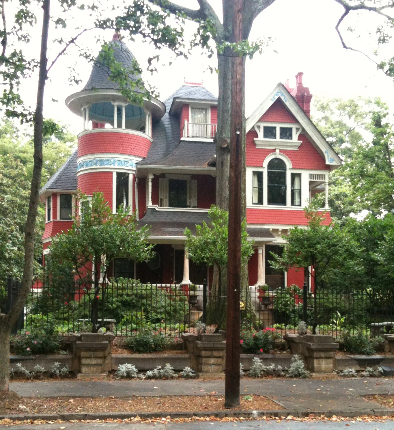
Virgil Street Northeast in Atlanta
Virgil Street Northeast in Atlanta is a residential street and runs in a northeast-southwest direction starting from Hale Street Northeast and ends at Ashland Avenue Northeast.
- Road Type
- residential street
- Route
- northeast-southwest
Image
Clothing stores
Schools
Tea shops
Ice cream shops
Bakeries
Restaurants
Bars
Charging stations
Liquor stores
Bike shops
Banks
Beauty salons
Streets nearby
Ashland Drive Northeast400 ft
Closed Lake Avenue400 ft
Lake Avenue NortheastInman Park
500 ft
Brickworks Circle500 ft
Druid Circle Northeast550 ft
Dixie Avenue Northeast0.1 mi
Ashland Avenue Northeast0.1 mi
Inman Lane0.1 mi
West Ashland Avenue Northeast0.1 mi
Hale Street Northeast0.1 mi
Euclid Avenue NortheastAtlanta Montessori International School, 76, Rene Rene, Kolo, Ardens Garden, Niramish, Da Phunlie Munkie Rasta Shop, The Bazaar, Tangles, Four Corners of the Earth Market Place, Euclid Yacht Club, El Bandito Mexican Grill, Elmyr, Earth Tone, Java Lords Coffeehouse & Bar, Groomzmen, Karma Boutique, Rag-O-Rama, Filthy Wealth & Co., Cherry Bomb, 7 Stages Playhouse, Moods Music, Ali Baba Mediterranean, Long Island Ink
0.2 mi
Waddell Street NortheastTesla Supercharger
0.2 mi
Spruce Street Northeast0.2 mi
Inman Walk0.2 mi
Waverly Way Northeast0.2 mi
Inman Village Parkway Northeast0.2 mi
Edgewood Avenue NortheastBoccaLupa, Inman Park Cooperative Preschool, Inman Dry Giods, Cafe 458, U*Space Gallery, planet Bombay, Locker Club, Old Fourth, Church Annex, Atlanta, Marietta and Peachtree, Five Points, GSU Police Department, DeKalb and Peachtree, Atlanta from the Ashes, Azalea Fresh Market, Subway, Hurt Park, Loughlin Radiation-Oncology Center, Sensational Subs, Kung Fu Tea, Mr. Hibachi, Herzing University, Atlanta, Streetz 94.5 FM, Spanish Harlem, Edgewood at Hillard, Street bike rack, Noni's, Sweet Auburn Market, Express Drugs
0.2 mi
Inman Mews Drive0.3 mi
Elizabeth Street NortheastStar Salon, K Chocolat, Bread & Butterfly
0.3 mi
Delta Place Northeast0.3 mi
DeKalb Avenue NortheastEdgewood, Clifton, Lloyds, Hell Yeah Gluten Free, Inman Park Animal Hospital, Dekalb Ave, Edgewood/Candler Park, Salon Red
0.4 mi
Poplar Circle Northeast0.4 mi
Atlanta Beltline Southeast TrailAtlanta Police Department Path Force Unit Precinct, Curry Up Now, Taqueria Tsunami, Four Fat Cows, Daily Dose Coffee
0.4 mi
Beltline Access LineLady Bird, Wild Heaven West End Brewery & Garden, Boxcar at Hop City West End, West End Mural, Gusto!, Bangkok Thai Restaurant, Butter and Cream, Hawkers Asian Street Food, The James Room, Best End Brewing Company, Bell Street Burritos, Two Urban Licks, Brewdog, Rathbun's Steak
0.4 mi
Wylie Street SoutheastWylie & Rum Island Grill, Nothing Bundt Cakes, Hop-In
0.4 mi
Selman Street Southeast0.4 mi
Kenyon Street Southeast0.4 mi
Field Street Southeast0.4 mi
Atlanta Beltline Eastside TrailAtlanta Bicycle Barn, Lingering Shade Social Club, Paris on Ponce, Landmark Midtown Art Cinema, Apres Diem, Mediterranean Grill, The Independent, Spot for Dogs, Three Peaches Gelato and Coffee, Midtown Butcher Shoppe, Arden's Garden, Purity Nails 21, Jenny's, Pour Taproom
0.4 mi
Moda Drive0.5 mi
Lang Way Southeast0.5 mi
Apartment buildings nearby
Mariposa Loft Apartments0.2 mi
Lizzie T0.3 mi
Buildings nearby
The Trolley Barn0.3 mi
Disused railways nearby
Stein Steel Lead0.4 mi
Fast food restaurants nearby
Revolution Doughnuts0.2 mi
Kindergartens nearby
Inman Park Cooperative Preschool0.2 mi
Parks nearby
Springvale Park0.2 mi
Delta Park0.2 mi
Places of worship nearby
Inman Park United Methodist Church0.4 mi
House of the Lords Prayer0.5 mi
Free Gospel Interdenominational Church0.5 mi
Railways nearby
Atlanta Terminal Subdivision0.4 mi
Residential areas nearby
Milltown Lofts0.4 mi
Restaurants nearby
Breaker Breaker0.5 mi
Retail buildings nearby
Krog Street Market0.1 mi
Subway lines nearby
MARTA East Line0.3 mi
Swimming pools nearby
Inman Park Swimming Pool0.2 mi
Other nearby
Reynoldstown0.3 mi
Public transit map Atlanta Legend
| Railway | |
| Bus | |
| Streetcar |
Bicycle map Atlanta Legend
| Bike path | |
| Bike lane on roadway | |
| Cycling allowed on bus lane | |
| Bicycle street | |
| Open to cyclists | |
| Open to cyclists, good path | |
| Cycling prohibited | |
| Cobblestone |
| Long-distance bike route | (depending on scale) | |
| Long-distance bike route |
Pedestrian map Atlanta Legend
| Path |
| Long-distance hiking trail | (depending on scale) | |
| Long-distance hiking trail | ||
| Pedestrians prohibited |