
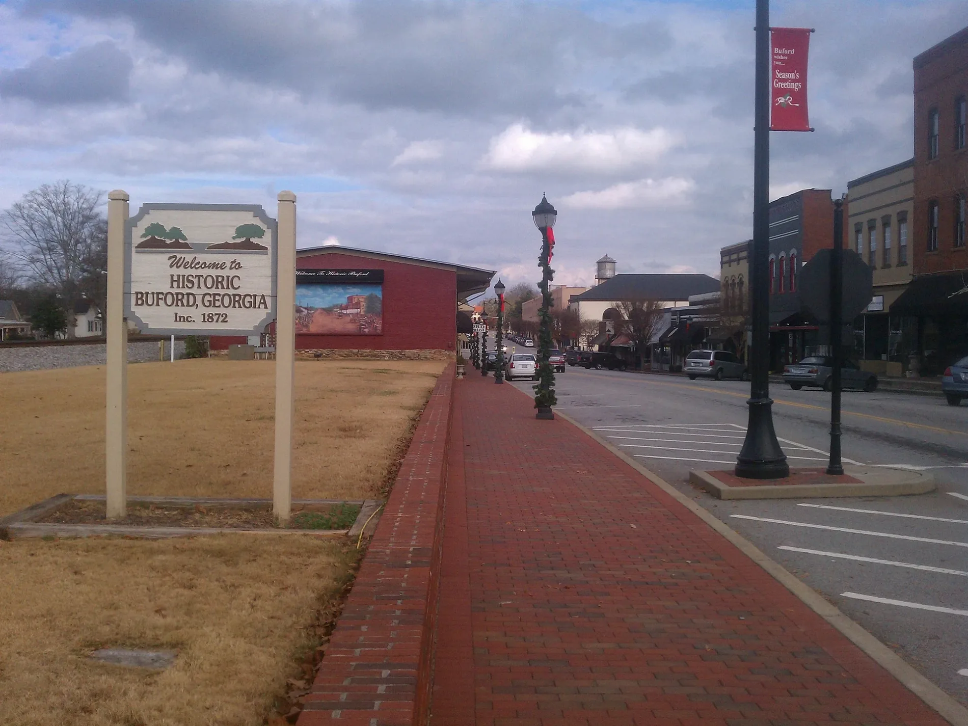
West Main Street in Buford, Georgia
West Main Street in Buford is a two-lane local road. It runs in a northeast-southwest direction starting from East Main Street Northeast and crosses Garnett Street Northeast, Scott Street, Silas King Street, South Alexander Street, North Church Street, South Church Street, South Lee Street, West Moreno Street, Elliot Street and Sugar Hill Road and ends at West Shadburn Avenue. West Main Street also exists in Chatham County, Hart County, Franklin County, Fannin County and Walker County.
- Road Type
- local road
- Lanes
- 2
- Route
- northeast-southwest
Image
Hair salons
Car washes
Arts centers
Places of worship
Gas stations
Charging stations
Schools
Police stations
Town halls
Auto repair shops
Streets nearby
North Lee Street350 ft
West Moreno StreetFirst Baptist Church of Buford
400 ft
George Street500 ft
South Lee StreetBuford Church of God, Rick Hendrick Chevrolet
0.1 mi
High Street Northeast0.1 mi
West Shadburn AvenueBuford Police Station, Buford City Hall
0.1 mi
High Street0.1 mi
South Church Street0.1 mi
Kennesaw Street0.1 mi
Bell Street0.2 mi
West Park Street0.2 mi
Garner Street0.2 mi
Scott Street0.2 mi
Silas King Street0.2 mi
West Jones Alley Northeast0.2 mi
North Church Street0.2 mi
Garnett Street Northeast0.2 mi
North Alexander Street Northeast0.2 mi
Kennesaw Street Northeast0.3 mi
South Alexander Street0.3 mi
South Street0.3 mi
Jones Street0.3 mi
East Jones Alley Northeast0.3 mi
Terrell Street0.3 mi
New Street Northeast0.3 mi
East Park Street0.3 mi
South Church Street Northeast0.3 mi
Cole Street0.3 mi
Oak Street0.3 mi
Elliot Street0.3 mi
Cemetery Street Northeast0.3 mi
Watson Street0.3 mi
Wilbanks Street0.4 mi
Poplar Street0.4 mi
Valentine Street0.4 mi
Cloud Street0.4 mi
Smokey Road0.4 mi
Poplar Street Northeast0.4 mi
Hogan Street Northeast0.5 mi
Adams Street0.5 mi
West Jackson Street0.5 mi
Rowe Street0.5 mi
Shops nearby
Doc Slicks Motorcycle Shop0.5 mi
Buildings nearby
Willard Wrecker Service0.4 mi
Places of worship nearby
Church of God0.2 mi
Union Baptist Church0.3 mi
Railways nearby
NS Greenville District0.1 mi
Restaurants nearby
Buford Grill250 ft
Rico's World Kitchen400 ft
Public transit map Buford Legend
| Railway | |
| Bus | |
| Streetcar |
Bicycle map Buford Legend
| Bike path | |
| Bike lane on roadway | |
| Cycling allowed on bus lane | |
| Bicycle street | |
| Open to cyclists | |
| Open to cyclists, good path | |
| Cycling prohibited | |
| Cobblestone |
| Long-distance bike route | (depending on scale) | |
| Long-distance bike route |
Pedestrian map Buford Legend
| Path |
| Long-distance hiking trail | (depending on scale) | |
| Long-distance hiking trail | ||
| Pedestrians prohibited |