
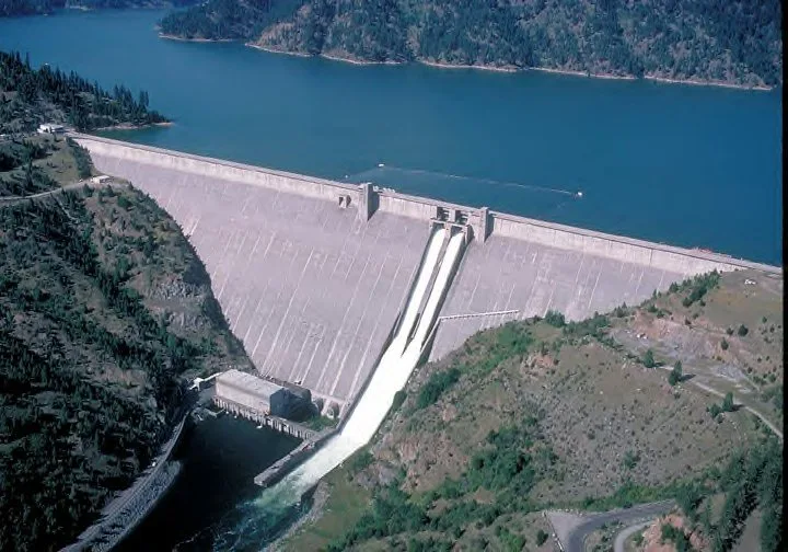
Dworshak Dam in Clearwater County, Idaho
Dworshak Dam in Clearwater County is a dam. Dworshak Dam is also known as Bruces Eddy. Ⓦ.
- Waterway Type
- dam
Image
Streets nearby
Viewpoint Road0.7 mi
Viewpoint Poad0.7 mi
Northfork Drive1.0 mi
State Highway 71.1 mi
High Country lane1.2 mi
Royodale Loop1.2 mi
117th Street1.2 mi
119th Street1.3 mi
118th Street1.3 mi
Taylor lane1.3 mi
Hartford Avenue1.3 mi
Grand Avenue1.3 mi
113th Street1.3 mi
115th Street1.3 mi
Beachview Lane1.3 mi
Diagonal Avenue1.3 mi
Marquette Court1.3 mi
108th Street1.3 mi
112th StreetRiverside
1.4 mi
Rivers Edge Lane1.4 mi
122nd Street1.4 mi
Sockeye Drive1.4 mi
Vista Avenue1.4 mi
125th Street1.4 mi
Ruger Lane1.4 mi
111th Street1.4 mi
110th Street1.4 mi
Scenic lane1.4 mi
Taber Lane1.4 mi
Laqa Avenue1.4 mi
107th Street1.4 mi
126th Street1.4 mi
105th Street1.5 mi
Hartford1.5 mi
Kent1.5 mi
Birchwood Lane1.5 mi
Diagonal Road1.5 mi
123rd Street1.5 mi
106th Street1.5 mi
Jerome Avenue1.5 mi
Obrien Road1.6 mi
Rodeyo Drive1.6 mi
Waterways nearby
Diversion Tunnel 2250 ft
Penstock 20.1 mi
Penstock 10.1 mi
Canals nearby
Spillway 2150 ft
Spillway 1200 ft
Rivers nearby
North Fork Clearwater River1.0 mi
Other nearby
Dworshak Heliport0.2 mi
| Year built | 1966 |
|---|---|
| Length | 1002 m |
| Located in | Clearwater County |
| Country | United States |
 Public transit map Clearwater County Legend
| Railway | |
| Bus | |
| Streetcar |
 Bicycle map Clearwater County Legend
| Bike path | |
| Bike lane on roadway | |
| Cycling allowed on bus lane | |
| Bicycle street | |
| Open to cyclists | |
| Open to cyclists, good path | |
| Cycling prohibited | |
| Cobblestone |
| Long-distance bike route | (depending on scale) | |
| Long-distance bike route |
 Pedestrian map Clearwater County Legend
| Path |
| Long-distance hiking trail | (depending on scale) | |
| Long-distance hiking trail | ||
| Pedestrians prohibited |