
North 9th Street in Quincy, Illinois
North 9th Street in Quincy is a residential street. It runs in a north-south direction starting from Locust Street and crosses Maple Street, Sycamore Street, Spruce Street, Cedar Street, Cherry Street, Chestnut Street, Lind Street, Elm Street, College Avenue, Oak Street and Spring Street. It ends in a cul-de-sac. Nearby there is a place of worship. North 9th Street also exists in DeKalb County.
- Road Type
- residential street
- Route
- north-south
Image
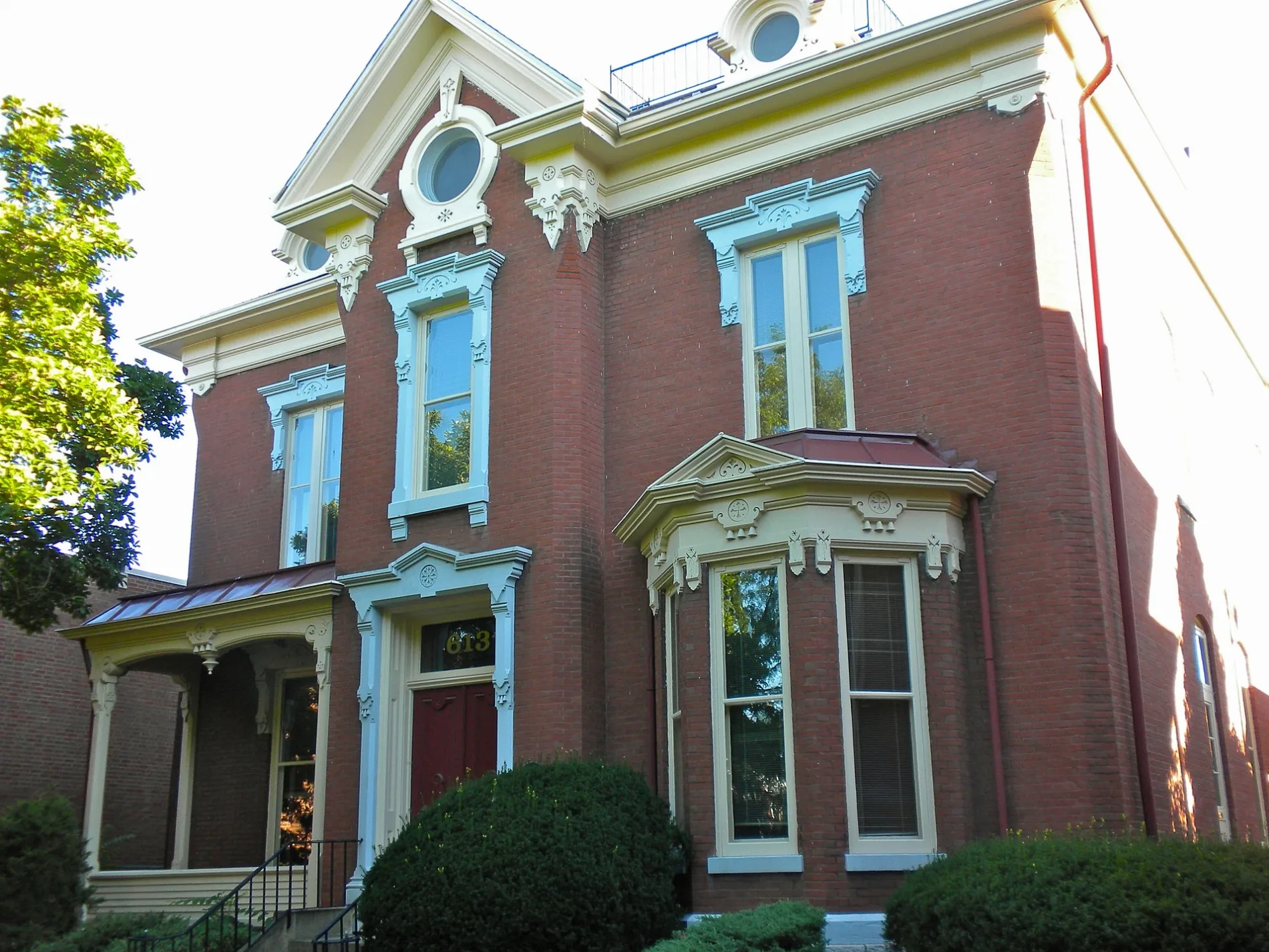
Places of worship
Streets nearby
College AvenueJackson School, Pour House, Our Redeemer Lutheran Church
0.1 mi
North 7th Street0.2 mi
Oak StreetBethel African Methodist Episcopal Church, Speakeasy's, Hometown Bar & Grill
0.2 mi
North 8th StreetFirst Baptist Church
0.2 mi
Elm Street0.3 mi
Walnut Alley0.3 mi
Spring Street0.3 mi
North 11th Street0.3 mi
Broadway StreetMadison Park Church, U.S. Cellular, Fierge, O'Reilly Auto Parts, Culver's, RISE, Tower of Pizza & Mexican, Blessing Express Clinic, McDonald's, Herbal Remedies Dispensary, Starbucks, Check 'n Go, All About Eyes, Pancheros Mexican Grill - Quincy
0.3 mi
Lind StreetGrace United Methodist Church, Shalom Fellowship Church, Immanuel Baptist Church
0.3 mi
North 13th Street0.4 mi
North 12th StreetFireHouse Tavern
0.4 mi
Hampshire StreetThyme Square, Lloyd's Gifts & Collectibles, EFB Coffee, Native Grill & Wings, Tiramisu
0.4 mi
North 14th Street0.5 mi
Cherry Street0.5 mi
North 10th StreetUnion Baptist Church
0.5 mi
Jail AlleyThe Fuzzy Bubbler
0.5 mi
Vermont StreetChicks on the River, Living World Fellowship Church
0.5 mi
North 4th StreetQuincy, Revelry
0.5 mi
North 6th StreetSilhouette Shoppe, Yellow Kiss Boutique
0.5 mi
Maertz Lane0.5 mi
North 5th StreetLincoln-Douglas Debate Museum, Schuecking
0.5 mi
North 3rd Street0.6 mi
Bakeries nearby
Krazy Cakes0.5 mi
Buildings nearby
AT&T Quincy Central Office0.3 mi
Quincy Post Office0.3 mi
Saint John's Anglican Church0.3 mi
Popp'n on Maine0.4 mi
Quincy Medical Group0.4 mi
Quincy Axe Company0.4 mi
Kroc Center0.4 mi
Quincy City Hall0.4 mi
Quincy Brewing Company0.4 mi
Maine Center0.5 mi
Churches nearby
Vermont Street United Methodist Church0.2 mi
Courthouses nearby
Adams County Courthouse0.4 mi
Event venues nearby
One: Special Event Venue0.4 mi
Fire stations nearby
Quincy Fire Department0.2 mi
Gardens nearby
Vermont Street Church Mission Garden0.3 mi
Gas stations nearby
Shell0.3 mi
Hair salons nearby
Gold Line Barbershop0.4 mi
Crush Salon0.4 mi
Parks nearby
Leon Bailey Memorial Park0.3 mi
Berrian Park0.6 mi
Places of worship nearby
Central Baptist Church0.3 mi
Saint John's Roman Catholic Church0.6 mi
Restaurants nearby
Maid-Rite0.3 mi
8te Open0.4 mi
Other nearby
Blessing Hospital Heliport0.2 mi
 Public transit map Quincy Legend
| Railway | |
| Bus | |
| Streetcar |
 Bicycle map Quincy Legend
| Bike path | |
| Bike lane on roadway | |
| Cycling allowed on bus lane | |
| Bicycle street | |
| Open to cyclists | |
| Open to cyclists, good path | |
| Cycling prohibited | |
| Cobblestone |
| Long-distance bike route | (depending on scale) | |
| Long-distance bike route |
 Pedestrian map Quincy Legend
| Path |
| Long-distance hiking trail | (depending on scale) | |
| Long-distance hiking trail | ||
| Pedestrians prohibited |