
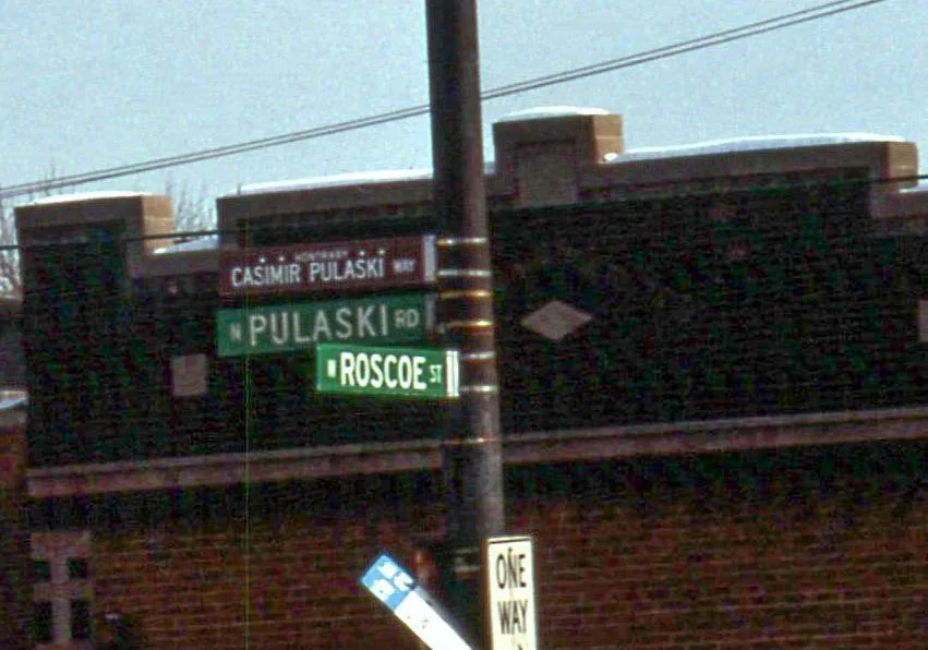
Pulaski Road in Robbins, Illinois
Pulaski Road in Robbins is a secondary road and it runs in a north-south direction and crosses Lincoln Lane West and ends at West 135th Street, while the other end is a cul-de-sac. Pulaski Road also exists in Midlothian and Crestwood. Ⓦ.
- Road Type
- secondary road
- Route
- north-south
Bus stops
- bus lines 359
Streets nearby
Lincoln Lane East0.1 mi
Harding Avenue0.2 mi
South Komensky Avenue0.2 mi
Springfield Avenue0.2 mi
Karlov Avenue0.2 mi
Avers AvenueMount Calvary Missionary Baptist Church
0.2 mi
West 135th Place0.2 mi
South Kedvale Avenue0.2 mi
West 135th Street135th Street & Kildare, 135th Street & Monticello, 135th Street & Central Park, 135th Street & Pulaski, 135th Street & Springfield, 135th Street & Hamlin, 135th Street & Lawndale, 135th Street & Spaulding, 135th Street & Homan, 135th Street & St. Louis, 135th Street & Komensky, 135th Street & Kedzie, BP Shop, BP
0.3 mi
Pulaski Road0.3 mi
136th Street0.3 mi
South Keeler Avenue0.3 mi
West 131st Street0.3 mi
South Tripp Avenue0.3 mi
Tri-State Tollway0.4 mi
136th Place0.4 mi
Ridgeway Avenue0.4 mi
West 134th Street0.4 mi
Keystone Avenue0.4 mi
137th StreetPulaski & 137th Street
0.4 mi
Lincoln Lane West0.4 mi
South Hamlin Court0.4 mi
Kolin Avenue0.5 mi
West 137th Place0.5 mi
Kildare Avenue0.5 mi
Kostner Avenue0.5 mi
Kedvale Avenue0.5 mi
West 130th Street0.5 mi
West 138th Street0.5 mi
136th Court0.6 mi
Kolmar Avenue0.6 mi
South Pulaski RoadPulaski & 116th Street, 12050 S Pulaski Rd, 12003 S Pulaski Rd, Pulaski & 119th Street, Pulaski & 115th Street, Pulaski & 126th Street, Pulaski & 123rd Street, Public Storage, Pulaski & 118th Street, Pulaski & 117th Street
0.6 mi
South Blossom Drive0.6 mi
137th Place0.7 mi
Orchard Lane0.7 mi
West 128th Place0.7 mi
South Apple Lane0.8 mi
West 129th Street0.8 mi
West 127th Street5001 W 127th Street, 5000 W 127th Street, 127th Street & Wireton, 127th Street & Kedzie, 127th Street & Ridgeway, 127th Street & Springfield, 127th Street & Pulaski, 127th Street & Cicero
0.8 mi
128th Place0.9 mi
South Kostner Avenue0.9 mi
Auto repair shops nearby
10 Second Automotive400 ft
Cemeteries nearby
Saint Benedict Catholic Cemetery0.6 mi
Convenience stores nearby
Shell0.2 mi
Speedway0.8 mi
7-Eleven0.9 mi
Industrial areas nearby
Arkema Coating Resins0.7 mi
Marketplaces nearby
Swap-O-Rama Flea Market0.8 mi
Parks nearby
Ronnetree Park0.9 mi
Places of worship nearby
Robbins Pentecostal Church0.3 mi
| Named after | Casimir Pulaski |
|---|---|
| Located in | Chicago |
| Country | United States |
Public transit map Robbins Legend
| Railway | |
| Bus | |
| Streetcar |
Bicycle map Robbins Legend
| Bike path | |
| Bike lane on roadway | |
| Cycling allowed on bus lane | |
| Bicycle street | |
| Open to cyclists | |
| Open to cyclists, good path | |
| Cycling prohibited | |
| Cobblestone |
| Long-distance bike route | (depending on scale) | |
| Long-distance bike route |
Pedestrian map Robbins Legend
| Path |
| Long-distance hiking trail | (depending on scale) | |
| Long-distance hiking trail | ||
| Pedestrians prohibited |