
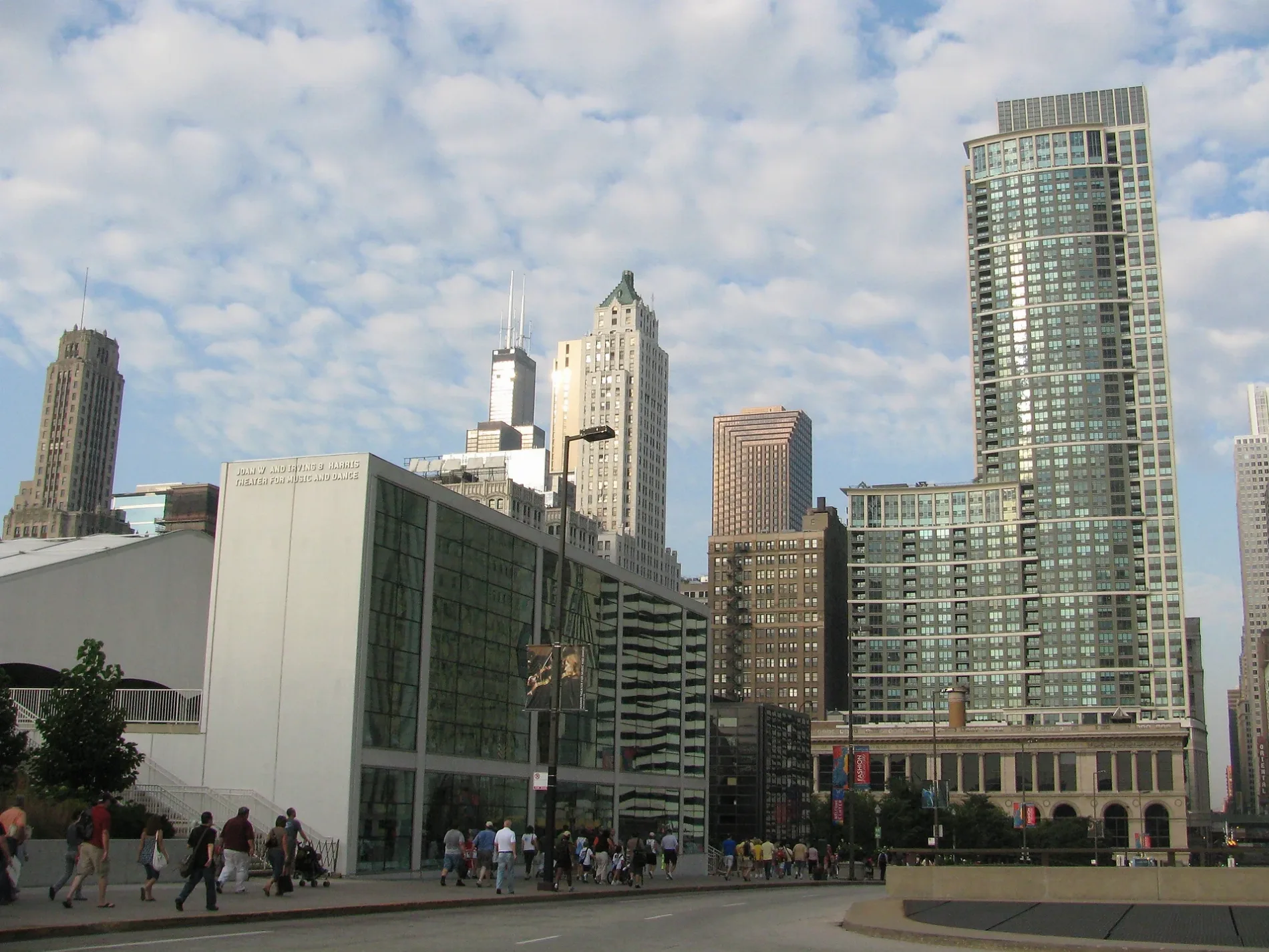
East Randolph Drive in Chicago Loop
East Randolph Drive in Loop in Chicago is a lit secondary road. The street has bike paths (bike lane) in some sections. It passes through a tunnel and runs in an east-west direction starting from East Randolph Street and crosses North Columbus Drive and North Lake Front Drive. This street is part of the Bicycle route "Randolph Street". The nearest stops are Randolph & Field Blvd and Randolph & Columbus. The bus line 60 stops here. Ⓦ.
- Road Type
- secondary road
- Route
- east-west
Image
Bus stops
- bus lines 60
Streets nearby
North Columbus Service Drive100 ft
Upper North Columbus DriveColumbus & Randolph
100 ft
Skating Ribbon400 ft
Lower Lower East Randolph Street500 ft
McCormick Place BuswayTerzo Piano, Cafe Moderno
500 ft
North Stetson AvenueCaffè RōM
550 ft
Lower East Lake Street550 ft
Aqua Running TrackCVS Pharmacy
0.1 mi
North Park Drive0.1 mi
East Benton PlaceMariano's Fresh Market, Eggy's, MingHin Cuisine, Chicago Dental Boutique, Subway, The Halal Guys, Walgreens
0.1 mi
Lower Lower North Field Boulevard0.2 mi
North Lower Columbus Service Drive0.2 mi
North Upper Columbus DriveColumbus (Middle) & Wacker
0.2 mi
East South Water StreetField Blvd & South Water St, Bright Horizons, Blackwood BBQ - Illinois Center, Dunkin', Bockwinkel's, Stetson Ave & South Water St, Millennium Station
0.2 mi
Stetson Service Avenue0.2 mi
Chicago RiverwalkFloating Tiki Bar, Tiki Pontoons, Wndella Tours - Riverwalk, O'Brien's, Weather Station, Allium, Urban Kayaks, Taco Rio, Tiny Tapp, ChiBoys, Chiya Chai, Colores Mexicanos, Feed Your Head, The Radiance of Being, City Winery at the Chicago Riverwalk, Chicago's First Lady 2, Chicago's First Lady 1, Mercury Tours 1, Chicago's First Lady 3, Mercury Tours 2, Mercury Chicago's Skyline Cruiseline, The Northman Beer & Cider Garden, You Are on Potawatomi Land, Chicago Brewhouse, Sweet Home Gelato, Chicago Cycle Boat, Anita Dee II, McCormick Bridgehouse & Chicago River Museum, Beat Kitchen, Black Tiberinus
0.3 mi
North Lower Stetson Avenue0.3 mi
North Field BoulevardLakeshore East
0.3 mi
East Wacker DriveThe Palm Restaurant
0.3 mi
DuSable Founder's WayShoreline Sightseeing, Chicago Rising from the Lake, Chi Bar, Odyssey Chicago River, Michigan Avenue, Medrina, Jean Baptiste Point Du Sable
0.3 mi
Apartment buildings nearby
340 on the Park0.1 mi
Aqua0.1 mi
The Buckingham0.1 mi
Park Millennium0.2 mi
The Tides0.2 mi
The Coast at Lakeshore East0.2 mi
Columbus Plaza0.2 mi
Bike shops nearby
McDonald's Cycle Center250 ft
Brownfields nearby
LSE Site O450 ft
Commercial areas nearby
Illinois Center0.1 mi
Fire stations nearby
Chicago Fire Department Engine Company 130.2 mi
Fitness centers nearby
Lakeshore Athletic Club0.2 mi
Hotels nearby
Fairmont Hotel Chicago0.1 mi
Hyatt Regency Chicago0.2 mi
Swissotel Chicago0.2 mi
Sheraton Grand Chicago0.3 mi
Office buildings nearby
Blue Cross-Blue Shield Tower350 ft
Aon Center500 ft
Two Prudential Plaza0.1 mi
Two Illinois Center0.2 mi
303 East Wacker0.2 mi
Parks nearby
Lakeshore East Park0.1 mi
Pavilions nearby
Northeast Exelon Pavilion300 ft
Public buildings nearby
Maggie Daley Park Fieldhouse500 ft
Retail buildings nearby
The Village Market0.2 mi
Rivers nearby
Chicago River0.3 mi
Row houses nearby
Aqua Parkhomes0.2 mi
Service buildings nearby
William P. Fahey Bridgehouse0.3 mi
Theaters nearby
Jay Pritzker Pavilion500 ft
Joan W. and Irving B. Harris Theater for Music and Dance550 ft
| Named after | Randolph County |
|---|---|
| Located in | Chicago |
| Country | United States |
Public transit map Loop Legend
| Railway | |
| Bus | |
| Streetcar |
Bicycle map Loop Legend
| Bike path | |
| Bike lane on roadway | |
| Cycling allowed on bus lane | |
| Bicycle street | |
| Open to cyclists | |
| Open to cyclists, good path | |
| Cycling prohibited | |
| Cobblestone |
| Long-distance bike route | (depending on scale) | |
| Long-distance bike route |
Pedestrian map Loop Legend
| Path |
| Long-distance hiking trail | (depending on scale) | |
| Long-distance hiking trail | ||
| Pedestrians prohibited |