
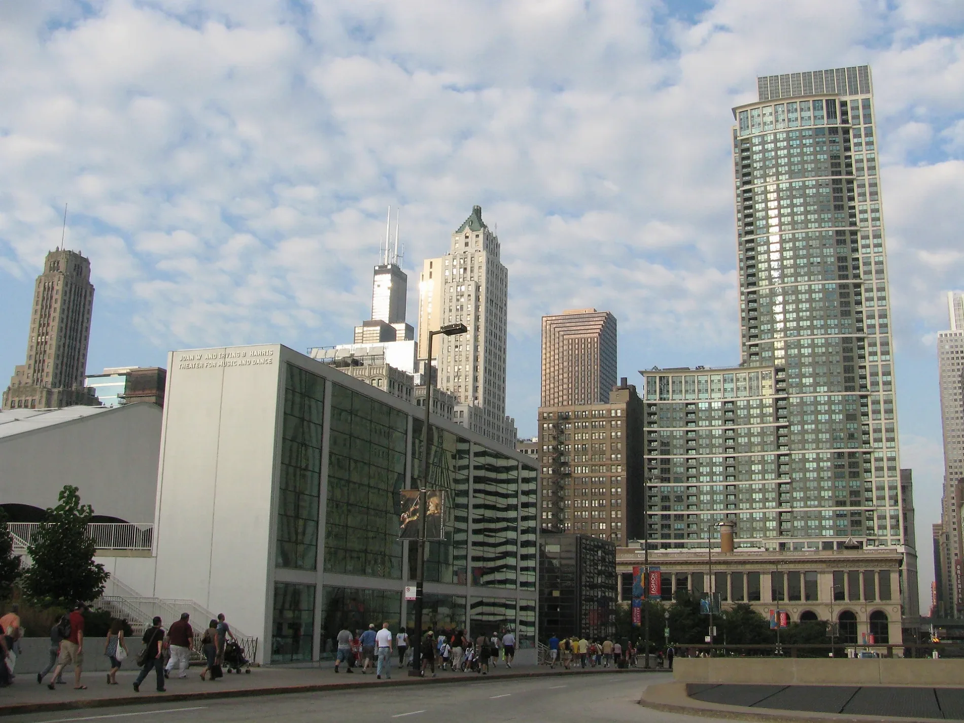
East Randolph Street in Chicago Loop
East Randolph Street in Loop in Chicago is a two-lane, asphalted, lit local road and it crosses a bridge. It runs in an east-west direction and crosses North Garland Court, North Wabash Avenue, North State Street, West Randolph Street, Upper North Columbus Drive, North Stetson Avenue, East Randolph Drive, North Beaubien Court, North Michigan Avenue, North Field Boulevard and North Harbor Drive. This street is part of the Bicycle route "Randolph Street". Nearby you can find among others a bike rental, a restaurant, a cafe and an artwork. The nearest stops are Randolph & Field Blvd, Randolph & Stetson, Randolph & Michigan and Randolph & Columbus. The bus lines 4, 20, 60, N4 and X4 serve this stop. Ⓦ.
- Road Type
- secondary road
- Bicycle
- use side path
- Speed Limit
- 20 mph
- Lanes
- 5
- Route
- east-west
Image
Artworks
Fast food restaurants
Bus stops
- bus lines 4, 20, 60, N4, X4
Florists
Bike rentals
Restaurants
Cafes
Dance schools
Streets nearby
North Garland CourtRoti, Paratransit, Teranz Boutique, Chicago Sports & Novelty, Ocean Prime
350 ft
East Benton PlaceSubway, The Halal Guys, Mariano's Fresh Market, Eggy's, MingHin Cuisine, Chicago Dental Boutique, Walgreens
0.1 mi
East South Water StreetBlackwood BBQ - Illinois Center, Dunkin', Bockwinkel's, Field Blvd & South Water St, Bright Horizons, Stetson Ave & South Water St, Millennium Station
0.2 mi
North Lower Beaubien CourtCVS Pharmacy, Tavern Club at 333, Nando's, Post Family Dental In The Loop
0.2 mi
East Haddock PlaceEmerald Loop, State and Lake Chicago Tavern, ROOF on theWit
0.2 mi
East Lake StreetFifth Third Bank, Dunkin', Chick-fil-A, Caffè Café, Panda Express, WFLD, Mammoth Poke & Ramen, 7-Eleven, Elephant & Castle, Billy Goat Tavern, Commons Club, Two Zero Three, Citibank, American Writers Museum, Michigan Avenue Immediate/Primary Care (MAICOH), Supply Clinic - Medical & Dental Supplies Online, Level Optical, Beck's Book Store
0.2 mi
Lower East Wacker PlaceMorton's The Steakhouse, Bar Pendry
0.2 mi
East Wacker Place7-Eleven, Art & Artisans
0.2 mi
East Lower Wacker Service DriveIrv Kupcinet, Wacker (Upper) & State
0.2 mi
East Upper Wacker DriveWacker (Upper) & State, Island Party Hut, Wacker (Upper) & Michigan, Hoyt's, The River Hotel, Land & Lake Kitchen, Christian Science Reading Room, Wacker (Upper) & Columbus, LH Rooftop, Bridges Lobby Grill at London House, Corner Bakery, Fannie May, Chicago First Lady, Wacker (Upper) & Stetson
0.2 mi
Buildings nearby
CTA East Lake Substation0.2 mi
Apartment buildings nearby
Millennium Park Plaza200 ft
The Heritage at Millennium Park300 ft
73 East Lake400 ft
MDA City Apartments0.1 mi
MILA0.1 mi
Joffrey Tower0.1 mi
Artworks nearby
Loop Da Loop0.2 mi
Cafes nearby
Coco Bar0.2 mi
Commercial buildings nearby
Page Brothers Building0.2 mi
Construction sites nearby
State/Lake CTA Station0.2 mi
Fountains nearby
Vietnam Veterans Fountain0.2 mi
Hotels nearby
Arlo Chicago250 ft
Virgin Hotels Chicago0.1 mi
Pendry Chicago0.2 mi
Hotel Monaco0.2 mi
Hampton Inn Chicago Downtown/North Loop0.2 mi
Hilton Garden Inn Chicago / North Loop0.2 mi
The Wit Hotel0.2 mi
citizenM Chicago0.2 mi
The Royal Sonesta Chicago Downtown0.2 mi
Club Quarters Hotel, Wacker at Michigan0.2 mi
London House Chicago0.2 mi
Office buildings nearby
Crain Communications Building150 ft
180 North Michigan Avenue500 ft
Seventy East Lake0.1 mi
Michigan Plaza South0.1 mi
Millinery Mart Building0.2 mi
Old Republic Building0.2 mi
35 East Wacker0.2 mi
Kemper Building0.2 mi
Parking lots nearby
60 East Lake Self Park0.1 mi
Wabash-Randolph Parking Garage0.1 mi
Hotel Parking0.1 mi
Places of worship nearby
Seventeenth Church of Christ Scientist0.2 mi
Residential areas nearby
Parkline Chicago450 ft
Subway lines nearby
Loop 'L'0.1 mi
Technical colleges nearby
Harold Washington College0.1 mi
Theaters nearby
Chicago Theatre0.2 mi
| Named after | Randolph County |
|---|---|
| Located in | Chicago |
| Country | United States |
Public transit map Loop Legend
| Railway | |
| Bus | |
| Streetcar |
Bicycle map Loop Legend
| Bike path | |
| Bike lane on roadway | |
| Cycling allowed on bus lane | |
| Bicycle street | |
| Open to cyclists | |
| Open to cyclists, good path | |
| Cycling prohibited | |
| Cobblestone |
| Long-distance bike route | (depending on scale) | |
| Long-distance bike route |
Pedestrian map Loop Legend
| Path |
| Long-distance hiking trail | (depending on scale) | |
| Long-distance hiking trail | ||
| Pedestrians prohibited |