
Davis Square Park in Chicago
Davis Square Park in Chicago is a park (Chicago Park District), South Marshfield Avenue 4430 (60609) 🌐. Ⓦ.
- House Number
- 4430
- Postal Code
- 60609
- Street
- South Marshfield Avenue
- Leisure
- park
- Operator
- Chicago Park District
- Website
- https://www.chicagoparkdistrict.com/parks-facilities/davis-dr-nathan-square-park
Image
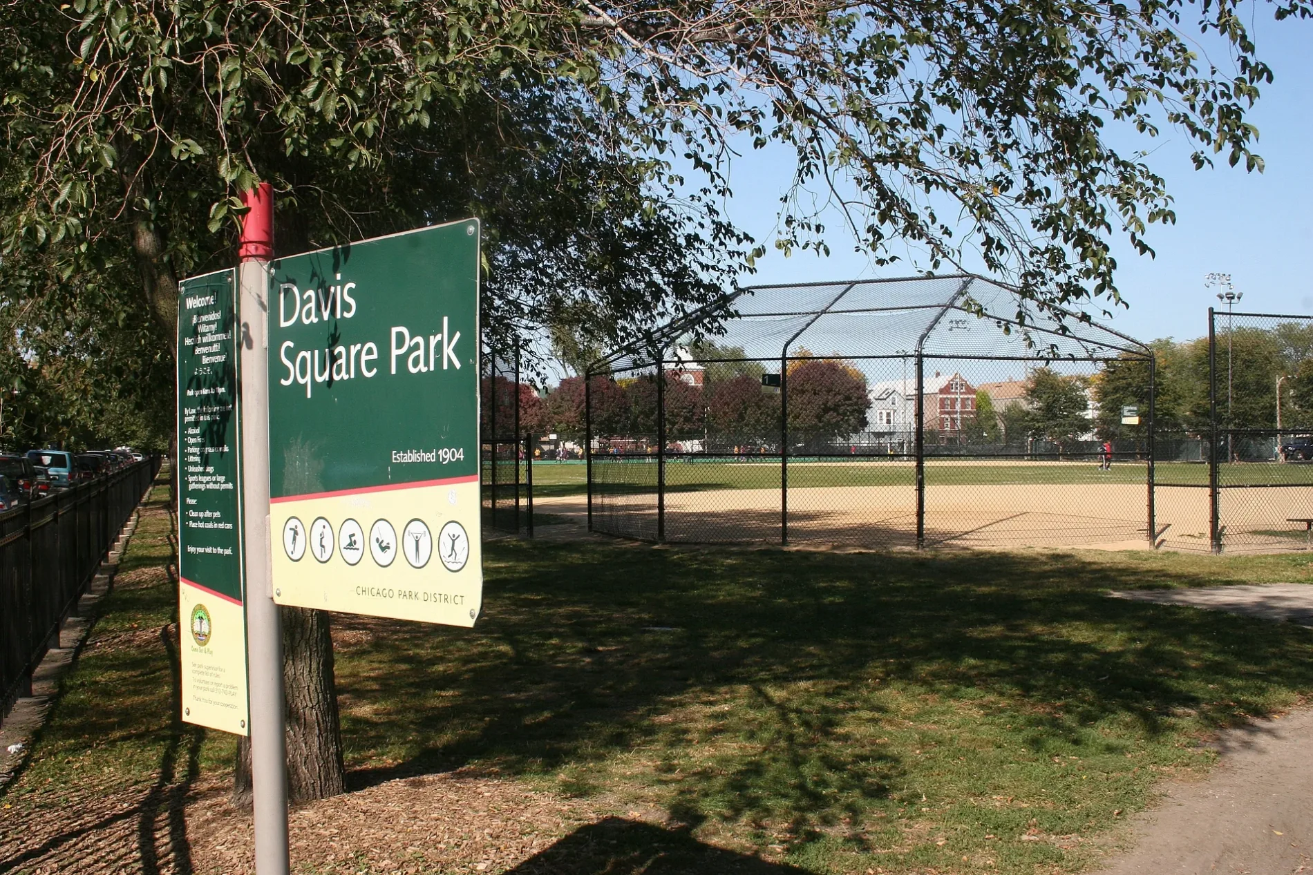
Streets nearby
South Marshfield Avenue0.1 mi
West 44th StreetMarshfield Ave & 44th St, Canaryville
0.2 mi
South Justine Street0.2 mi
South Wood StreetPaul Cornell
0.2 mi
South Laflin Street0.2 mi
West 45th Street0.2 mi
South Paulina Street0.2 mi
South McDowell AvenueHomer’s, Ashland Ave & McDowell Ave, PLS
0.3 mi
West 47th Street47th Street & Wood, Back of the Yards Coffeehouse, 47th Street & Western Blvd, 47th Street & Oakley, 47th Street & Wallace, 47th Street & Normal, 47th Street & Damen, Rainbow, 47th Street & Aberdeen, 47th Street & Morgan, 47th Street & Wolcott, Citgo, 47th Street & Racine, 47th Street & Throop, 47th Street & Loomis, 47th Street & Ashland, 47th Street & Hoyne, Boost Mobile, DTLR, Back of The Yards Coffeehouse and Roastery, Cricket Wireless, 47th Street & Halsted, 47th Street & Union, Bell Heir’s BBQ, 47th Street & Laflin, Tom's Place Pancake House, Little Caesars, America's Best Contacts & Eyeglasses, Birrieria y Taqueria El Arandas
0.3 mi
South Honore Street0.3 mi
South Hermitage Avenue0.3 mi
South Wolcott Avenue0.3 mi
West 42nd Street42nd Street & Halsted
0.4 mi
South Winchester AvenueBenitez Bakery
0.4 mi
South Damen AvenueDamen & 53rd Street, Damen & 52nd Street, Damen & 54th Street, Damen & 50th Street, Damen & Garfield, Damen & 51st Street, Damen Ave & 51st St, Damen & 48th Street, Damen & 49th Street
0.4 mi
West 46th StreetHalsted & 46th Street, Whiner Beer Co.
0.5 mi
South Ashland AvenueAshland & 53rd Street, Ashland & Garfield, Ashland & 46th Street, Ashland & 43rd Street, Ashland & 49th Street, Chase, La Baguette Bakery, Domino's, T-Mobile, Casa Catalina, Central Bakery, Ashland & 48th Street, Foot Locker, Midwest Ink Bros, Rainbow, Manz Made, Ashland & 45th Street, Ashland & 42nd Street, Subway, Cricket Wireless, Ashland & 47th Street, Dollar Tree, Ashland & Pershing, Ashland & 52nd Street, ACCESS Ashland Family Health Center, Ashland & 51st Street, Ashland Ave & 50th St, Back of the Yards
0.5 mi
West 41st StreetHalsted & 41st Street, 41st Street & Emerald
0.5 mi
Apartment buildings nearby
Chicago Commons0.2 mi
Banks nearby
Fifth Third Bank0.3 mi
Citibank0.3 mi
Bank of America0.4 mi
Buildings nearby
Power House300 ft
Filter House300 ft
Locker Building450 ft
Cell phone stores nearby
Metro by T-Mobile0.2 mi
Convenience stores nearby
BP Shop500 ft
47th Dollar Food Mart, Inc0.2 mi
Fast food restaurants nearby
Dunkin'0.2 mi
Church's Chicken0.3 mi
McDonald's0.4 mi
Fire stations nearby
Plant Chicago200 ft
Chicago Fire Department Engine Company 490.1 mi
Gas stations nearby
BP500 ft
Industrial buildings nearby
Ashland Cold Storage0.3 mi
OSI Chicago – Ashland0.4 mi
Marketplaces nearby
Swap-O-Rama0.5 mi
Money transfer services nearby
Western Union0.1 mi
Pharmacies nearby
Walgreens0.2 mi
Places of worship nearby
Immaculate Heart Of Mary Church450 ft
Holy Cross Catholic Church0.2 mi
New Life Community Church0.2 mi
Public buildings nearby
Social Security Administration0.2 mi
Retail buildings nearby
Art Santos - State Farm Insurance Agent0.2 mi
Goldblatt's Building0.3 mi
Schools nearby
Holy Cross School0.2 mi
Sports centers nearby
Davis Square Park Fieldhouse450 ft
Supermarkets nearby
Supermercado El Gurero0.3 mi
Variety stores nearby
Dollar General500 ft
| Named after | Nathan Smith Davis |
|---|---|
| Area | 8.3 |
| Heritage designation | National Register of Historic Places listed place |
| Located in | Chicago, Cook County |
| Country | United States |
 Public transit map Chicago Legend
| Railway | |
| Bus | |
| Streetcar |
 Bicycle map Chicago Legend
| Bike path | |
| Bike lane on roadway | |
| Cycling allowed on bus lane | |
| Bicycle street | |
| Open to cyclists | |
| Open to cyclists, good path | |
| Cycling prohibited | |
| Cobblestone |
| Long-distance bike route | (depending on scale) | |
| Long-distance bike route |
 Pedestrian map Chicago Legend
| Path |
| Long-distance hiking trail | (depending on scale) | |
| Long-distance hiking trail | ||
| Pedestrians prohibited |