
Indiana

Indiana
This City map of Indiana shows streets, paths, and places across the state in the United States. Indiana covers approximately 94,321 square kilometres and lies at an elevation of about 210 metres. Its population increased from 6,483,802 in 2010 to 6,785,528 in 2020. Indiana was founded in 1816 and is divided into 108 mapped subregions, including counties, towns, and settlements. Five long-distance cycling routes are documented in the state.
Chesterfield

Chesterfield is an admin_level=8 subregion of Indiana. It is mapped within the state’s local administrative structure. The settlement belongs to the network of 108 subregions represented on this Indiana City map.
To the mapAshley

Ashley is a town in Indiana and an admin_level=8 subregion. It has 1,026 inhabitants and lies at an elevation of 305 metres. The town is part of Indiana’s local settlement pattern in the United States.
To the mapPrinces Lakes

Princes Lakes is a human settlement in Johnson County, Indiana, and an admin_level=8 subregion. It has 1,372 inhabitants and covers 3,937,116 square metres. The settlement lies at an elevation of 250 metres.
To the mapEdinburgh

Edinburgh is an admin_level=8 subregion in Indiana. The town is located within the state’s local administrative map. Its position connects the settlement to Indiana’s network of towns and counties.
To the mapWolcottville

Wolcottville is an admin_level=8 subregion of Indiana. It is recorded as a local settlement in the United States. The place is included among the 108 subregions mapped for Indiana.
To the mapMarkle

Markle is an admin_level=8 subregion in Indiana. The settlement belongs to the local administrative structure of the state. Its streets and places are represented in this regional City map.
To the mapZanesville

Zanesville is an admin_level=8 subregion of Indiana. It is mapped as a local settlement within the United States. The place forms part of Indiana’s 108-subregion administrative overview.
To the mapOtterbein

Otterbein is an admin_level=8 subregion in Indiana. The town is included in the state’s local settlement map. Its location is shown together with Indiana’s surrounding roads, paths, and places.
To the mapSt. Paul

St. Paul is an admin_level=8 subregion of Indiana. It is recorded as a local settlement in the United States. The community is one of the mapped subregions within Indiana.
To the mapMilltown

Milltown is an admin_level=8 subregion in Indiana. The settlement is part of the state’s local administrative structure. Its streets and paths are included in the Indiana City map.
To the mapHamilton

Hamilton is a town in Indiana and an admin_level=8 subregion. It has 1,529 inhabitants and covers 7,770,000 square metres. The town lies at an elevation of 275 metres.
To the mapGlenwood

Glenwood is an admin_level=8 subregion of Indiana. It is mapped as a local settlement in the United States. The place is included in Indiana’s regional overview of streets, paths, and administrative areas.
To the mapShirley

Shirley is a town in Indiana and an admin_level=8 subregion. Its population is 819, and its area is 897,547 square metres. The town lies at an elevation of 313 metres.
To the mapCumberland

Cumberland is a town in Hancock and Marion Counties, Indiana, and an admin_level=8 subregion. It had 5,954 inhabitants, covers 6,187,307 square metres, and lies at 260 metres elevation. The town was established in 1831.
To the mapJamestown

Jamestown is an admin_level=8 subregion in Indiana. It is included as a local settlement in the United States. The town appears within the state’s mapped network of 108 subregions.
To the mapKoontz Lake

Koontz Lake is an admin_level=8 subregion of Indiana. The settlement is associated with the lake of the same name. It is included in the Indiana City map with local streets, paths, and places.
To the mapDearborn County

Dearborn County is an admin_level=6 county in southeastern Indiana. It has 50,679 inhabitants and covers approximately 795 square kilometres. The county was established in 1803 and belongs to Indiana’s county-level administrative structure.
To the mapLake County

Lake County is an admin_level=6 county in Indiana. Its population is 487,865, making it one of the state’s most populous counties. The county is located in northwestern Indiana within the Chicago metropolitan area.
To the mapNewton County

Newton County is an admin_level=6 county in northwestern Indiana. It has 13,830 inhabitants and covers approximately 1,045 square kilometres. The county was established in 1835.
To the mapOwen County

Owen County is an admin_level=6 county in west-central Indiana. Its population is 21,321 and its area is approximately 1,004 square kilometres. The county was established in 1818.
To the mapClay County

Clay County is an admin_level=6 county in western Indiana. It has 26,466 inhabitants and covers approximately 933 square kilometres. The county was established in 1825.
To the mapGreene County

Greene County is an admin_level=6 county in southwestern Indiana. It has 30,803 inhabitants and covers approximately 1,414 square kilometres. The county was established in 1821 and includes landscapes of the Wabash Valley.
To the mapMonroe County

Monroe County is an admin_level=6 county in south-central Indiana. Its population is 139,718 and its area is approximately 1,065 square kilometres. Bloomington, home of Indiana University, is the county seat.
To the mapSullivan County

Sullivan County is an admin_level=6 county in southwestern Indiana. It has 20,817 inhabitants and covers approximately 1,176 square kilometres. The county was established in 1816, the year Indiana became a state.
To the mapBrown County

Brown County is an admin_level=6 county in south-central Indiana. Its population is 15,475 and its area is approximately 820 square kilometres. The county was established in 1836 and is known for the wooded hills of Brown County State Park.
To the mapBartholomew County

Bartholomew County is an admin_level=6 county in south-central Indiana. Columbus is its county seat and is recognized for modern architecture by architects including Eero Saarinen and I. M. Pei. The county is part of the regional map around the East Fork of the White River.
To the mapJackson County

Jackson County is an admin_level=6 county in southern Indiana. It has 46,428 inhabitants and covers approximately 1,331 square kilometres. The county was established in 1816 and includes the city of Seymour.
To the mapJennings County
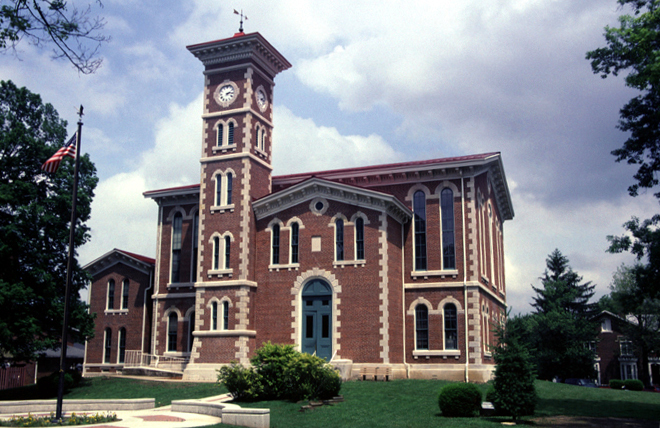
Jennings County is an admin_level=6 county in southeastern Indiana. Its population is 27,613 and its area is approximately 980 square kilometres. The county was established in 1816.
To the mapDecatur County

Decatur County is an admin_level=6 county in southeastern Indiana. It has 26,472 inhabitants and covers approximately 967 square kilometres. The county was established in 1822, and Greensburg is its county seat.
To the mapShelby County

Shelby County is an admin_level=6 county southeast of Indianapolis. Its population is 45,055 and its area is approximately 1,070 square kilometres. The county was established in 1821.
To the mapPutnam County

Putnam County is an admin_level=6 county in west-central Indiana. It has 37,585 inhabitants and includes Greencastle, the county seat. DePauw University is located in Greencastle.
To the mapMorgan County

Morgan County is an admin_level=6 county southwest of Indianapolis. Its population is 71,780 and its area is approximately 1,060 square kilometres. The county was established in 1821.
To the mapJohnson County

Johnson County is an admin_level=6 county south of Indianapolis. It has 161,765 inhabitants and covers approximately 833 square kilometres. The county was established in 1823 and includes Princes Lakes.
To the mapRipley County

Ripley County is an admin_level=6 county in southeastern Indiana. Its population is 28,995 and its area is approximately 1,160 square kilometres. The county was established in 1816.
To the mapDaviess County

Daviess County is an admin_level=6 county in southwestern Indiana. It has 33,381 inhabitants and covers approximately 1,131 square kilometres. The county was established in 1816 and lies along the East Fork of the White River.
To the mapMartin County

Martin County is an admin_level=6 county in southwestern Indiana. Its population is 9,812 and its area is approximately 882 square kilometres. The county was established in 1820.
To the mapLawrence County

Lawrence County is an admin_level=6 county in southern Indiana. It has 45,011 inhabitants and covers approximately 1,171 square kilometres. The county was established in 1818 and includes Bedford.
To the mapOrange County

Orange County is an admin_level=6 county in southern Indiana. Its population is 19,867 and its area is approximately 1,057 square kilometres. The county was established in 1816 and contains French Lick and West Baden Springs.
To the mapDubois County

Dubois County is an admin_level=6 county in southwestern Indiana. It has 43,637 inhabitants and covers approximately 1,127 square kilometres. The county was established in 1817 and includes Jasper.
To the mapWashington County

Washington County is an admin_level=6 county in southern Indiana. Its population is 28,182 and its area is approximately 1,337 square kilometres. The county was established in 1814 and includes Salem.
To the mapPike County

Pike County is an admin_level=6 county in southwestern Indiana. It has 12,250 inhabitants and covers approximately 883 square kilometres. The county was established in 1816 and lies in the White River basin.
To the mapScott County

Scott County is an admin_level=6 county in southern Indiana. Its population is 24,384 and its area is approximately 499 square kilometres. The county was established in 1820 and includes Scottsburg.
To the mapKnox County

Knox County is an admin_level=6 county in southwestern Indiana. It has 36,282 inhabitants and covers approximately 1,357 square kilometres. The county was established in 1790, and Vincennes is its county seat.
To the mapAllen County

Allen County is an admin_level=6 county in northeastern Indiana. Its population is 385,410 and its area is approximately 1,710 square kilometres. Fort Wayne, Indiana’s second-largest city, is the county seat.
To the mapAdams County

Adams County is an admin_level=6 county in northeastern Indiana. It has 35,809 inhabitants and covers approximately 880 square kilometres. The county was established in 1836 and includes Decatur.
To the mapWells County

Wells County is an admin_level=6 county in northeastern Indiana. Its population is 28,180 and its area is approximately 959 square kilometres. The county was established in 1837.
To the mapWhitley County

Whitley County is an admin_level=6 county in northeastern Indiana. It has 34,191 inhabitants and covers approximately 875 square kilometres. The county was established in 1835 and includes Columbia City.
To the mapHuntington County

Huntington County is an admin_level=6 county in northeastern Indiana. Its population is 36,662 and its area is approximately 1,005 square kilometres. The county was established in 1832 and includes Huntington.
To the mapNoble County
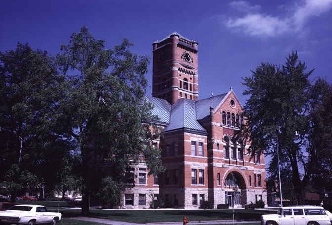
Noble County is an admin_level=6 county in northeastern Indiana. It has 47,457 inhabitants and covers approximately 1,082 square kilometres. The county was established in 1835 and contains numerous lakes near Rome City and Kendallville.
To the mapDeKalb County

DeKalb County is an admin_level=6 county in northeastern Indiana. Its population is 43,265 and its area is approximately 942 square kilometres. The county was established in 1837 and includes Auburn.
To the mapCrawford County

Crawford County is an admin_level=6 county in southern Indiana. It has 10,526 inhabitants and covers approximately 800 square kilometres. The county was established in 1818 and includes the Ohio River community of Leavenworth.
To the mapBenton County

Benton County is an admin_level=6 county in northwestern Indiana. Its population is 8,719 and its area is approximately 1,053 square kilometres. The county was established in 1840 and includes Fowler.
To the mapElkhart County

Elkhart County is an admin_level=6 county in northern Indiana. It has 207,047 inhabitants and covers approximately 1,212 square kilometres. The county was established in 1830, and Elkhart and Goshen are major cities in the county.
To the mapJasper County

Jasper County is an admin_level=6 county in northwestern Indiana. Its population is 32,918 and its area is approximately 1,454 square kilometres. The county was established in 1835 and includes Rensselaer.
To the mapKosciusko County

Kosciusko County is an admin_level=6 county in northern Indiana. It has 80,240 inhabitants and covers approximately 1,436 square kilometres. The county was established in 1835 and includes Warsaw and several natural lakes.
To the mapLaGrange County

LaGrange County is an admin_level=6 county in northeastern Indiana. Its population is 40,446 and its area is approximately 1,002 square kilometres. The county was established in 1832 and includes the town of LaGrange.
To the mapLaPorte County

LaPorte County is an admin_level=6 county in northwestern Indiana on Lake Michigan. LaPorte and Michigan City are important communities in the county. Indiana Dunes National Park extends along the Lake Michigan shoreline to the west.
To the mapPulaski County
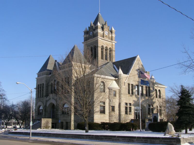
Pulaski County is an admin_level=6 county in northwestern Indiana. Winamac is the county seat on the Tippecanoe River. The county’s mapped roads and settlements form part of the northern Indiana regional structure.
To the mapSaint Joseph County
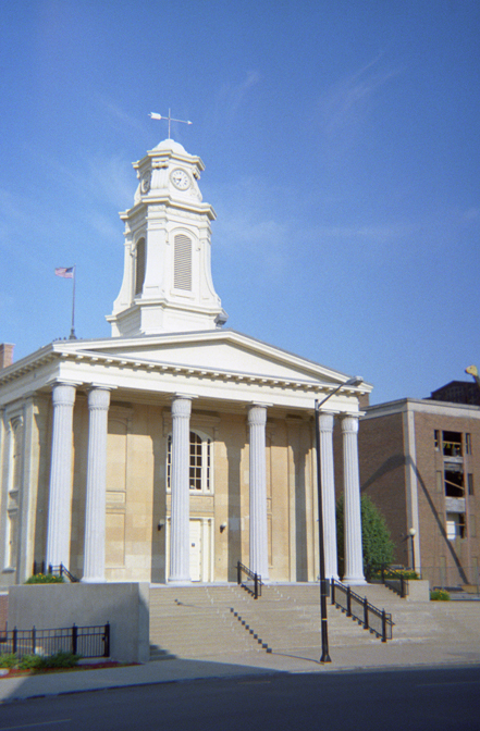
Saint Joseph County is an admin_level=6 county in northern Indiana. It has 272,912 inhabitants, covers approximately 1,194 square kilometres, and lies at an elevation of about 246 metres. South Bend, Mishawaka, and the University of Notre Dame are located in the county; it was established in 1830.
To the mapStarke County

Starke County is an admin_level=6 county in northwestern Indiana. Its population is 23,371 and its area is approximately 809 square kilometres. The county was established in 1850 and includes Knox.
To the mapData sources: OpenStreetMap (ODbL), Wikidata (CC0) · Image: Wikimedia Commons
| Named after | Indiana Territory |
|---|---|
| Year built | 1816 |
| Area | 94321 km² |
| Elevation | 210 m |
| Located in | United States |
| Country | United States |
| Body of water | Lake Michigan, Ohio River |
| Population | 6785528 |
| Website | https://www.in.gov |
| Nickname | The Hoosier State |
| Native name | Indiana |
| Official name | State of Indiana |

 Public transit map Indiana Legend
 | Railway | |
| Bus | |
| Tram |
 Bicycle map Indiana Legend
 | Bike path | |
| Bike lane on roadway | |
| Cycling allowed on bus lane | |
| Bicycle street | |
| Open to cyclists | |
| Open to cyclists, good path | |
| Cycling prohibited | |
| Cobblestone |
| Long-distance bike route | (depending on scale) | |
| Long-distance bike route |
 Pedestrian map Indiana Legend
 | Path |
| Long-distance hiking trail | (depending on scale) | |
| Long-distance hiking trail | ||
| Pedestrians prohibited |