
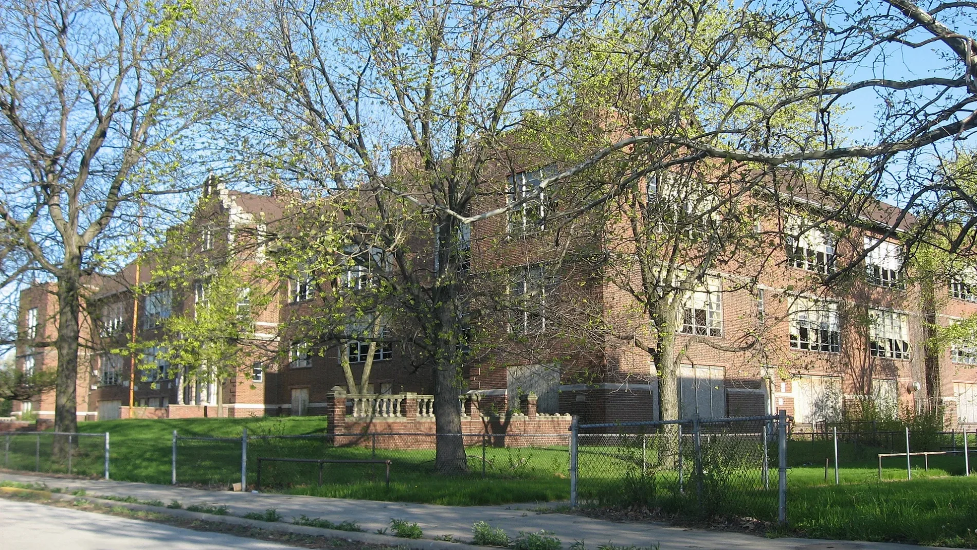
Emerson High School in Emerson, Gary, Indiana
Emerson High School in Gary is a brownfield (Gary Community School Corporation), East 7th Avenue 716. Emerson High School is also known as Ralph Waldo Emerson School. Ⓦ.
- House Number
- 716
- Street
- East 7th Avenue
- Operator
- Gary Community School Corporation
- Alternate Name
- Ralph Waldo Emerson School
- Land Use
- brownfield
Image
Schools
Payment terminals
Beauty salons
Bus stops
Places of worship
Fast food restaurants
Cell phone stores
Artworks
Restaurants
Cosmetics stores
Platforms
Streets nearby
Rhode Island Street0.1 mi
East 6th AvenueEmerson, New Divine Truth Apostolic Church, Anew Life Child Care Ministry
0.1 mi
Vermont StreetSaints Monica and Luke Church
0.1 mi
Carolina Street0.2 mi
Kentucky Street0.2 mi
Ohio Street0.3 mi
East 4th AvenueElbert H. Gary Monument, Mayor Richard G. Hatcher Monuument
0.3 mi
Tennessee StreetCoke Plant Gate [CLOSED]
0.3 mi
Louisiana Street0.3 mi
Access Road0.3 mi
Indiana Toll RoadGary Metro Center
0.4 mi
Malcolm X Drive0.4 mi
Maryland Street0.4 mi
Martin Luther King Drive0.4 mi
East 8th Avenue0.4 mi
Pennsylvania Street0.4 mi
Delaware Street0.4 mi
East 7th AvenueSaint Lukes School
0.4 mi
Mississippi Street0.4 mi
Connecticut Street0.5 mi
East 5th AvenueGary, Food Express Café, Gary Middle College, Righteous Ribs, CP 58.1
0.5 mi
Illinois Street0.5 mi
Central AvenueCentral & MLK Drive
0.6 mi
Georgia Street0.6 mi
Mason Avenue0.6 mi
East 13th Avenue0.6 mi
Alabama Street0.6 mi
East 10th Place0.7 mi
Abandoned railways nearby
Gary & Western0.7 mi
Convenience stores nearby
Citgo0.2 mi
Event venues nearby
ArtHouse0.4 mi
Fast food restaurants nearby
Sharks Fish & Chicken0.2 mi
Fire stations nearby
Gary Fire Department Station #10.5 mi
Industrial areas nearby
Indiana Sugars0.3 mi
Industrial buildings nearby
Alliance Tubular Products0.8 mi
Parks nearby
Buffington Park0.3 mi
Jordan Triangle0.4 mi
Idle Hour Park0.5 mi
Places of worship nearby
Centennial United Methodist Church0.1 mi
Progressive Community Church0.1 mi
Railways nearby
NICTD South Shore Line0.3 mi
Gary Branch0.3 mi
City Track0.4 mi
Barr Subdivision0.5 mi
NS Chicago Line0.5 mi
Dixie Lead0.6 mi
School buildings nearby
Former Ralph Waldo Emerson School400 ft
Stadiums nearby
U.S. Steel Yard0.5 mi
Other nearby
Virginia Substation0.4 mi
| Located in | Gary |
|---|---|
| Country | United States |
Public transit map Emerson Legend
| Railway | |
| Bus | |
| Streetcar |
Bicycle map Emerson Legend
| Bike path | |
| Bike lane on roadway | |
| Cycling allowed on bus lane | |
| Bicycle street | |
| Open to cyclists | |
| Open to cyclists, good path | |
| Cycling prohibited | |
| Cobblestone |
| Long-distance bike route | (depending on scale) | |
| Long-distance bike route |
Pedestrian map Emerson Legend
| Path |
| Long-distance hiking trail | (depending on scale) | |
| Long-distance hiking trail | ||
| Pedestrians prohibited |