
30th/Museum in Indianapolis
30th/Museum in Indianapolis is a bus stop (Bus Purple Line, Red Line) (Indianapolis Public Transportation Corporation, IndyGo, wheelchair accessible, Shelter, Bench, Trash bin, Tactile guidance system, lit). 30th/Museum is located near Alley 75 East.
- Operator
- Indianapolis Public Transportation Corporation
- Road Type
- bus stop
- Wheelchair Access
- yes
Image
Hair salons
Florists
Bars
Places of worship
Bus stops
- bus lines 90, 92
Artworks
Libraries
Tourist information centers
Restaurants
Bike shops
Streets nearby
West 30th Street30th & Falcon IB, 30th and Falcon OB, Crossroads Floral Delivery, Venerable Flackville, Speedway
150 ft
North Pennsylvania StreetTide Cleaners, The Mae, The National Bank of Indianapolis, Daddy Jack's Restaurant & Bar, Another Broken Egg Cafe, Yujo, Syrinx, Axum, BMO, Cups Coffee, Jimmy John's, The Den, Dream Palace Books & Coffee
450 ft
North Illinois StreetBuca di Beppo, Giordano's Pizzeria, Market Tower Parking Garage, Saint Thomas Aquinas Roman Catholic Church, Chase, Graeter's, The Secret Ingredient, Charles Mayer & Co., Kids Ink Children's Bookstore, Byrne's Grilled Pizza, Eckert & Ross Fine Art, The Flying Cupcake, Petite G Jewelers, Be The Boutique, Kincaid's Meat Market, Chalet, Animation Art Studio, Cheatham & Moore Barber Shop, Melody Inn, Indy Pawn, Dollar General, Third Dimension Worship Church, U-Haul, Tea's Me Community Cafe
0.1 mi
North Meridian StreetInfozone Branch Indianapolis-Marion County Public Library, 30th/Museum, Pan, Meridian and Vermont OB, FedEx Office, Starbucks, Implant Dentistry & Periodontics - Indianapolis, Sondhi-Biggs-Hansen Orthodontics, CVS Pharmacy, Meridian and 16th OB, North Meridian Street Historic District, 18th Street, Walgreens, Meridian and 16th IB, Merchant's Garage, T-Mobile, Meridian/38th, 34th Street, Fall Creek/Ivy Tech, KFC, KFC / Taco Bell, 22nd Street, KeyBank
0.1 mi
Pedestrian Skybridge0.1 mi
West 29th Street29th and Clifton EB, Baba's Steak & Lemonade, Shelter 5
0.2 mi
Alley 75 East0.2 mi
East 30th StreetRyder, Green Wave Computer Recycling, Warren Township Fire Station 444, Phillips 66, MacAllister Used Equipment, Abyssinian Baptist Church, 30th and Arthington WB, 30th and Arthington EB, Steve Schmidt Competition Engines, 30th Street Animal Hospital, Backyard Blessings Garden Center, Warren Township Fire Station 445
0.2 mi
North Delaware StreetMeridian Park, Subito Soups, MashCraft, Renew Dental Arts, Delaware Blu Salon and Spa, Delaware and New York Super Stop, The Tap, The Oakmont, Spectrum, St. Joseph, Delaware and North Super Stop, India Garden Restaurant
0.2 mi
Mapleton Trace0.2 mi
North Washington Boulevard0.2 mi
West 28th Street0.3 mi
Princeton Place0.3 mi
North Talbott Street0.3 mi
Trenton Street0.3 mi
30th Street Protected Bike LaneAdult Dinosaur Skeleton, Child Dinosaur Skeletons, Interdependence Sculpture
0.3 mi
East 29th Street0.3 mi
West 27th Street0.4 mi
East 27th StreetMessiah African Methodist Episcopal Zion Temple
0.4 mi
East Fall Creek Parkway North DriveEveything that Grows needs water
0.4 mi
East Fall Creek Parkway, North DriveSilver Fall
0.4 mi
Fall Creek TrailFall Creek Greenway
0.4 mi
Fall Creek/Ivy Tech0.4 mi
East Fall Creek Parkway, South Drive0.4 mi
East Fall Creek Parkway South Drive0.4 mi
North New Jersey StreetCity Nail Bar, Fall Creek Place, Classic Cleaners
0.4 mi
East 28th StreetRock of Ages Baptist Church, Mount Calvary Baptist Church, Sherman and 28th OB
0.5 mi
Central AvenueCentral and 32nd OB, Central and 32nd IB, Alpha Omega Church, Braid Besties Salon, Freewheelin' Community Bikes, Central and 30th OB, Trinity Presbyterian Church, College Crest, Central and 38th OB, Central and 38th IB, Central and Powell IB, Central and 34th OB, Central and 34th IB, Central and 25th OB, Old Northside Historic District, Central and 16th IB, Central Ave & 13th St, Central and 13th OB, Central and 28th OB, Central and 28th IB, Central and 44th IB, Central and 44th OB, Central and 42nd OB, Central and 42nd IB, Central and 40th IB, Central and 11th IB, Central and 22nd IB, Central and 19th IB, Central and 16th OB, Artie's on Central, City Way Animal Clinics - Fall Creek Place, Central and 11th OB, Central and 22nd OB, Central and 30th IB
0.5 mi
Apartment buildings nearby
Admiral Apartments500 ft
Parkview Apartments0.3 mi
Buildings nearby
Julia Carson Government Center0.4 mi
Cafes nearby
Unleavened Bread Cafe0.4 mi
Commercial buildings nearby
[former WIBC/WNAP studios]0.2 mi
Construction sites nearby
Central @ 290.4 mi
Convenience stores nearby
Shell0.1 mi
Kindergartens nearby
Kid City USA - Meridian Park0.2 mi
Museums nearby
Childrens Museum150 ft
Parking lots nearby
Childrens Museum Parking Garage0.1 mi
Julia M. Carson Learning Resource Center & Parking Garage0.3 mi
Parks nearby
Al Polin Park0.2 mi
Fall Creek Greenway0.3 mi
Single-family houses nearby
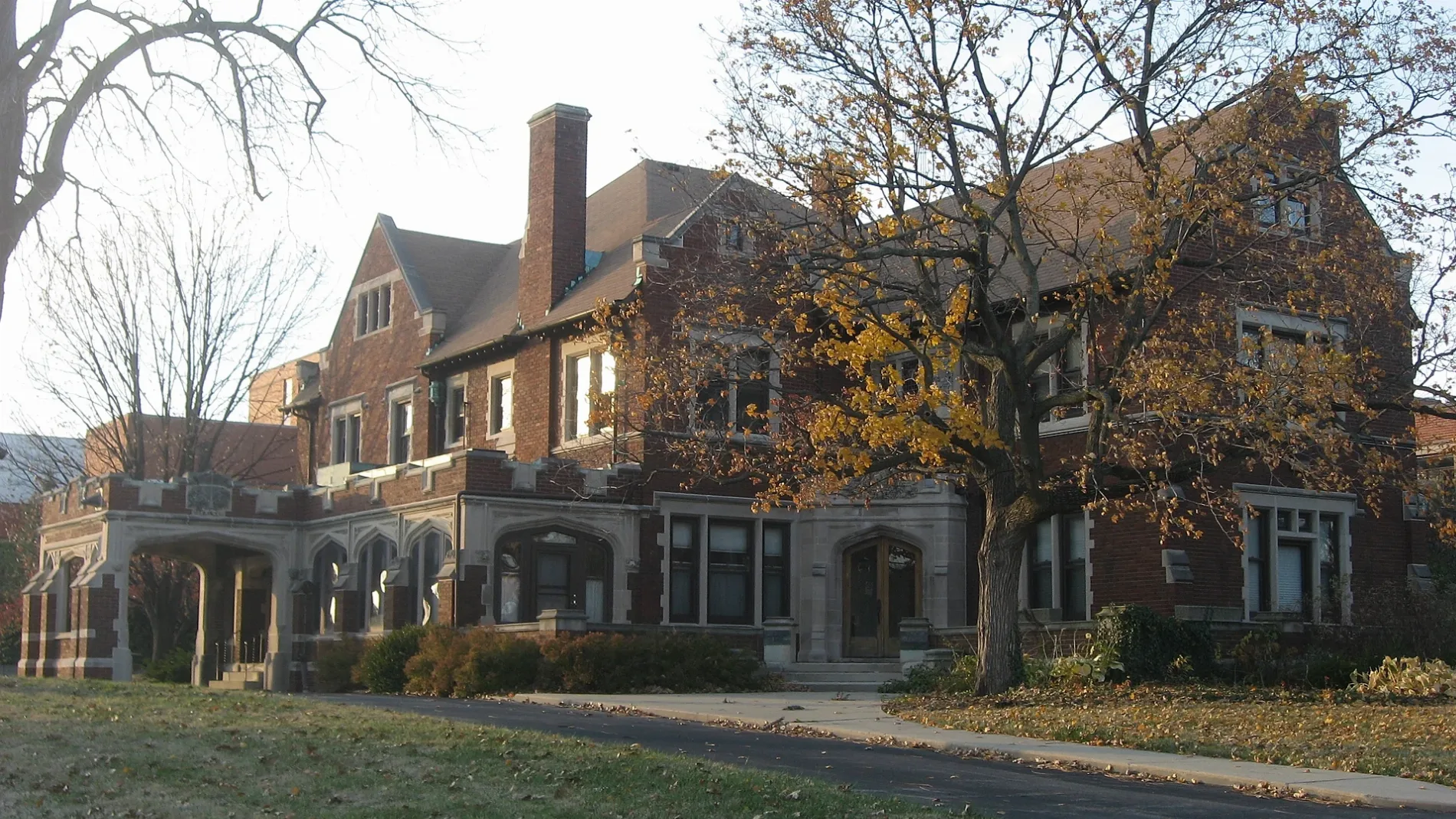
The Manor at the Children's Museum of Indianapolis450 ft
Sagamore Institute0.1 mi
Keller & Keller0.2 mi
Sports centers nearby
Riley Children's Health Sports Legends Experience0.1 mi
Technical colleges nearby
Corporate College and Cullinary Center0.2 mi
North Illinois Center0.3 mi
Other nearby
Highland Vicinity0.3 mi
Fall Creek Place0.4 mi
Public transit map Indianapolis Legend
| Railway | |
| Bus | |
| Streetcar |
Bicycle map Indianapolis Legend
| Bike path | |
| Bike lane on roadway | |
| Cycling allowed on bus lane | |
| Bicycle street | |
| Open to cyclists | |
| Open to cyclists, good path | |
| Cycling prohibited | |
| Cobblestone |
| Long-distance bike route | (depending on scale) | |
| Long-distance bike route |
Pedestrian map Indianapolis Legend
| Path |
| Long-distance hiking trail | (depending on scale) | |
| Long-distance hiking trail | ||
| Pedestrians prohibited |