
Indianapolis Museum of Art
Indianapolis Museum of Art in Indianapolis is a museum (opening hours: Sun–Wed 10–17; Thu–Sat 10–20, Web), Michigan Road 4000 (46208). Indianapolis Museum of Art is also known as Herron Museum of Art. Ⓦ.
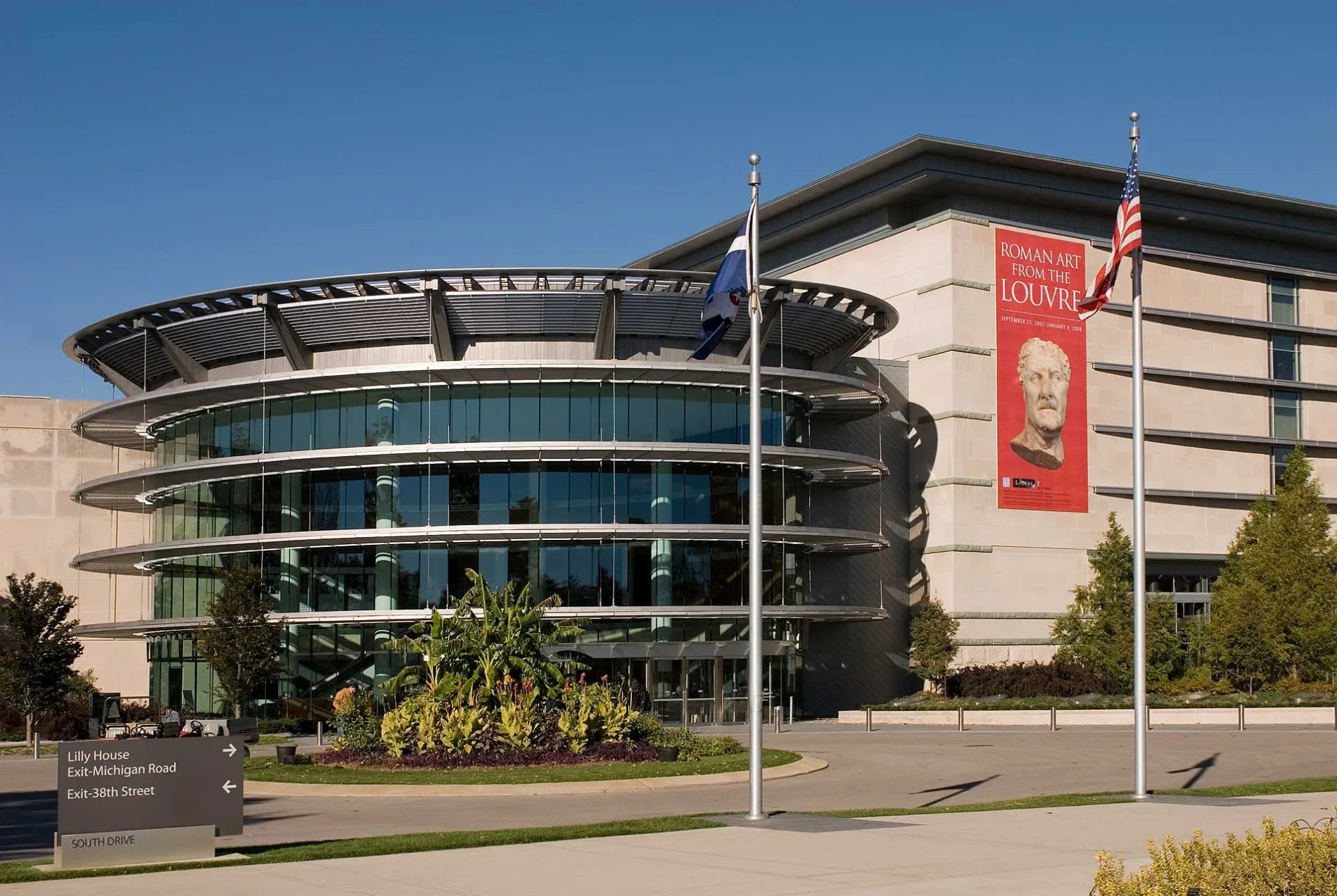
- House Number
- 4000
- Street
- Michigan Road
- Website
- https://discovernewfields.org/
- Postal Code
- 46208
- Tourism
- museum
- Building Type
- building
Artworks
Bus stops
Fountains
Theaters
Streets nearby
Woodstock BridgeCopy of Diana of Versailles, The Tobias Theater, Randolph H . Deer Special Events Pavilion
550 ft
Katharine B. Sutphin Border GardenDiana with Dog
0.2 mi
West 38th StreetSubway, 38th St & High School Rd, Woodstock, Thai Town Cuisine, Coinstar, 38th St & Lawndale Ave, Speedway, PLS Auto, 38th and Eagle Creek OB, 38th and Shore IB, North United Methodist Church, BP Shop
0.2 mi
North White River Parkway East DriveShelter 2
0.2 mi
Woodstock Drive0.3 mi
Golden Hill Drive0.3 mi
Spring Hollow Road0.4 mi
Pickwick Place0.4 mi
North White River Parkway West Drive1151 N White River Pkwy OB
0.4 mi
Michigan RoadMichigan Road and 38th IB, Augusta, Michigan Rd & Fox Hill Ct, Michigan Rd & 62nd St, Michigan Rd & 63rd St, Michigan Rd & 64th St, Michigan Rd & Coil St, Michigan Rd & 66th St, Blaze Pizza, Panda Express, White Castle, Michigan Rd and 86th IB, Steak 'n Shake, KFC, Michigan Rd and 86th OB, Michigan Rd & 57th St, Boarding Pass Bites, Michigan Rd & Kessler Blvd W Dr, Antique Wellhead, Michigan Rd & 60th St, Michigan Rd & Fox Hill Dr, Family Dollar, 8400 Michigan Road Lowe's, Discount Tire, McDonald's, Michigan Road and 79th IB, Michigan Rd & 58th St, Michigan Road and 38th OB
0.4 mi
Central Canal TowpathFresh Thyme, Pacers Bikeshare, Canal Bistro, Gavin-Divergence
0.4 mi
Barnes Avenue0.4 mi
Dr Martin Luther King Jr StreetDr MLK and 16th, Dairy Queen
0.4 mi
White River Wapahani TrailNIFS, Flora Metallica
0.4 mi
Clifton StreetClifton and Congress OB
0.4 mi
Governors Road0.4 mi
Totem Lane0.5 mi
Pomander Place0.5 mi
West 37th Street0.5 mi
West Alley 3725 North0.5 mi
Kenneth "Babyface" Edmonds HighwayShoe Carnival, Bee Coffee Roasteres, Bee Coffee Roasters
0.6 mi
West 42nd StreetShooters Hill, Hoagies and Hops Butler-Tarkington, Be Bella Company LLC
0.6 mi
West 36th Street0.6 mi
North Alley 1200 West0.6 mi
West Alley 3650 North0.6 mi
Crescent Avenue0.6 mi
Haughey Avenue0.7 mi
Artworks nearby
Dickenson Four Seasons Garden0.2 mi
Park of the Laments0.2 mi
Free Basket0.2 mi
Buildings nearby
Garden Terrace0.2 mi
Indiana Interchurch Center0.3 mi
Canals nearby
Indiana Central Canal0.5 mi
Garden centers nearby
Madeline F. Elder Greenhouse0.2 mi
Gardens nearby
Nonie's Garden100 ft
Sutphin Mall0.1 mi
R.D. Wood Formal Garden0.1 mi
Golf courses nearby
Woodstock Club0.2 mi
Riverside Golf Academy0.5 mi
Museums nearby
Lilly House0.2 mi
Orchards nearby
Tanner Orchard0.2 mi
Parks nearby
Bertha Ross Park0.5 mi
The Viginia B. Fairbanks Art & Nature Park0.5 mi
Newfields0.6 mi
Rivers nearby
White River0.6 mi
Theaters nearby
Amphitheater0.1 mi
Ticket offices nearby
Garden Entrance300 ft
Waters nearby
Glick Fountain0.2 mi
Other nearby
Wallet Island0.3 mi
| Year built | 1883 |
|---|---|
| Official opening | 1883 |
| Located in | Indianapolis |
| Country | United States |
| Visitors per year | 428213 |
| Described by | Open GLAM Survey |
Public transit map Indianapolis Legend
| Railway | |
| Bus | |
| Streetcar |
Bicycle map Indianapolis Legend
| Bike path | |
| Bike lane on roadway | |
| Cycling allowed on bus lane | |
| Bicycle street | |
| Open to cyclists | |
| Open to cyclists, good path | |
| Cycling prohibited | |
| Cobblestone |
| Long-distance bike route | (depending on scale) | |
| Long-distance bike route |
Pedestrian map Indianapolis Legend
| Path |
| Long-distance hiking trail | (depending on scale) | |
| Long-distance hiking trail | ||
| Pedestrians prohibited |