
Indianapolis Union Station
Indianapolis Union Station in Indianapolis is a train station, West Jackson Place 39 (46225). Ⓦ.
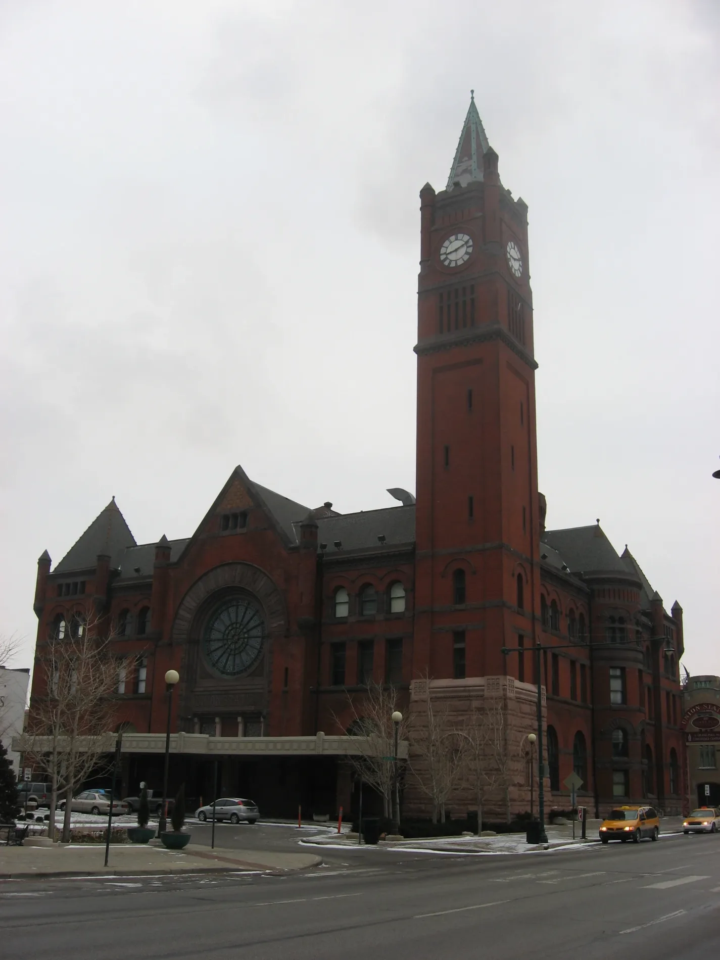
- House Number
- 39
- Street
- West Jackson Place
- Website
- http://www.amtrak.com/servlet/ContentServer?pagename=am/am2Station/Station_Page&code=IND
- Postal Code
- 46225
- Building Type
- train station
Restaurants
Hotels
Casinos
Bus stops
Artworks
Video game stores
Cafes
Stations
Platforms
Fast food restaurants
Charging stations
Streets nearby
South Illinois StreetStarbucks, Le Meridien Indianapolis, St. Elmo Steak House, Dick's Last Resort, Mount Fuji, Spoke & Steele, Casino Party Planners Indiana, Indianapolis Union Station, P.F. Chang's, Ruth's Chris Steak House
100 ft
West Louisiana StreetCrowne Plaza Indianapolis Downtown (Union Station)
250 ft
West Jackson Place250 ft
Gardner LaneIndianapolis Union Station
450 ft
McCrea Street450 ft
Amtrak & Grayhound Parking500 ft
East Louisiana Street550 ft
West South Street550 ft
Bates Street0.1 mi
Mechanic Street0.1 mi
East Jackson Place0.1 mi
West Georgia StreetGeorgia Street Grind, The Old Spaghetti Factory, Hooters
0.1 mi
South Meridian StreetSacred Heart High School, Meridian and Palmer IB, Indianapolis Union Station, Shell, Illumine Coffee - Downtown, GetGo, Speedway, Pizza Hut Delivery, Greek Islands, the Archivist
0.1 mi
South Capitol AvenueIndianapolis Union Station
0.1 mi
Madison AvenueAithawng Asia Grocery, South Side Animal Hospital, Big Time Tattoos and Piercings, Speedway, Arby's, Walgreens, Grace Homecare LLC, Lelen Asian Grocery Store, Ram Tha Asian Grocery, Lemro Asian Grocery Store, Madison Avenue Baptist Church, Regions Bank, Taco Bell, Updike Bathroom Remodeling, Wendy's
0.1 mi
South Alley 150 West0.2 mi
West Chesapeake Street0.2 mi
South Senate AvenueCP Kentucky Avenue
0.2 mi
West Maryland StreetYard House, Victory Field EB, Mama Ines Mexican Bakery, Western Union, PNC Bank, Little Caesars, Dollar General, Seoul Fresh, Maryland St & Missouri St, Conner's Kitchen + Bar Indianapolis, Tesla Supercharger, Marathon Health at PNC Center, Subway, Steak 'n Shake
0.2 mi
Mc Gill Street0.3 mi
Indianapolis Cultural TrailIMAX, Hong Kong Restaurant, Harmony Tea Shoppe, Tuggles Gifts & Goods, Higher Life, Fountain Square Liquors, Washington St & Illinois St, Tastings Wine bar & Bistro, Tony's, Forty Five Degrees, Tini, Subway, Bru Burger Bar, Brick Head 3, Ann Dancing, Commissary Barber & Barista, Needler's Pharmacy, Care/Don’t Care, Tappers Arcade Bar, Fletcher Place, Yats, Love Handle, Global Gifts, Goulding & Wood Pipe Organ Builders, Gordon's Milkshake Bar, Cafe Patachou, Washington St & Senate Ave, George Washington, Chipotle, Red's Classic Barber Shop Co., Five Guys, Crab 99, FlixBus Indianapolis, Dugout Bar, Calvin Fletcher Coffee, La Eskina, Amelia's Bread, Indiana and Blackford OB, Madam Walker Legacy Center, Indiana and West OB, T-Mobile, Mass Appeal, Meridian and St Clair OB, Indiana and Blake IB, Peyton Manning, Red Lion, El Arado, The HiFi, Lo-Fi Lounge Indy, Hasuno, Market Square Tap Room
0.3 mi
South Missouri StreetMissouri and South IB
0.3 mi
North Capitol AvenueStatehouse, 14th Street, IU Health, Care Center at the Tower, 9th Street, Brew Link Brewing Downtown, Musician's Repair and Sales, Vermont
0.3 mi
StatehouseOne North Capitol Center, Statehouse
0.3 mi
North Senate AvenueIndiana Government Center Location C, Christopher Columbus, Time Flow, LITEBoxIN-- ISL, Lux Aeterna, Coal Miner
0.4 mi
Apartment buildings nearby
Janus Lofts350 ft
Bars nearby
Slippery Noodle Inn0.1 mi
Buildings nearby
One Jackson Square300 ft
250 South Meridian450 ft
235 South Meridian Street0.1 mi
Pan American Plaza (Tower)0.1 mi
L. S. Ayres Annex Warehouse0.2 mi
The Artsgarden0.3 mi
Commercial buildings nearby
Simon Tower0.3 mi
Fast food restaurants nearby
White Castle0.1 mi
Hotels nearby
Omni Severin Hotel300 ft
Hampton Inn Indianapolis Downtown Across from Circle Centre0.2 mi
Hyatt Regency Indianapolis0.3 mi
The Westin Indianapolis0.3 mi
Conrad Indianapolis0.3 mi
Embassy Suites by Hilton Indianapolis - Downtown0.3 mi
Marriott Indianapolis Downtown0.3 mi
Office buildings nearby
One North Capitol0.3 mi
Parking lots nearby
World of Wonders Garage0.1 mi
Parks nearby
Hudnut Commons0.3 mi
Places of worship nearby
Saint John the Evangelist Roman Catholic Church0.2 mi
Post offices nearby
Andrew Jacobs Jr. Post Office0.1 mi
Railways nearby
CSX Indianapolis Terminal Subdivision300 ft
Schools nearby
Saint Johns Academy0.1 mi
| Year built | 1979 |
|---|---|
| Official opening | 1979 |
| Operator | Amtrak |
| Owned by | Indianapolis |
| Heritage designation | National Register of Historic Places listed place |
| Located in | Indianapolis |
| Country | United States |
Public transit map Indianapolis Legend
| Railway | |
| Bus | |
| Streetcar |
Bicycle map Indianapolis Legend
| Bike path | |
| Bike lane on roadway | |
| Cycling allowed on bus lane | |
| Bicycle street | |
| Open to cyclists | |
| Open to cyclists, good path | |
| Cycling prohibited | |
| Cobblestone |
| Long-distance bike route | (depending on scale) | |
| Long-distance bike route |
Pedestrian map Indianapolis Legend
| Path |
| Long-distance hiking trail | (depending on scale) | |
| Long-distance hiking trail | ||
| Pedestrians prohibited |