
Long's Bakery in Indianapolis
Long's Bakery in Indianapolis is a bakery, North Tremont Street 1453 (46222). Ⓦ.
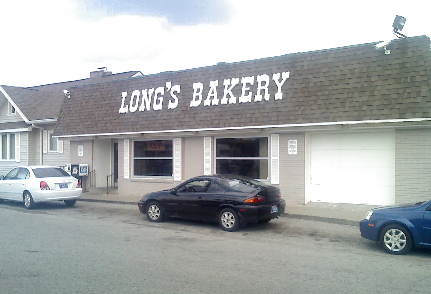
- House Number
- 1453
- Street
- North Tremont Street
- Postal Code
- 46222
- Shop
- bakery
- Building Type
- building
Bus stops
Places of worship
Beauty salons
Clinics
Gas stations
Cell phone stores
Fire stations
Post offices
Supermarkets
Food courts
Streets nearby
North Pershing Avenue250 ft
West 16th StreetPhillips 66, Circle K, 16th and Capitol OB, McDonald's, 16th Street Gas, 16th and MLK IB, 16th and Senate IB, 16th and Dr MLK, BRTC, Goodman Campbell Brain and Spine, 16th and Harding IB
250 ft
North Alley 2400 West350 ft
North Belleview Place0.1 mi
Lafayette RoadSpeedway, CVS Pharmacy, Snacks, Dollar Tree, India Sizzling, King Wok, Furniture Discounters, Value City, Save-A-Lot, Lafayette Square Mall IndyGo Transfer, Lafayette Square Mall, Lafayette and Kessler OB, Mr. Collision Llc
0.1 mi
North White River Parkway West Drive1151 N White River Pkwy OB
0.1 mi
West 17th Street0.2 mi
West 14th StreetLight and Life Free Methodist Chapel
0.2 mi
North Mount Street0.2 mi
North Tremont Street0.2 mi
Mount Street0.2 mi
White River Wapahani TrailNIFS, Flora Metallica
0.3 mi
North Sheffield Avenue0.3 mi
Waterway Boulevard0.3 mi
King AvenueKing's Beauty
0.3 mi
North Belmont Avenue0.3 mi
West 11th StreetGrounded Plant + Floral Co.
0.4 mi
North Alley 2540 West0.4 mi
North Traub Avenue0.4 mi
West 10th StreetPanda Express, Tropical Smoothie Cafe, CAVA, Patachou, Turner's, Visionloft, Julieta Taco Shop, The Car Museum, Arby's, 10th and Girls School IB, 10th and Beachway EB, Toppers, Speedway, 10th and Country Club, Jiffy Lube, Mobil, Silver Express, Subway, GoodLife, Rookies Sports Pub, Charity Church Ministries, Charity Church Child Care Center, Church's Chicken, BP
0.5 mi
Apartment buildings nearby
Pershing Place Apartments450 ft
Union 160.1 mi
Auto repair shops nearby
Falcone Collison Center300 ft
Falcone Collision Center500 ft
Speedway Body Shop Inc0.2 mi
Castaneda's Body Shop0.5 mi
Bars nearby
Sunset Strip250 ft
Buildings nearby
Mountain of Fire & Miracles Ministries (Revelation Center)0.1 mi
Car dealerships nearby
Tillman Van Sales150 ft
Sigma Group400 ft
Speedway Car Sales0.1 mi
E. Curtis Auto Sales Inc0.2 mi
Speedway Subaru0.3 mi
Community centers nearby
New Life Baptist Church Family Life Center0.4 mi
Fish markets nearby
John's Fish Market0.5 mi
Funeral homes nearby
Payne Funeral Home0.5 mi
Motels nearby
Gateway Motel0.2 mi
Office buildings nearby
Speedway Volkwagen0.3 mi
Parks nearby
Belmont Beach0.2 mi
Places of worship nearby
First Samuel Baptist Church0.2 mi
Latter House Ministries0.2 mi
St Paul Baptist Church0.3 mi
New Light Missionary Baptist Church0.4 mi
Caldwell Chapel AME Zion Church0.4 mi
Army Of The Lord0.5 mi
Light of the World Baptist Church0.5 mi
Restaurants nearby
Los Molcajetes0.2 mi
Supermarkets nearby
Trinity Haitian Market550 ft
Weirs nearby
Emerichsville Dam0.3 mi
| Located in | Indianapolis |
|---|---|
| Country | United States |
Public transit map Indianapolis Legend
| Railway | |
| Bus | |
| Streetcar |
Bicycle map Indianapolis Legend
| Bike path | |
| Bike lane on roadway | |
| Cycling allowed on bus lane | |
| Bicycle street | |
| Open to cyclists | |
| Open to cyclists, good path | |
| Cycling prohibited | |
| Cobblestone |
| Long-distance bike route | (depending on scale) | |
| Long-distance bike route |
Pedestrian map Indianapolis Legend
| Path |
| Long-distance hiking trail | (depending on scale) | |
| Long-distance hiking trail | ||
| Pedestrians prohibited |