
The Baker in Indianapolis
The Baker in Indianapolis is an apartment building, Massachusetts Avenue 339 (46204). The Baker is also known as Massala. Ⓦ.
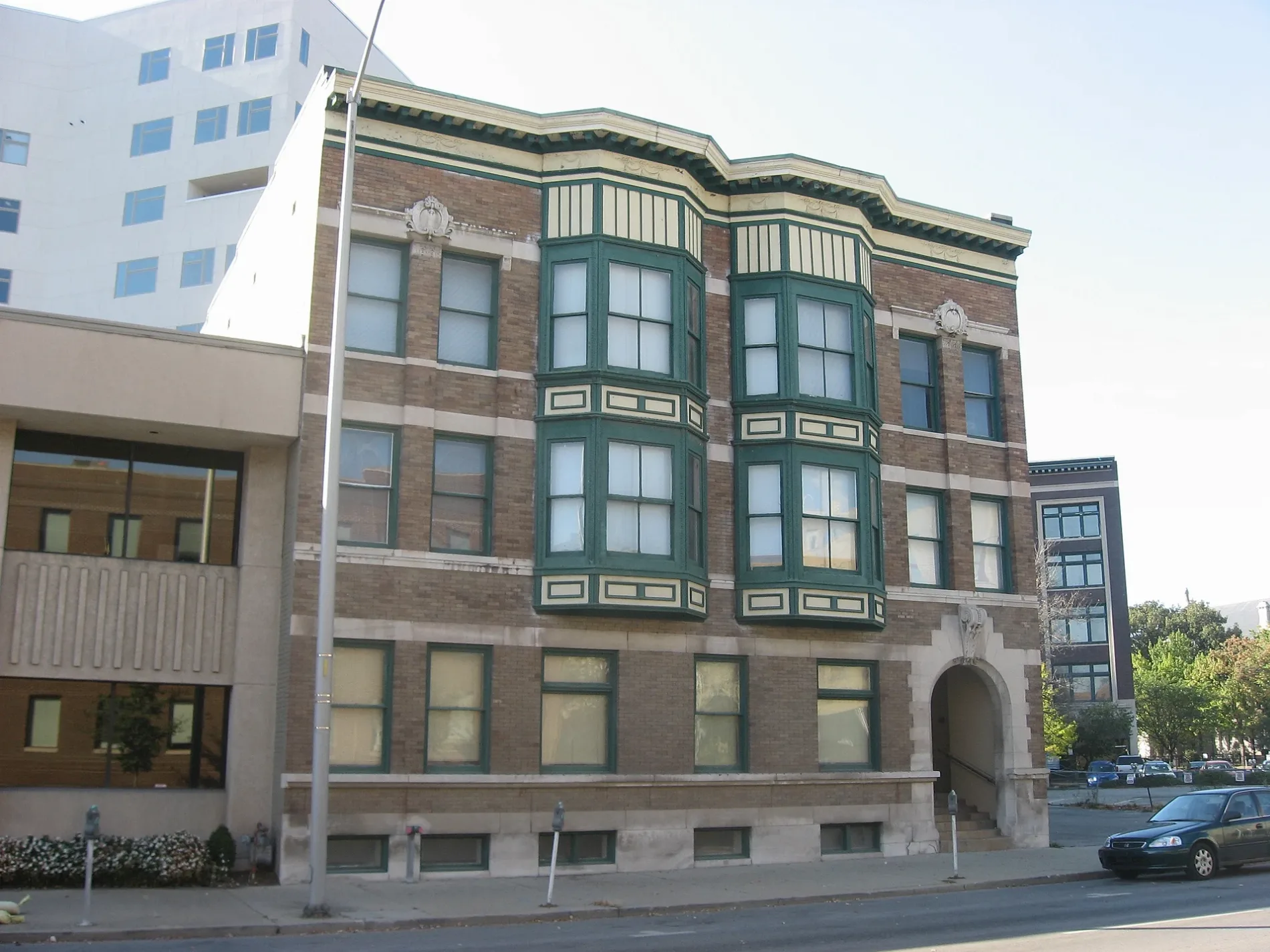
- House Number
- 339
- Street
- Massachusetts Avenue
- Postal Code
- 46204
- Building Type
- apartment building
Restaurants
Supermarkets
Bars
Bus stops
Pubs
Pharmacies
Artworks
Fast food restaurants
Shoe stores
Banks
Cafes
Streets nearby
North Alabama StreetHomeless Jesus, Alabama and New York, Alabama and North, Signature Bodies Day Spa
250 ft
North Alley 265 E500 ft
Indianapolis Cultural TrailIMAX, Hong Kong Restaurant, Harmony Tea Shoppe, Tuggles Gifts & Goods, Higher Life, Fountain Square Liquors, Washington St & Illinois St, Tastings Wine bar & Bistro, Tony's, Forty Five Degrees, Tini, Subway, Bru Burger Bar, Brick Head 3, Ann Dancing, Commissary Barber & Barista, Needler's Pharmacy, Care/Don’t Care, Tappers Arcade Bar, Fletcher Place, Yats, Love Handle, Global Gifts, Goulding & Wood Pipe Organ Builders, Gordon's Milkshake Bar, Cafe Patachou, Washington St & Senate Ave, George Washington, Chipotle, Red's Classic Barber Shop Co., Five Guys, Crab 99, FlixBus Indianapolis, Dugout Bar, Calvin Fletcher Coffee, La Eskina, Amelia's Bread, Indiana and Blackford OB, Madam Walker Legacy Center, Indiana and West OB, T-Mobile, Mass Appeal, Meridian and St Clair OB, Indiana and Blake IB, Peyton Manning, Red Lion, El Arado, The HiFi, Lo-Fi Lounge Indy, Hasuno, Market Square Tap Room
500 ft
North Ogden Street0.1 mi
East Miami Street0.1 mi
Hudson Street0.1 mi
Firehouse Place0.1 mi
North New Jersey StreetCity Nail Bar, Fall Creek Place, Classic Cleaners
0.2 mi
Massachusetts AvenueThe Eagle, Bazbeaux, Stout's Shoes, Bakersfield, Garden Table, Burnside Inn, Ball & Biscuit, Slapfish, Tie-Breakers, CP 280, Rosemary & Olive, Tomorrow Bookstore, Mass Ave Wine, Bottleworks Hotel, Starbucks, Tavern at the Point, Chatterbox Tavern, Sub Zero, Reclamation, Moar Tea, Silver in the City, Three Dog Bakery, Liberty Street, Chatham Tap, Oishi Sushi and Ramen, Ralston's Draft House, The Frame Shop, Petra Cafe, Mesh, Toolbox Men's Supply Company, Thaitanium, Indianapolis Fire Fighters Museum, The District Theatre, Pacers Bikeshare, Crema, Almost Famous, Kilwins, DGX, LouVino Indianapolis Mass Ave Restaurant & Wine Bar, Old National Bank, Salt on Mass, Goodfellas Mass Ave, Tsaocaa Indianapolis, Top Out Cafe, Valero, Belt Junction
0.2 mi
North Cleveland StreetSaint Marys School
0.2 mi
North East StreetCity Way Animal Clinic Mass Ave, Mary & Friends, Union 50
0.2 mi
Lockerbie Street0.3 mi
East Vermont Place0.3 mi
Lockerbie Circle South0.3 mi
Apartment buildings nearby
Massala Building100 ft
Marott Center250 ft
Hammond Block (Budnick's Trading Block)300 ft
The Sid-Mar450 ft
The Oxford500 ft
The Devonshire500 ft
The Alexandra0.1 mi
Riley Towers I0.2 mi
Block 200.2 mi
Milikan on Mass0.3 mi
John J. Barton Apartments0.3 mi
Penrose on Mass Ave0.3 mi
Auto repair shops nearby
Firestone0.1 mi
Buildings nearby
Lockerbie Marketplace 303 Building350 ft
The Vienna400 ft
The Massachusetts0.1 mi
The Mayleeno0.2 mi
The Academy at Lockerbie0.2 mi
Fire House at Lockerbie Commons0.2 mi
Fitness centers nearby
The Hot Room Downtown400 ft
Gas stations nearby
Marathon0.1 mi
Museums nearby
The Hall0.1 mi
James Whitcomb Riley Home0.3 mi
Office buildings nearby
The Wil-Fra-Mar400 ft
Places of worship nearby
Roberts Park United Methodist Church450 ft
Saint Mary's Catholic Church0.1 mi
Zion Evangelical United Church of Christ0.3 mi
Public buildings nearby
The Dartmouth0.1 mi
Salvation Army Center City Corps0.2 mi
Residential areas nearby
The Devlin0.1 mi
Lockerbie Square0.3 mi
Retail buildings nearby
Stout's Gray Building300 ft
Lockerbie Marketplace 350 Building500 ft
The Athenaeum0.2 mi
Theaters nearby
Old National Centre0.2 mi
| Heritage designation | National Register of Historic Places listed place |
|---|---|
| Located in | Indiana |
| Country | United States |
Public transit map Indianapolis Legend
| Railway | |
| Bus | |
| Streetcar |
Bicycle map Indianapolis Legend
| Bike path | |
| Bike lane on roadway | |
| Cycling allowed on bus lane | |
| Bicycle street | |
| Open to cyclists | |
| Open to cyclists, good path | |
| Cycling prohibited | |
| Cobblestone |
| Long-distance bike route | (depending on scale) | |
| Long-distance bike route |
Pedestrian map Indianapolis Legend
| Path |
| Long-distance hiking trail | (depending on scale) | |
| Long-distance hiking trail | ||
| Pedestrians prohibited |