
The Colonial in Indianapolis
The Colonial in Indianapolis is a building (Heritage monument), North Delaware Street 201 (46204). Ⓦ.
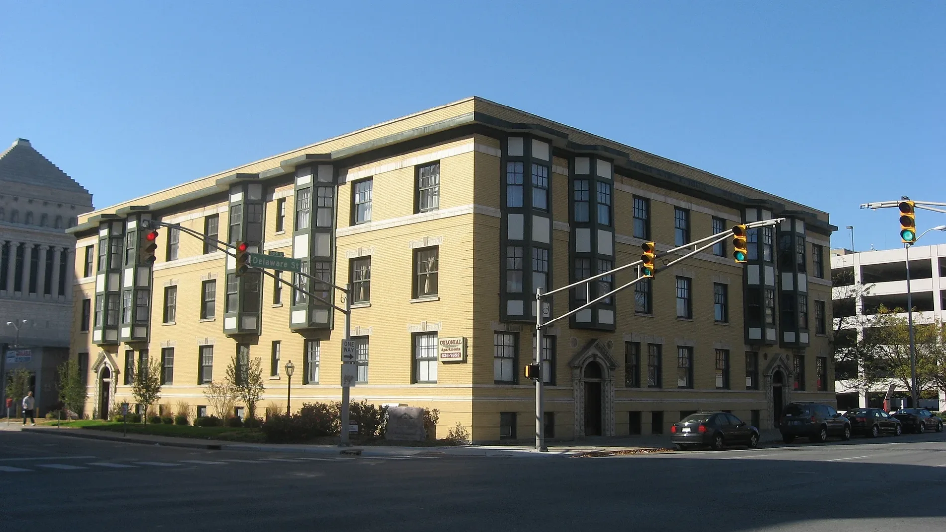
- House Number
- 201
- Street
- North Delaware Street
- Postal Code
- 46204
- Building Type
- building
Restaurants
Pubs
Fountains
Artworks
Bus stops
Shoe stores
Gas stations
Bars
Fast food restaurants
Streets nearby
East Vermont StreetNeedler's Fresh Market, Vicino
100 ft
North Talbott Street250 ft
East Tippecanoe Street350 ft
Sturm Avenue350 ft
East Allegheny Street350 ft
East Michigan StreetMarathon, Michigan and Emerson EB, Ellenberger Park EB, Clark's Coffee, Michigan and Walcott EB, Michigan and Tecumseh EB, Michigan and Keystone EB, Indiana War Memorial Plaza, Coat Check Coffee, Michigan and Spring EB, The Rathskeller, Fat Dan's Deli, Taylor's, Luna and Co., Michigan and Arsenal EB, Underground, Yazsh, Laurine's, Michigan and Highland EB, Michigan and Sherman EB, Carrillo's Used Appliances, Michigan and Grant EB, Michigan and Linwood EB, Michigan and Wallace EB, Michigan and Lasalle Eb, Michigan and Rural EB, Michigan and Oakland EB
500 ft
North Pennsylvania StreetTide Cleaners, The Mae, The National Bank of Indianapolis, Daddy Jack's Restaurant & Bar, Another Broken Egg Cafe, Yujo, Syrinx, Axum, BMO, Cups Coffee, Jimmy John's, The Den, Dream Palace Books & Coffee
0.2 mi
Fort Wayne AvenueThe Obelisk, Saffron Cafe, Fort Wayne and Sahm OB, Fort Wayne and 9th IB
0.2 mi
East North StreetRiley Towers Hair Forum, Condado Tacos
0.2 mi
Tippecanoe StreetStyles by Darcey & Co., Gemma & Karimi, LLP
0.2 mi
North Alley 65 West0.2 mi
West Allegheny Street0.2 mi
North Meridian StreetPan, Meridian and Vermont OB, FedEx Office, Starbucks, Implant Dentistry & Periodontics - Indianapolis, Sondhi-Biggs-Hansen Orthodontics, CVS Pharmacy, Meridian and 16th OB, North Meridian Street Historic District, 18th Street, Walgreens, Meridian and 16th IB, Merchant's Garage, T-Mobile, Meridian/38th, 34th Street, Infozone Branch Indianapolis-Marion County Public Library, 30th/Museum, Fall Creek/Ivy Tech, KFC, KFC / Taco Bell, 22nd Street, KeyBank
0.3 mi
North Pierson Street0.3 mi
West Vermont StreetEl Toro Bravo, Caribou Coffee, Chick-fil-A, Vermont St and Lynhurst Dr WB, Vermont and Lynhurst EB, Vermont and Capitol IB, Music Travel Consultants, Hampton Inn Indianapolis Downtown IUPUI, Starbucks
0.3 mi
North Illinois StreetBuca di Beppo, Giordano's Pizzeria, Market Tower Parking Garage, Saint Thomas Aquinas Roman Catholic Church, Chase, Graeter's, The Secret Ingredient, Charles Mayer & Co., Kids Ink Children's Bookstore, Byrne's Grilled Pizza, Eckert & Ross Fine Art, The Flying Cupcake, Petite G Jewelers, Be The Boutique, Kincaid's Meat Market, Chalet, Animation Art Studio, Cheatham & Moore Barber Shop, Melody Inn, Indy Pawn, Dollar General, Third Dimension Worship Church, U-Haul, Tea's Me Community Cafe
0.3 mi
Illinois Street PBLPanera Bread, TJ Maxx, Claypool Coffee & Ice Cream, Weber Grill
0.3 mi
Buildings nearby
The Ardmore0.2 mi
Apartment buildings nearby
Industry Indianapolis300 ft
Marott Center350 ft
333 Penn Apartments400 ft
Pulliam Square Apartments550 ft
Hammond Block (Budnick's Trading Block)0.1 mi
Minton-Capehart Federal Building0.1 mi
The Whit Apartments0.1 mi
Indianapolis Athletic Club0.2 mi
Vermont Place0.2 mi
The Rink0.3 mi
Auto repair shops nearby
Firestone500 ft
Buildings nearby
Indiana World War Memorial0.1 mi
HKM Employment Attorneys LLP0.2 mi
Courthouses nearby
Birch Bayh Federal Building and U.S. Courthouse0.2 mi
Office buildings nearby
Regions Tower0.2 mi
Park Meridian II0.2 mi
BMO Plaza0.2 mi
Park Meridian III0.2 mi
Salesforce Tower0.2 mi
AT&T Building0.2 mi
Capital Center0.3 mi
Parking garages nearby
The Savoy0.2 mi
Parking lots nearby
429 Penn Parking250 ft
Pulliam Garage300 ft
Parks nearby
University Park0.1 mi
Indiana World War Memorial Plaza0.1 mi
American Legion Mall0.2 mi
Places of worship nearby
Roberts Park United Methodist Church200 ft
Public buildings nearby
The Dartmouth500 ft
Retail buildings nearby
Stout's Gray Building250 ft
Repro-Graphics Building0.3 mi
| Located in | Indiana |
|---|---|
| Country | United States |
Public transit map Indianapolis Legend
| Railway | |
| Bus | |
| Streetcar |
Bicycle map Indianapolis Legend
| Bike path | |
| Bike lane on roadway | |
| Cycling allowed on bus lane | |
| Bicycle street | |
| Open to cyclists | |
| Open to cyclists, good path | |
| Cycling prohibited | |
| Cobblestone |
| Long-distance bike route | (depending on scale) | |
| Long-distance bike route |
Pedestrian map Indianapolis Legend
| Path |
| Long-distance hiking trail | (depending on scale) | |
| Long-distance hiking trail | ||
| Pedestrians prohibited |