
Richardson Court in Ames, Iowa
Richardson Court in Ames is an asphalted service road and runs in an east-west direction starting from Carrie Lane Court and ends at Beach Road. Nearby you can find an artwork and a restaurant. The nearest bus stop is Lincoln Way at Union Drive Westbound (about 150 m away). Richardson Court also exists in Kossuth County.
- Road Type
- service road
- Speed Limit
- 15 mph
- Route
- east-west
Image
Streets nearby
Carrie Lane CourtRichardson Court
250 ft
Lincoln WayBuchanan Hall, Iowa Department of Transportation, Woman's Head, Taco John's, Asia Foods Store, Smoke Stop, Le's Nail Salon, Mayfair Cleaners, Lincoln Way at Maple Avenue Westbound, Lincoln Way at Hazel Avenue Westbound, Lincoln Avenue at Russell Avenue Westbound, Lincoln Way at South Russell Avenue Eastbound, Lincoln Way at South Hazel Avenue Eastbound, Lincoln Way at North Dakota Avenue Westbound, Lincoln Way at Alcott Avenue, Lincoln Way at Hilton Coliseum Westbound, U.S. Bank, Cafe Beaudelaire, Copyworks, All Cuts Barber Shop, Mayhem Comics, Mr. Burrito, Leedz Salon, Lincoln Way at Sheldon Avenue Eastbound, Iowa State University, Lincoln Way at Hickory Drive Westbound, Lincoln Way at Marshall Avenue Westbound, Lincoln Way at Franklin Avenue Westbound, Lincoln Way at Wiloth Avenue Westbound, Massage Reflexology, Neighborhood Liquor Mart, Central Iowa Vapors, Vibe Nutrition, 7 Brew, Jeff's Pizza Shop, Kingland Systems, High Class Glass, Starbucks, Blaze Pizza, Potbelly, Freddy's, Lincoln Way at Lynn Avenue Eastbound, Barefoot Campus Outfitter, Cactus 2, Roni's Mac Bar - Ames, Which Wich?, Lincoln Way at Beach Avenue Westbound, Lincoln Way at Union Drive Westbound, Lincoln Way at Beach Avenue Eastbound, Flowerama, Lincoln Way at South Duff Avenue Eastbound, Lincoln Way at Walnut Avenue Eastbound, Lincoln Way at Clark Avenue Westbound, Lincoln Way at Duff Avenue Westbound, Lincoln Way at Kellogg Avenue Westbound, Lincoln Way at South Kellogg Avenue Eastbound, Rent-A-Center, Inspire Nutrition, Trickle's Tires & Automotive, Hometown Cash Advance, Iowa Department of Transportation Westbound, Jersey Mike's Subs, GameStop, Little Caesars, Orange Leaf Frozen Yogurt, Tropical Smoothie Cafe, Humble Donuts, Massage Heights, Lincoln Way at Lynn Avenue Westbound, ISU Bookstore, Whirlwind, Lincoln Way at State Avenue Eastbound, Lincoln Way at South Dakota Avenue Eastbound, Lincoln Way at Beedle Drive Eastbound, Lincoln Way at Marshall Avenue Eastbound, Lincoln Way at South Franklin Avenue Eastbound, The UPS Store, Wells Fargo, Lincoln Way at State Avenue Westbound, Lincoln Way at South Wilmoth Avenue Eastbound, Lincoln Way at Hilton Coliseum Eastbound
450 ft
Knoll Road500 ft
Beach AvenueElwood the Gnome, Beach Avenue at Sunset Drive Northbound, Beach Avenue at Sunset Drive Southbound
0.1 mi
Gray Avenue0.1 mi
Wallace RoadWallace Road at Gerdin Hall, Wallace Road at East Parking Deck, Food Sciences Building, Wallace Road at Forker Hall, Ice Blue, General Services West, Agronomy Hall
0.2 mi
Beach RoadGeneral Services South, Beach Road at Forker Hall, Lied Recreation, Beach Road at Linden Hall, Maple Hall
0.3 mi
Farm House RoadGlobal Cafe, Janus Agri Altar
0.3 mi
6th Street6th Street at Duff Avenue Westbound, Kwik Stop, 6th Street at Brookridge Avenue Eastbound, Ames, Ames Police Department, Ames City Auditorium, Little Free Library, Skate Park Mosaic, Margaret Mericle Memorial Bench, Mary & Joe "Clyde" Green Memorial Bench, Patt Ritland-Willig Memorial Bench, 6th Street at Brookside Park Eastbound
0.4 mi
Buildings nearby
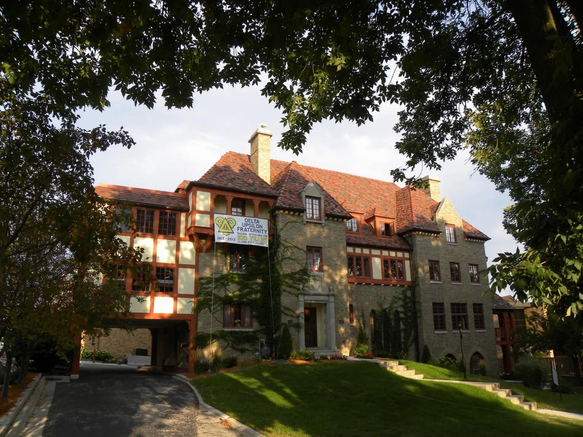
Beta Theta Pi500 ft
Alpha Tau Omega0.1 mi
Triangle Fraternity0.1 mi
Pi Kappa Alpha0.1 mi
Phi Kappa Theta0.1 mi
Phi Delta Theta0.1 mi
ACACIA0.2 mi
Dormitories nearby
Birch Residence Hall150 ft
Barton Residence Hall250 ft
Welch Residence Hall300 ft
Roberts Residence Hall400 ft
Lyon Residence Hall450 ft
Freeman Residence Hall500 ft
Linden Residence Hall500 ft
Oak-Elm Residence Hall550 ft
Geoffroy Hall0.1 mi
Maple Residence Hall0.1 mi
Houses nearby
Knoll0.1 mi
Industrial areas nearby
Iowa State University Power Plant0.3 mi
Museums nearby
Farm House Museum0.3 mi
Parking lots nearby
East Parking Deck0.2 mi
Parks nearby
Richardson Court Park500 ft
Central Campus0.2 mi
Sports centers nearby
Forker Tennis Courts0.2 mi
University buildings nearby
Hixson-Lied Student Success Center500 ft
Maple-Willow-Larch Commons0.2 mi
Gerdin Business Building0.2 mi
Forker Building0.2 mi
East Hall0.2 mi
Heady Hall0.2 mi
Sloss House0.2 mi
Curtiss Hall0.2 mi
Ross Hall0.2 mi
Hamilton Hall0.3 mi
Landscape Architecture Building0.3 mi
General Services Building0.3 mi
Jischke Honors Building0.3 mi
Troxel Hall0.3 mi
Agronomy Hall0.3 mi
United States Department of Agriculture Greenhouse0.4 mi
Public transit map Ames Legend
| Railway | |
| Bus | |
| Streetcar |
Bicycle map Ames Legend
| Bike path | |
| Bike lane on roadway | |
| Cycling allowed on bus lane | |
| Bicycle street | |
| Open to cyclists | |
| Open to cyclists, good path | |
| Cycling prohibited | |
| Cobblestone |
| Long-distance bike route | (depending on scale) | |
| Long-distance bike route |
Pedestrian map Ames Legend
| Path |
| Long-distance hiking trail | (depending on scale) | |
| Long-distance hiking trail | ||
| Pedestrians prohibited |