This page is the City map of Kansas in the United States, with streets, paths and places shown across the state. Kansas covers approximately 213,100 square kilometres and lies at about 600 metres above sea level. The state was admitted to the Union in 1861 and had 2,937,880 residents in 2020, compared with 2,853,118 in 2010. Kansas is divided into 113 mapped subregions, including cities, counties and other local administrative areas.
Clifton is mapped as an administrative-level-8 subdivision of Kansas in the United States. The locality belongs to a state covering about 213,100 square kilometres. Its map entry identifies the local administrative boundary rather than a county. Kansas was founded as a state in 1861.
Gregory O'Loughlin Related names: Southern California Edison Company, Owner Southern Sierras Power Company, Builder, Public domain – Wikimedia Commons
Vining is a city in Kansas and is mapped at administrative level 8. The city has 43 residents and an area of 577,774 square metres. Its recorded elevation is 387 metres, below the Kansas state reference elevation of 600 metres. Vining is part of the Kansas City and place network shown on this map.
Bonner Springs is mapped as an administrative-level-8 subdivision in Kansas. The city belongs to the United States state whose area is approximately 213,100 square kilometres. Its map entry distinguishes the local place from Kansas counties at administrative level 6. Kansas became a state in 1861.
Lake Quivira is an administrative-level-8 subdivision of Kansas in the United States. The locality is included among the 113 mapped subregions of the state. Kansas covers approximately 213,100 square kilometres and has a reference elevation of 600 metres. The map records Lake Quivira as a local administrative area.
Sedgwick is a city in Harvey and Sedgwick counties, Kansas, mapped at administrative level 8. It has 1,603 residents and covers 3,667,045 square metres. The recorded elevation is 421 metres. Sedgwick is distinct from Sedgwick County, a larger administrative-level-6 unit with 523,824 residents.
Willard is mapped as an administrative-level-8 subdivision in Kansas, United States. Its entry represents a local place within the state’s system of 113 mapped subregions. Kansas covers approximately 213,100 square kilometres. The state was established in 1861.
Clayton is an administrative-level-8 subdivision of Kansas. The locality is represented on the Kansas map as a local administrative area rather than as one of the state’s counties. Kansas had 2,937,880 residents in 2020. Its total area is approximately 213,100 square kilometres.
Geuda Springs is a human settlement in Kansas, mapped at administrative level 8. It has 158 residents and an area of 871,395 square metres. The recorded elevation is 339 metres. Geuda Springs is part of Kansas, a United States state founded in 1861.
Stanton County is mapped at administrative level 6 in Kansas. The county forms part of a state covering approximately 213,100 square kilometres. Its administrative boundary is shown separately from Kansas cities such as Vining and Sedgwick. Kansas had 2,937,880 residents in 2020.
scanned by Gary Johnson; original creator unknown; not stated on card, Public domain – Wikimedia Commons
Harvey County is a Kansas county mapped at administrative level 6. It has 35,073 residents. The county includes the city of Sedgwick, which is also recorded separately at administrative level 8. Kansas covers approximately 213,100 square kilometres.
McPherson County is a county in Kansas, mapped at administrative level 6. It had 30,223 residents and covers 2,334,000,000 square metres. The county was established in 1867. It belongs to Kansas, whose 2020 population was 2,937,880.
Sedgwick County is a Kansas county mapped at administrative level 6. It has 523,824 residents and an area of 2,614,000,000 square metres. The county was established in 1870. Wichita is the county seat, while the separate city of Sedgwick lies in both Sedgwick and Harvey counties.
Harper County is mapped at administrative level 6 in Kansas. Its county boundary belongs to the state’s network of 113 mapped subregions. Kansas covers approximately 213,100 square kilometres. The state was admitted to the United States in 1861.
Reno County is a Kansas county mapped at administrative level 6. It has 63,718 residents. Hutchinson is the county seat and is a distinct city within the county. Kansas had 2,937,880 residents in 2020.
Cherokee County is a Kansas county mapped at administrative level 6. It has 19,362 residents and covers 1,531,000,000 square metres. The county was established in 1855. Its location is in southeastern Kansas, within the United States.
Decatur County is a Kansas county mapped at administrative level 6. It has 2,764 residents, covers 2,316,000,000 square metres and has a recorded elevation of 814 metres. The county was established in 1873. Its elevation is higher than the Kansas state reference of 600 metres.
Ellis County is a Kansas county mapped at administrative level 6. It has 28,934 residents and covers 2,332,000,000 square metres. The county was established in 1867. Hays is the county seat and is one of the principal places in western Kansas.
Linn County is a Kansas county mapped at administrative level 6. It has 9,591 residents and an area of 1,570,000,000 square metres. The county was established in 1867. Linn County belongs to the United States state of Kansas.
Mitchell County is mapped at administrative level 6 in Kansas. The county is part of a state covering approximately 213,100 square kilometres. Its map boundary is separate from the state’s cities and administrative-level-8 localities. Kansas was founded as a state in 1861.
Brown County is a Kansas county mapped at administrative level 6. It has 9,508 residents and covers 1,482,000,000 square metres. The county was established in 1855. Kansas had 2,937,880 residents in 2020.
Atchison County is a Kansas county mapped at administrative level 6. It has 16,348 residents and covers 1,127,000,000 square metres. The county was established in 1855. The city of Atchison is located within the county along the Missouri River.
Smith County is mapped at administrative level 6 in Kansas. The county is included in the state’s system of mapped local boundaries. Kansas covers approximately 213,100 square kilometres and has about 2,937,880 residents. Smith County is distinct from the city-level entries in the region.
Clay County is a Kansas county mapped at administrative level 6. It has 8,117 residents and covers 1,698,000,000 square metres. The county was established in 1857. Clay Center is the county seat in north-central Kansas.
Phillips County is mapped at administrative level 6 in Kansas. Its boundary forms part of the local administrative structure of the United States state. Kansas covers approximately 213,100 square kilometres. The state’s population reached 2,937,880 in 2020.
Morris County is a Kansas county mapped at administrative level 6. It has 5,386 residents and covers 1,820,000,000 square metres. The county was established in 1859. Council Grove is the county seat in east-central Kansas.
Kearny County is a Kansas county mapped at administrative level 6. It has 3,983 residents and covers 2,257,000,000 square metres. The county was established in 1873. Lakin is the county seat in southwestern Kansas.
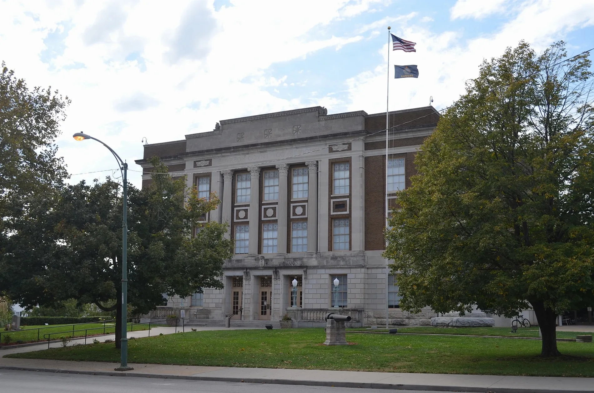
Bourbon County is a Kansas county mapped at administrative level 6. It has 14,360 residents and covers 1,655,000,000 square metres. The county was established in 1855. Fort Scott is the county seat and contains the Fort Scott National Historic Site.
Elk County is a Kansas county mapped at administrative level 6. It has 2,483 residents and covers 1,684,000,000 square metres. The county was established in 1875. Elk County is part of the United States state of Kansas.
Hodgeman County is mapped at administrative level 6 in Kansas. Its boundary is included in the regional map of the United States state. Kansas covers approximately 213,100 square kilometres. The county belongs to a state with 2,937,880 residents in 2020.
Meade County is a Kansas county mapped at administrative level 6. It has 4,055 residents and covers 2,537,000,000 square metres. The county was established in 1873. Meade is the county seat in southwestern Kansas.
Anderson County is a Kansas county mapped at administrative level 6. It has 7,836 residents and covers 1,513,000,000 square metres. The county was established in 1855. Garnett is the county seat of Anderson County.
Edwards County is mapped at administrative level 6 in Kansas. The county is part of a state with approximately 213,100 square kilometres of area. Its local boundary is recorded separately from Kansas cities and administrative-level-8 subdivisions. Kansas was founded in 1861.
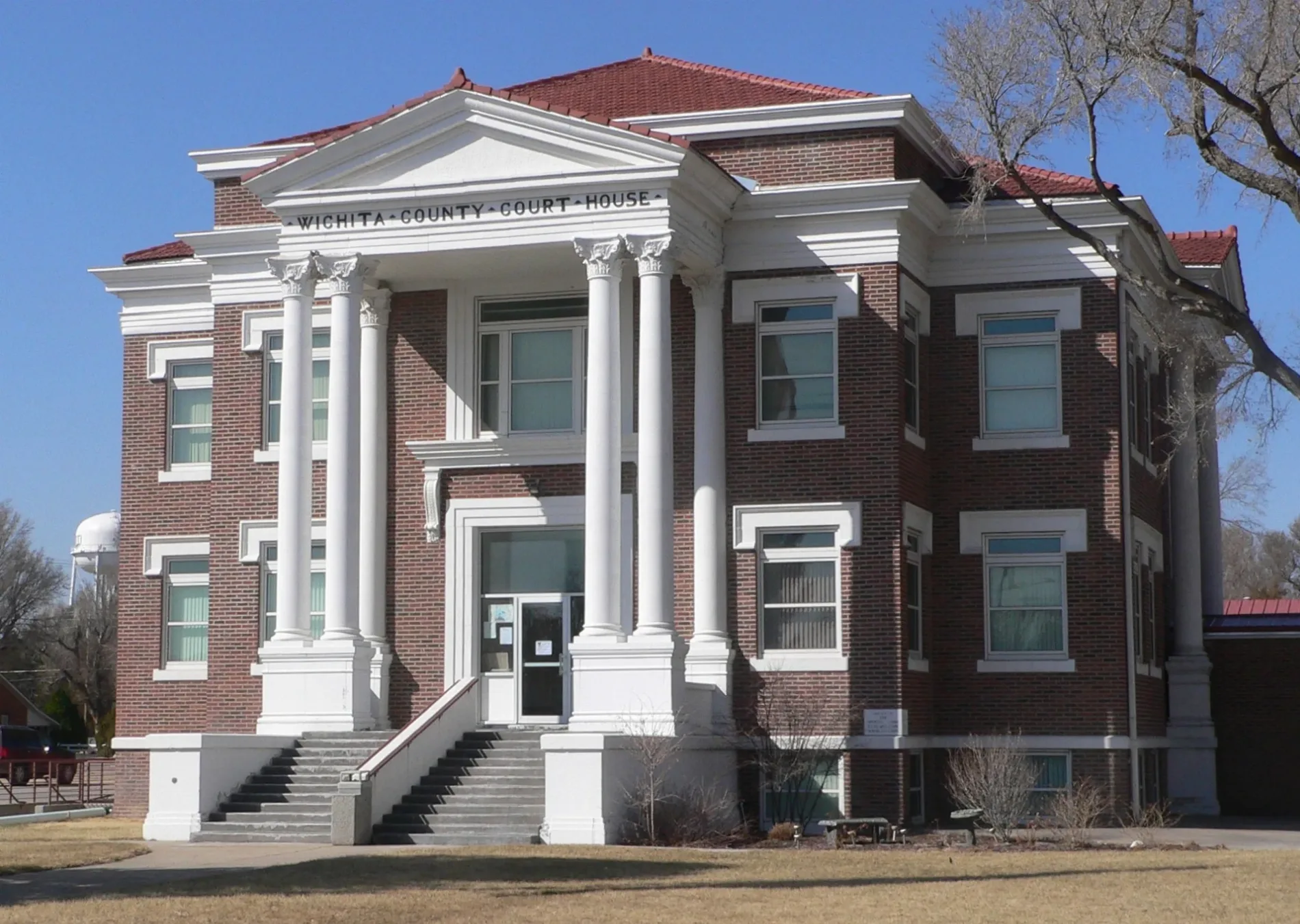
Wichita County is a Kansas county mapped at administrative level 6. It has 2,152 residents and covers 1,861,000,000 square metres. The county was established in 1873. Leoti is the county seat in western Kansas.
Rice County is a Kansas county mapped at administrative level 6. It has 9,427 residents and covers 1,886,000,000 square metres. The county was established in 1867. Lyons is the county seat of Rice County.
Thomas County is mapped at administrative level 6 in Kansas. The county forms part of the state’s mapped administrative structure. Kansas covers approximately 213,100 square kilometres and has a state reference elevation of 600 metres. Colby is the county seat in northwestern Kansas.
Stafford County is mapped at administrative level 6 in Kansas. Its county boundary is included in the Kansas regional map. The state had 2,937,880 residents in 2020. Stafford County is distinct from local administrative-level-8 places.
Norton County is mapped at administrative level 6 in Kansas. Norton is the county seat in northwestern Kansas. The county belongs to a state covering approximately 213,100 square kilometres. Kansas was admitted to the United States in 1861.
Grant County is mapped at administrative level 6 in Kansas. Ulysses is the county seat in southwestern Kansas. The county is part of a state with approximately 2,937,880 residents. Kansas covers about 213,100 square kilometres.
Chautauqua County is a Kansas county mapped at administrative level 6. It has 3,379 residents and covers 1,670,000,000 square metres. The county was established in 1875. Sedan is the county seat in southeastern Kansas.
Wallace County is a Kansas county mapped at administrative level 6. It has 1,512 residents and covers 2,367,000,000 square metres. The county was established in 1888. Sharon Springs is the county seat in western Kansas.
Rooks County is a Kansas county mapped at administrative level 6. It has 4,919 residents and covers 2,319,000,000 square metres. The county was established in 1867. Stockton is the county seat of Rooks County.
Jackson County is a Kansas county mapped at administrative level 6. It has 13,232 residents and covers 1,704,000,000 square metres. The county was established in 1859. Holton is the county seat in northeastern Kansas.
Morton County is a Kansas county mapped at administrative level 6. It has 2,701 residents and covers 1,891,000,000 square metres. The county was established in 1886. Elkhart is the county seat in the southwestern corner of Kansas.
Hamilton County is a Kansas county mapped at administrative level 6. It has 2,518 residents and covers 2,584,000,000 square metres. The county was established in 1873. Syracuse is the county seat in southwestern Kansas.
Wabaunsee County is a Kansas county mapped at administrative level 6. It has 6,877 residents and covers 2,071,000,000 square metres. The county was established in 1855. Alma is the county seat, and the county lies in east-central Kansas.
Riley County is a Kansas county mapped at administrative level 6. It has 71,959 residents and covers 1,611,000,000 square metres. The county was established in 1855. Manhattan, home of Kansas State University, is the county seat.
Gray County is a Kansas county mapped at administrative level 6. It has 5,653 residents and covers 2,252,000,000 square metres. The county was established in 1881. Cimarron is the county seat in southwestern Kansas.
Republic County is mapped at administrative level 6 in Kansas. Belleville is the county seat in north-central Kansas. The county belongs to a state covering approximately 213,100 square kilometres. Kansas had 2,937,880 residents in 2020.
Rawlins County is mapped at administrative level 6 in Kansas. Atwood is the county seat in northwestern Kansas. The county is part of the United States state founded in 1861. Kansas covers approximately 213,100 square kilometres.
Barton County is a Kansas county mapped at administrative level 6. It has 25,493 residents and covers 2,332,000,000 square metres. The county was established in 1867. Great Bend is the county seat, and the Arkansas River crosses the county.
Cowley County is a Kansas county mapped at administrative level 6. It has 34,549 residents and covers 2,933,000,000 square metres. The county was established in 1867. Winfield is the county seat, while Arkansas City is another major city in southern Kansas.
Dickinson County is a Kansas county mapped at administrative level 6. It has 18,402 residents and covers 2,207,000,000 square metres. The county was established in 1857. Abilene is the county seat and the former home of President Dwight D. Eisenhower.
Osborne County is mapped at administrative level 6 in Kansas. Osborne is the county seat in north-central Kansas. The county belongs to a state covering approximately 213,100 square kilometres. Kansas was admitted to the United States in 1861.
Logan County is mapped at administrative level 6 in Kansas. Oakley is the county seat in western Kansas. The county is part of the state’s 213,100-square-kilometre area. Kansas had 2,937,880 residents in 2020.
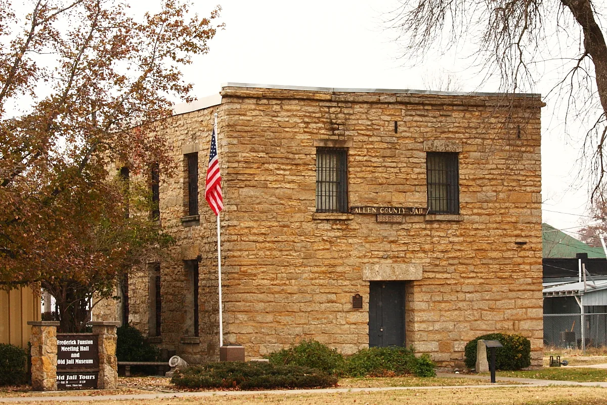
Allen County is a Kansas county mapped at administrative level 6. It has 12,526 residents and covers 1,308,000,000 square metres. The county was established in 1855. Iola is the county seat in southeastern Kansas.
Greenwood County is a Kansas county mapped at administrative level 6. It has 6,016 residents and covers 2,985,000,000 square metres. The county was established in 1855. Eureka is the county seat of Greenwood County.
Douglas County is a Kansas county mapped at administrative level 6. It has 118,785 residents and covers 1,229,000,000 square metres. The county was established in 1855. Lawrence is the county seat and the home of the University of Kansas.
Pawnee County is mapped at administrative level 6 in Kansas. Larned is the county seat in central Kansas. The county is included in the regional map of a state covering approximately 213,100 square kilometres. Kansas had 2,937,880 residents in 2020.
Coffey County is a county in east-central Kansas, mapped at administrative level 6. It has 8,360 residents and covers 1,695,000,000 square metres. The county was established in 1855. Burlington is the county seat of Coffey County.
Butler County is a Kansas county mapped at administrative level 6. It has 67,380 residents and covers 3,746,000,000 square metres. The county was established in 1855. El Dorado is the county seat, and the county lies east of Wichita in south-central Kansas.













 Public transit map Kansas Legend
  Bicycle map Kansas Legend
  Pedestrian map Kansas Legend