
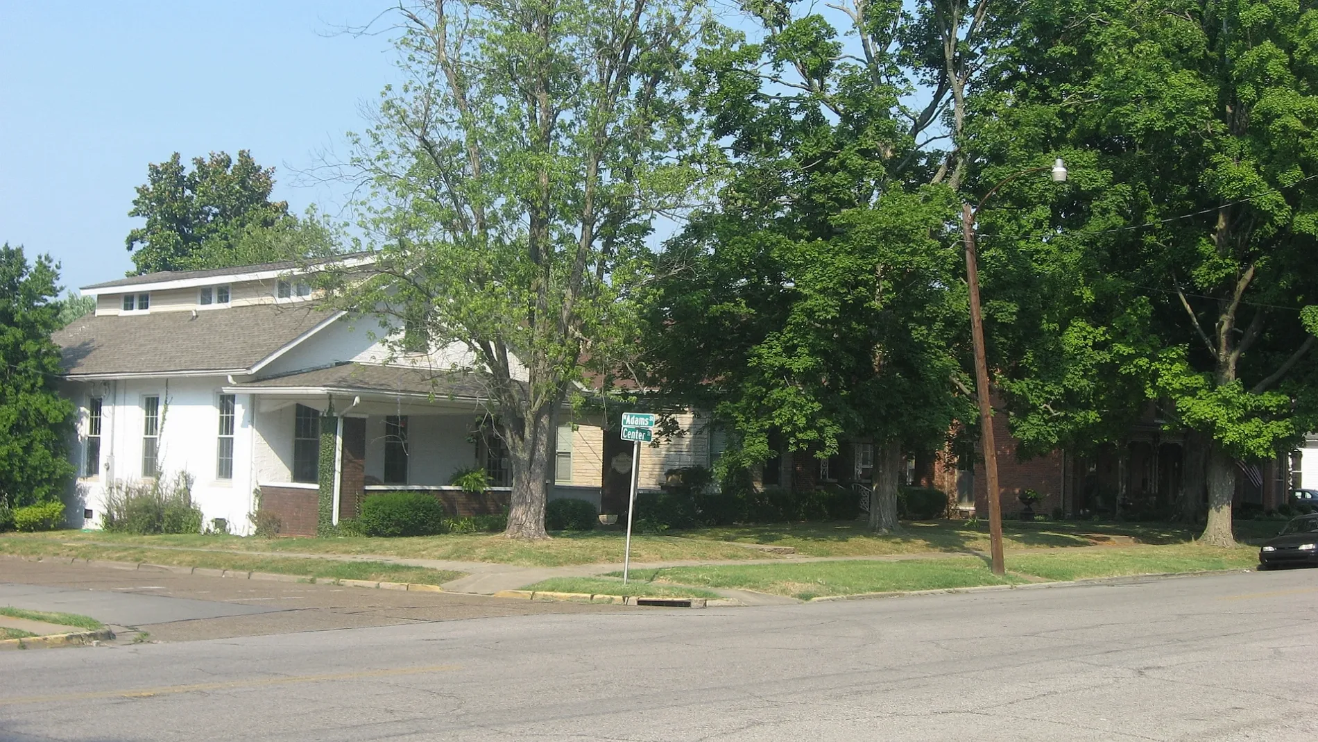
North Alves Street in Henderson, Kentucky
North Alves Street in Henderson is a residential street. It runs in a northeast-southwest direction starting from 4th Street and crosses 3rd Street, 2nd Street, 1st Street and Cs-1063 and ends at Center Street.
- Road Type
- residential street
- Route
- northeast-southwest
Image
Places of worship
Restaurants
Gas stations
Auto parts stores
Gift shops
Tourist information centers
Fast food restaurants
Clothing stores
Cafes
Copy shops
Florists
Secondhand stores
Schools
Pharmacies
Delis
Banks
Antique stores
Streets nearby
2nd StreetHoly Name School, Walgreens, Wendy's, Shell, Coffee Shop, Henderson, Rookie's Sports Bar and Restaurant, Commonwealth Kitchen & Bar, Horsefeathers Gifts, Bagelrama!
500 ft
Cs-13820.1 mi
Fulcher Avenue0.1 mi
North Adams Street0.2 mi
4th StreetCSX Henderson Yard, NAPA Auto Parts
0.2 mi
North Ingram Street0.2 mi
North Holloway Street0.2 mi
Cs-10630.2 mi
Center Street0.2 mi
1st StreetSimon's Shoes, Alles Brothers, Concord Custom Cleaners, The Color Connection, Tacoholics, The Planet, This & That Consignment, Fast Print, Inc, Wild Turkey Cock, Popeyes
0.3 mi
North Green StreetThe Pizza Station, Thorntons, Walgreens, Henderson Church of Christ
0.3 mi
Carlisle Street0.3 mi
North Julia Street0.3 mi
Harts Alley0.3 mi
North Alvasia StreetTikay Carribean Taste LLC
0.3 mi
Lambert Street0.3 mi
Beals Alley0.4 mi
North Elm StreetO'Daniel's Flower Shop, A & J Consignment, The Elm - Consignments & More, Old National Bank, Rally's, Klassy Kids, Memories Past & Present
0.4 mi
5th Street0.4 mi
Clark Street0.4 mi
Forest Avenue0.4 mi
3rd StreetTea Cafe & Gift Shop, Third Street House Gift Shop, Crick & Fife Pediatricians
0.4 mi
Short 7th Street0.4 mi
Heilman Avenue0.4 mi
Pennel Street0.4 mi
7th StreetSeventh Street School
0.5 mi
North Main StreetConfederate Raid on Newburgh, A Civil War Action, Abba's Music, Oh My Goodness at Balfour, Paisleys Gift Shop, The Gold Mine, Planters Coffeehouse, The Clothes Horse, Just Plus!, The Bank of Henderson, A Day To Remember Florist, Gallery Gifts & Bridal
0.5 mi
6th Street0.5 mi
Bob Posey Street0.5 mi
8th Street Court0.5 mi
8th Street0.6 mi
Banks nearby
Fifth Third Bank0.3 mi
Independence Bank0.3 mi
Buildings nearby
Worsham Wedding Chapel0.4 mi
Aruzo0.4 mi
Commercial buildings nearby
Holy Name School300 ft
Fast food restaurants nearby
McDonald's0.4 mi
Captain D's0.4 mi
Guest houses nearby
L&N Bed and Breakfast0.5 mi
Motels nearby
Henderson Downtown Motel0.4 mi
Parks nearby
Kimmel Park0.4 mi
The Perch Pocket Park0.4 mi
Places of worship nearby
Holy Name of Jesus Catholic Church0.2 mi
First United Methodist Church0.3 mi
Henderson’s First Baptist Church0.4 mi
Railways nearby
LH&STL Subdivision0.2 mi
CSX Henderson Subdivision0.4 mi
School buildings nearby
Central Academy0.3 mi
Thelma B. Johnson Early Learning Center0.5 mi
Public transit map Henderson Legend
| Railway | |
| Bus | |
| Streetcar |
Bicycle map Henderson Legend
| Bike path | |
| Bike lane on roadway | |
| Cycling allowed on bus lane | |
| Bicycle street | |
| Open to cyclists | |
| Open to cyclists, good path | |
| Cycling prohibited | |
| Cobblestone |
| Long-distance bike route | (depending on scale) | |
| Long-distance bike route |
Pedestrian map Henderson Legend
| Path |
| Long-distance hiking trail | (depending on scale) | |
| Long-distance hiking trail | ||
| Pedestrians prohibited |