
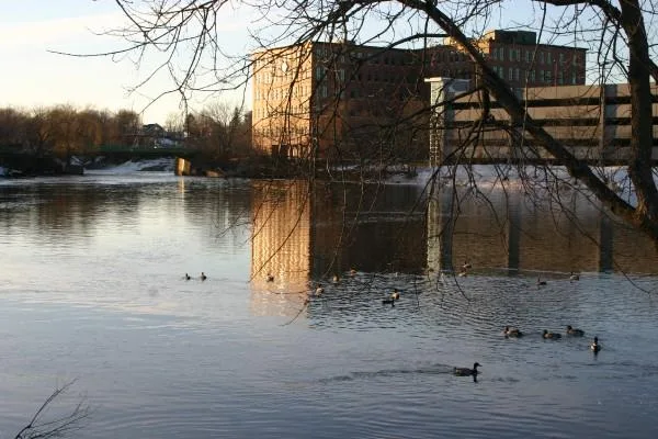
Presumpscot River in Falmouth, Maine
Presumpscot River in Falmouth is a river. Presumpscot River also exists in Portland, Westbrook, Standish, Gorham and Windham. Ⓦ.
- Waterway Type
- river
Post offices
Cemeteries
Pharmacies
Ice cream shops
Stationery stores
Hair salons
Thrift stores
Restaurants
Places of worship
Schools
Movie theaters
Convenience stores
Police stations
Supermarkets
Tourist information centers
Auto repair shops
Department stores
Dentist offices
Shoe stores
Sporting goods stores
Galleries
Variety stores
Streets nearby
Allen Avenue0.1 mi
Maple Street0.2 mi
Falls Road0.3 mi
Allen Avenue ExtensionPleasant Hill
0.3 mi
Lower Falls Road0.3 mi
Cleaves Farm Road0.3 mi
Veronica Lane0.3 mi
Sherwood Drive0.4 mi
Knight Hill Road0.4 mi
Heather Lane0.4 mi
Winding River Lane0.4 mi
Pleasant Hill Road0.4 mi
Penny Lane0.4 mi
Daniels Way0.4 mi
Clifton Road0.4 mi
Falmouth RoadMcCrann Preserve
0.4 mi
River Place0.5 mi
Maccabe Road0.5 mi
Sweet Fern Lane0.5 mi
Oakland Road0.5 mi
Stonecrest Drive0.5 mi
Merrill Road0.5 mi
Thistle Lane0.5 mi
Wright Way0.6 mi
Pine Road0.6 mi
Plumwood Way0.6 mi
Brackett Road0.6 mi
Stapleford Drive0.6 mi
Carriage Road0.6 mi
Bridgewater Lane0.6 mi
Pleasant Hill West0.6 mi
Middle RoadD W Lunt School, Emmaus Church, Emmaus Lutheran Church
0.6 mi
Eustis Farm Road0.6 mi
Pleasant Hill Green Loop0.6 mi
Pleasant Hill East0.7 mi
Pleasant Hil0.7 mi
Entwood Road0.7 mi
William Way0.7 mi
Cole Street0.7 mi
Oak Ridge Way0.7 mi
Country Lane0.7 mi
Barre Way0.7 mi
Blueberry Lane0.7 mi
Rebecca Way0.8 mi
Disused railways nearby
Berlin Subdivision0.6 mi
Nature reserves nearby
Berle Mill Pond0.7 mi
Pleasant Hill Woods Preserve0.7 mi
Parks nearby
Walton Park150 ft
Grave School Park0.3 mi
| Length | 43 |
|---|---|
| Located in | Maine |
| Country | United States |
| Source | Sebago Lake |
| Mouth | Atlantic Ocean |
| Tributary | Pleasant River |
 Public transit map Falmouth Legend
| Railway | |
| Bus | |
| Streetcar |
 Bicycle map Falmouth Legend
| Bike path | |
| Bike lane on roadway | |
| Cycling allowed on bus lane | |
| Bicycle street | |
| Open to cyclists | |
| Open to cyclists, good path | |
| Cycling prohibited | |
| Cobblestone |
| Long-distance bike route | (depending on scale) | |
| Long-distance bike route |
 Pedestrian map Falmouth Legend
| Path |
| Long-distance hiking trail | (depending on scale) | |
| Long-distance hiking trail | ||
| Pedestrians prohibited |