
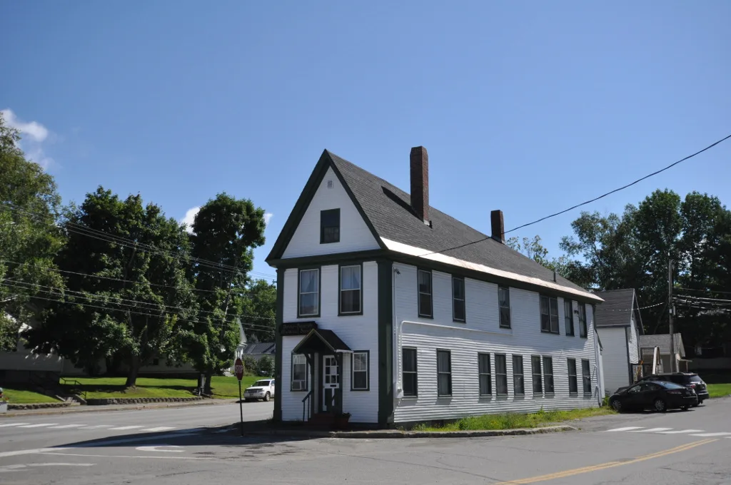
Lawrence Street in Dover-Foxcroft, Maine
Lawrence Street in Dover-Foxcroft is a residential street. It runs in an east-west direction starting from South Street and crosses Court Street. It ends in a cul-de-sac. Lawrence Street also exists in York County, Androscoggin County, Cumberland County, Kennebec County and Knox County.
- Road Type
- residential street
- Route
- east-west
Image
Banks
Recycling stations
Police stations
Shopping malls
Car dealerships
Motels
Restaurants
Fire stations
Movie theaters
Gas stations
Convenience stores
Auto parts stores
Places of worship
Museums
- dih cheese fort (Web) – approx. 0.2 mi.
Farm supply stores
Florists
Gift shops
Cell phone stores
Streets nearby
Mayo Street400 ft
Sunset View0.1 mi
High Street0.1 mi
South StreetFamily Eye Care, Piscataquis Chamber of Commerce, Dover-Foxcroft Redemption Center
0.1 mi
Harvey Street0.2 mi
Wiley Street0.2 mi
Pleasant StreetDover-Foxcroft, Foxbrook Variety, Dover-Foxcroft Fire Department
0.2 mi
Court Street0.2 mi
County Street0.3 mi
Cricket Lane0.3 mi
Pearl Street0.3 mi
East Main Streetdih cheese fort, Athens Pizza, Pats Pizza, Bangor Savings Bank, Bob's Sugarhouse, Center Theatre
0.3 mi
Monument Square0.3 mi
North StreetChurch of the Nazarene, Foxcroft Printing
0.3 mi
West Main StreetGulf, Irving, Subway, Dollar Tree, Dover Audology and Hearing Aid, Butterfields, Mountains Market, Camden National Bank, Foxcroft Pharmacy, Dunkin'
0.3 mi
Monument Sqaure0.3 mi
Moosehead LaneCongregational Church of Dover-Foxcroft, Mission Impizzable
0.3 mi
Nicholas Lane0.4 mi
Essex StreetEssex Street Dental
0.4 mi
Exchange Street0.4 mi
River StreetLiving Word Assembly of God Church, United Baptist Church of Dover, United Methodist Church, Central Hall Dover-Foxcroft Town Offices, Dover Foxcroft Police Department
0.4 mi
Railroad Avenue0.4 mi
Lincoln StreetChloes Collections Florist, Bobs Farm Home and Garden
0.4 mi
Davis Street0.4 mi
Lilac Lane0.5 mi
Riverside Avenue0.5 mi
Central Avenue0.5 mi
Edes Avenue0.5 mi
Dover-Foxcroft Recreational Rail Trail0.5 mi
Spring Street0.5 mi
Buildings nearby
Dover-Foxcroft Public Works0.2 mi
Attractions nearby
Dover-Foxcroft Historical Society0.2 mi
Buildings nearby
Peaks House0.3 mi
Community centers nearby
Masonic Temple0.3 mi
Courthouses nearby
Piscataquis County Courthouse0.3 mi
Drugstores nearby
Walgreens0.2 mi
Hotels nearby
Bed and Breakfast0.4 mi
Ice cream shops nearby
Pats Dairyland0.2 mi
Libraries nearby
Thompson Free Library0.3 mi
Police stations nearby
Piscataquis County Sheriff0.2 mi
Post offices nearby
Dover Foxcroft Post Office0.4 mi
Restaurants nearby
The Mill0.3 mi
Rivers nearby
Piscataquis River0.3 mi
Shopping malls nearby
Union Square Mall0.3 mi
Sports fields nearby
Municipal Basketball Court0.4 mi
Streams nearby
Dunham Brook0.4 mi
Supermarkets nearby
Will’s Shop’n Save0.4 mi
Weirs nearby
Upper Dam0.3 mi
Other nearby
Dover-Foxcroft substation0.2 mi
Public transit map Dover-Foxcroft Legend
| Railway | |
| Bus | |
| Streetcar |
Bicycle map Dover-Foxcroft Legend
| Bike path | |
| Bike lane on roadway | |
| Cycling allowed on bus lane | |
| Bicycle street | |
| Open to cyclists | |
| Open to cyclists, good path | |
| Cycling prohibited | |
| Cobblestone |
| Long-distance bike route | (depending on scale) | |
| Long-distance bike route |
Pedestrian map Dover-Foxcroft Legend
| Path |
| Long-distance hiking trail | (depending on scale) | |
| Long-distance hiking trail | ||
| Pedestrians prohibited |