
Deblois Flight Strip in Deblois, Maine
Deblois Flight Strip in Deblois is an airfield. Ⓦ.
- Operator
- State of Maine Department of Transportation
Image
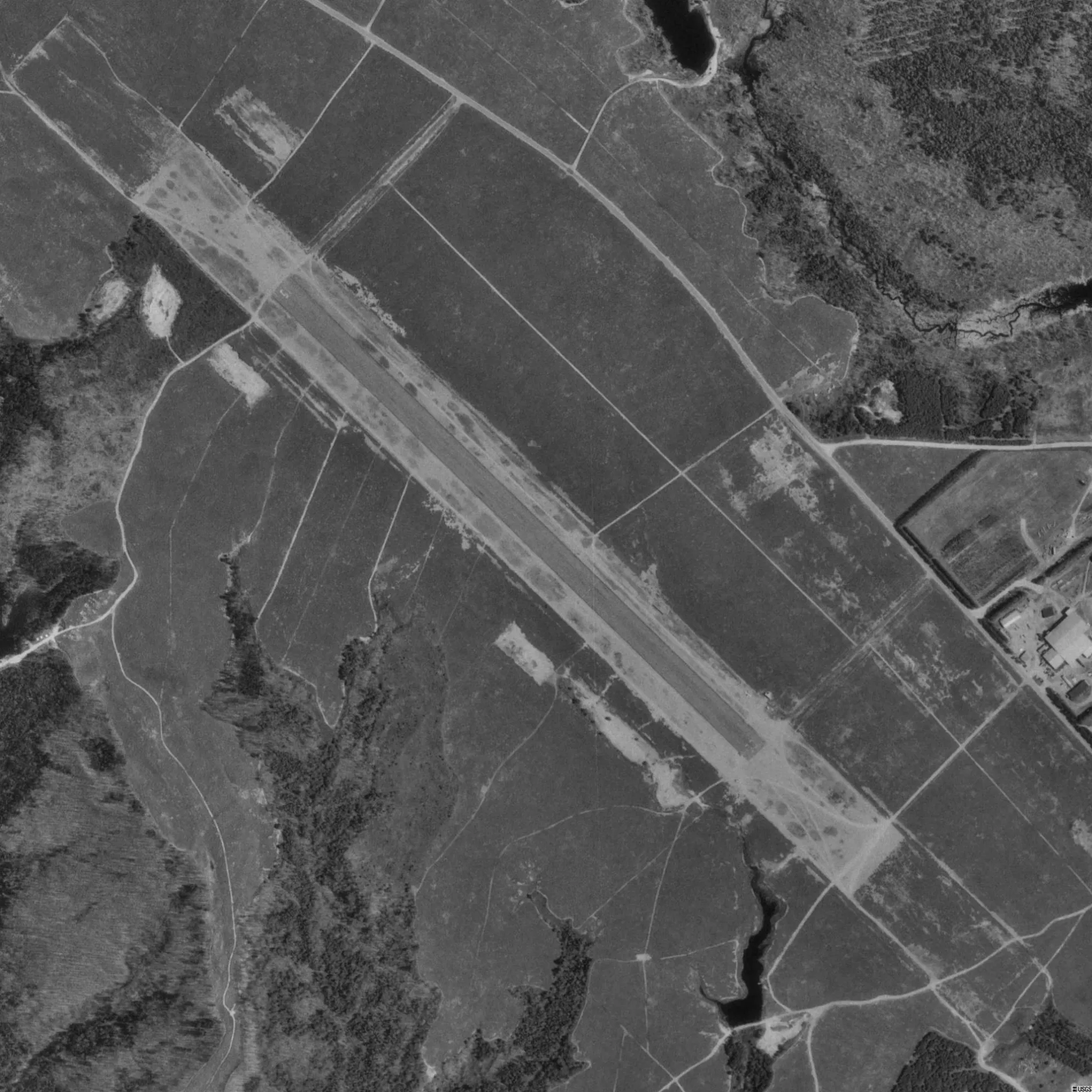
Streets nearby
Air Strip0.6 mi
Lower Road0.8 mi
Eleanor Mae Road1.5 mi
Route 1931.5 mi
Gravel Pit Road1.8 mi
Velvet Road1.8 mi
Hardwood Ridge Road1.8 mi
River Bend Road2.1 mi
Gulf Road2.2 mi
Kinane Lane2.3 mi
Rearing Pool Road2.3 mi
Beddington RoadDeblois
2.4 mi
Lane Road2.4 mi
Somtuesy Way2.6 mi
Schoodic Lake Road2.7 mi
Baseline Road2.8 mi
Hatchery Road2.9 mi
East Fork Road3.0 mi
North Main Street3.0 mi
Unnamed 16 Road3.1 mi
Unnamed 17 Road3.1 mi
Salmon Lane3.2 mi
East Branch Road3.3 mi
Old Popal Hill Road3.4 mi
Long Pond Road3.5 mi
Horseshoe Pond Road3.6 mi
Dams nearby
Lower JR Grant Dam2.1 mi
Mic-Mac Dam2.2 mi
Fire stations nearby
Deblois Volunteer Fire Department2.1 mi
Forests nearby
Dorman Island3.1 mi
Nature reserves nearby
Popple Hill Preserve2.8 mi
Bog Brook Wildlife Management Area3.4 mi
McHatton Brook Preserve3.7 mi
Rivers nearby
Narraguagus River2.4 mi
Great Falls Branch3.1 mi
Schoodic Brook3.1 mi
Streams nearby
Bog Stream2.6 mi
Crotch Camp Brook2.7 mi
Fickett Brook3.1 mi
Steel Meadow Brook3.2 mi
Corliss Brook3.2 mi
MacHatton Brook3.5 mi
Town halls nearby
Deblois Town Hall2.1 mi
Waters nearby
Mic-Mac Pond2.1 mi
Oak Pond3.0 mi
West Pike Brook Pond3.2 mi
Spring Hole Pond3.2 mi
East Pike Brook Pond3.5 mi
Other nearby
Deblois Substation2.0 mi
| Named after | Deblois |
|---|---|
| Elevation | 66 m |
| Located in | Maine |
| Country | United States |
 Public transit map Deblois Legend
| Railway | |
| Bus | |
| Streetcar |
 Bicycle map Deblois Legend
| Bike path | |
| Bike lane on roadway | |
| Cycling allowed on bus lane | |
| Bicycle street | |
| Open to cyclists | |
| Open to cyclists, good path | |
| Cycling prohibited | |
| Cobblestone |
| Long-distance bike route | (depending on scale) | |
| Long-distance bike route |
 Pedestrian map Deblois Legend
| Path |
| Long-distance hiking trail | (depending on scale) | |
| Long-distance hiking trail | ||
| Pedestrians prohibited |