
Westfield Montgomery Mall in Bethesda, MD 20817
Westfield Montgomery Mall in Bethesda, MD 20817 (Montgomery County) is a retail area. Westfield Montgomery Mall is also known as Montgomery Mall. Ⓦ.
- Land Use
- retail area
Image
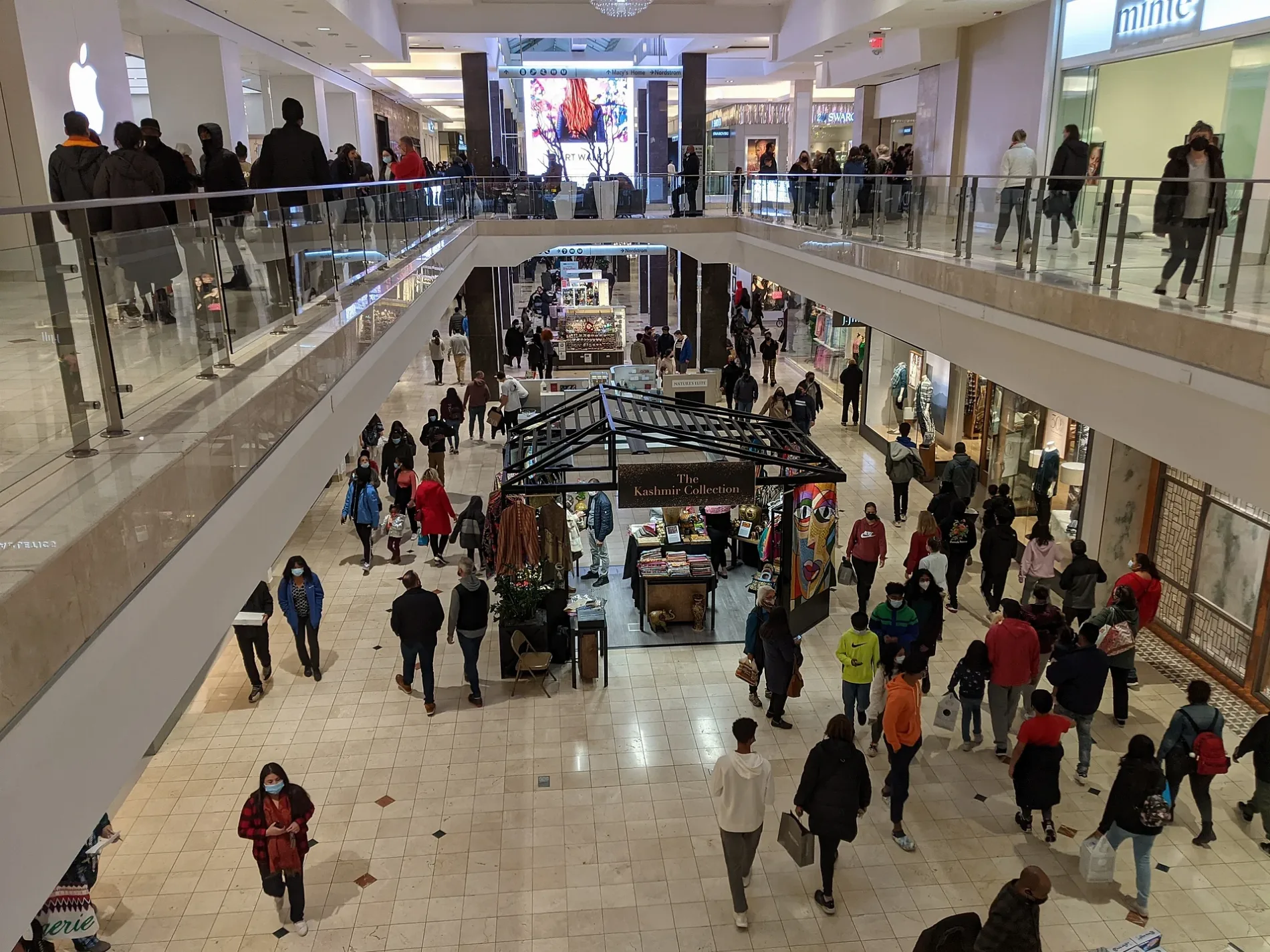
Streets nearby
Democracy BoulevardDemocracy Blvd & Old Georgetown Rd, Democracy Bl at Davis Library, Democracy Bl at Bells Mill Rd, Democracy Bl at Mayfield Dr, Bethesda Fire Station Company 26, Democracy Blvd & Fernwood Rd, Center for Back Injury Prevention and Rehabilitation, Center For Repetitive Motion Disorders, Democracy Bl at Fernwood Rd
0.2 mi
Swansong Way0.2 mi
Thomas Branch Drive0.2 mi
Coventry Way0.3 mi
Westlake TerraceA, E, D, B, C
0.3 mi
Auto Park AvenueFive Guys
0.3 mi
Bosworth Court0.3 mi
Taveshire Way0.3 mi
Derbyshire Lane0.3 mi
Surreywood Lane0.3 mi
Motor City Drive0.3 mi
Langhorne Court0.3 mi
Fernwood RoadFernwood Rd at Thomas Spring Wy, Fernwood Road & Rock Spring Drive Northbound, Fernwood Rd at Rock Spring Dr, Fernwood Rd & Camalier Building, Fernwood Road at Camalier Building (opp. Demo. Plaza), Fernwood Road & Camalier Building Northbound, Fernwood Rd at Marriott Dr
0.3 mi
Beacon Terrace0.3 mi
Rockledge DriveRockledge Dr. (at Rockledge Executive Plaza), Rockledge Dr. (bet. Rock Spring Dr. and Democracy Blvd.), Rockledge & Rock Spring Demo Mid-block Southbound, Rockledge Dr + Rock Spring Dr, Rockledge Drive & 6901 Opposite Northbound, Rockledge Drive (opp. 6901), Rockledge Drive & Lockheed Martin Opposite Northbound, Rockledge Dr. (opp. Lockheed Martin), Rockledge 6710 & Rock Center Opposite Eastbound, 6710 Rockledge Dr., Rockledge & Rockledge Executive Plaza Eastbound
0.3 mi
Lakeview Drive0.3 mi
Buttermere Lane0.3 mi
Galsworthy Place0.4 mi
Westlake Drive0.4 mi
Taveshire Court0.4 mi
Bells Mill Road0.4 mi
Arizona Circle0.4 mi
Greyswood RoadFernwood
0.4 mi
Woodhill RoadWildwood Hills
0.4 mi
Viceroy Alley0.4 mi
Crestberry Place0.4 mi
Crestberry Lane0.4 mi
Windflower Way0.4 mi
Bluestar Avenue0.4 mi
Sanvitalia Street0.4 mi
Artesa Lane0.4 mi
Derbyshire Court0.5 mi
Greentree RoadGreentree Rd and Bradmoor Dr, Greentree Rd and Ridge Pl
0.5 mi
Silver Linden Street0.5 mi
Piedmont Alley0.5 mi
Weaver Alley0.5 mi
Harden Alley0.5 mi
Buildings nearby
National Center for Research Resources0.4 mi
Locust Grove0.4 mi
Commercial areas nearby
Democracy Center0.3 mi
Construction sites nearby
The Grandview0.4 mi
Fire stations nearby
Station 26 - Bethesda0.4 mi
Hardware stores nearby
The Home Depot0.3 mi
Parking lots nearby
Nordstrom Parking100 ft
Parks nearby
Stratton Local Park0.3 mi
Residential areas nearby
Lakeview House Apartments0.3 mi
Retail areas nearby
Westlake Crossing0.3 mi
Retail buildings nearby
Westfield Montgomery300 ft
Streams nearby
Thomas Branch0.2 mi
| Year built | 1968 |
|---|---|
| Official opening | 1968 |
| Elevation | 98 m |
| Located in | Montgomery County |
| Postal code | 20817 |
| Country | United States |
| Website | https://www.westfield.com/united-states/montgomery |
| Official name | Westfield Montgomery |
| Has part | Arclight Bethesda, Movies at Montgomery Mall |
| Location | Bethesda |
 Public transit map Montgomery County Legend
| Railway | |
| Bus | |
| Streetcar |
 Bicycle map Montgomery County Legend
| Bike path | |
| Bike lane on roadway | |
| Cycling allowed on bus lane | |
| Bicycle street | |
| Open to cyclists | |
| Open to cyclists, good path | |
| Cycling prohibited | |
| Cobblestone |
| Long-distance bike route | (depending on scale) | |
| Long-distance bike route |
 Pedestrian map Montgomery County Legend
| Path |
| Long-distance hiking trail | (depending on scale) | |
| Long-distance hiking trail | ||
| Pedestrians prohibited |