
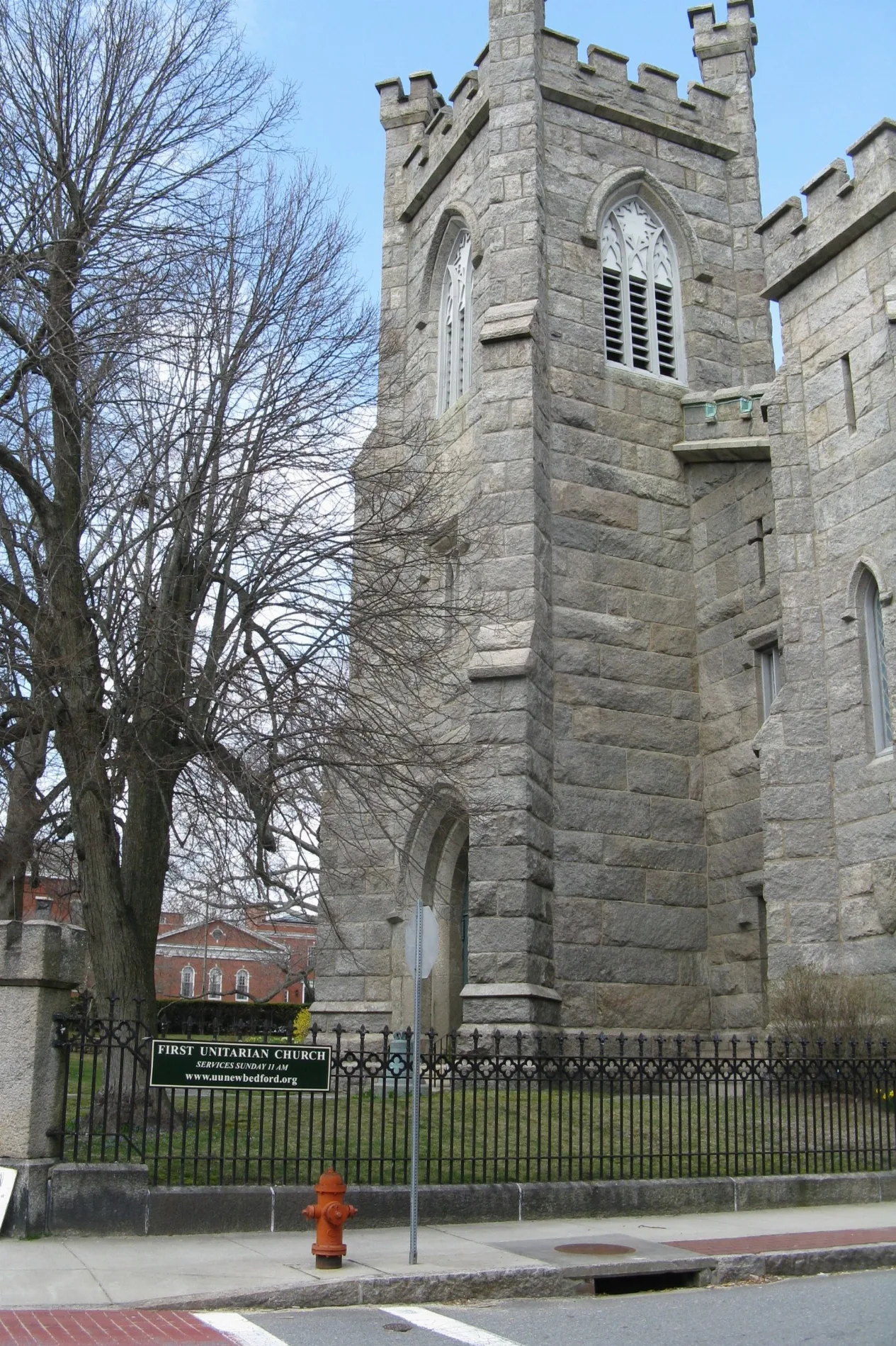
First Unitarian Church in New Bedford, Massachusetts
First Unitarian Church in New Bedford is a Church, Eighth Street 71. It is also known as Congregational Church and was built in 1830. First Unitarian Church also exists in Worcester County.
- House Number
- 71
- Street
- Eighth Street
- Amenity
- place of worship
- Building Type
- church
Image
Cell phone stores
Funeral homes
Libraries
Clothing stores
Beauty salons
Hair salons
Drugstores
Fast food restaurants
Bus stops
Copy shops
Bookstores
Florists
Galleries
Restaurants
Police stations
Cafes
Bars
Museums
Schools
Variety stores
Mailboxes
Streets nearby
Eighth Street200 ft
Spring StreetNativity Prep School
500 ft
Morgan StreetDonaghy New Day Cremation and Funeral Care
500 ft
Mechanics Lane500 ft
Park PlaceBristol County Print Shop
500 ft
Market Street0.1 mi
North Sixth StreetDunkin'
0.1 mi
North Orchard Street0.1 mi
South Sixth StreetSixes & Sevens
0.1 mi
Middle StreetUSPS, NOAA Fisheries
0.2 mi
Sears CourtFamily Dollar, New Bedford Police Station
0.2 mi
Seventh Street0.2 mi
Sixth Street0.2 mi
Orchard StreetPinnacle Auto Sales, US Post Office, Dollar Tree
0.2 mi
County StreetNew Bedford Law Library, McDonald's, Luzo Auto Center, Saint James Church
0.2 mi
East Clinton Street0.2 mi
Pleasant StreetNew Bedford Terminal
0.2 mi
Clinton Place0.2 mi
Walnut Street0.2 mi
Purchase StreetSafelite AutoGlass, GLORY, New Bedford Fire Department, Cafe Arpeggio
0.2 mi
Barkers Lane0.2 mi
William StreetNew Bedford Whaling National Historical Park, Arthur Moniz Gallery, New Bedford Merchant, New Bedford Whaling National Historical Park Visitor Center, New Bedford Free Public Library, New Bedford Art Museum, No Problemo, New Bedford Barber Co, Celia's Boutique, Rite Aid, TL6 the Gallery, April Evans Beauty Lounge Beautique, King of Kings
0.3 mi
Dover Street0.3 mi
Kempton StreetChina Star, Dominos stop, Bedford towers stop, Kempton St. Stop, Walgreens stop, Sunoco, One Stop Gas
0.3 mi
Frederick Douglass Lane0.3 mi
Acushnet AvenueRyder, Honey Dew, Pronails Spa, Clifford Chapel, Elizabeth's, Donaghy School
0.3 mi
Madison Street0.3 mi
Apartment buildings nearby
Star Store0.2 mi
The Regency0.3 mi
Banks nearby
Bank of America0.2 mi
Buildings nearby
Bristol County South Registry of Deeds500 ft
New Bedford Meeting House0.1 mi
Keith Hastings Federal Building0.2 mi
U.S. Custom House0.3 mi
Rotch-Jones Duff House & Garden Museum0.3 mi
Clothing stores nearby
Carter's Clothing0.3 mi
Galleries nearby
Gallery X300 ft
Garages nearby
Regency Parking Garage0.3 mi
Gardens nearby
Rotch- Jones-Duff House & Garden Museum0.3 mi
Hotels nearby
New Bedford Harbor Hotel0.1 mi
Parking lots nearby
SRTA New Bedford Terminal0.2 mi
Parks nearby
Wings Court Park0.2 mi
Peter Francisco Square0.2 mi
54th Massachusetts Plaza0.3 mi
Custom House Square Park0.3 mi
Places of worship nearby
Center Trinity United Methodist Church500 ft
Post offices nearby
New Bedford Post Office0.2 mi
Technical colleges nearby
Cherry Building0.2 mi
Town halls nearby
New Bedford City Hall0.1 mi
| Year built | 1830 |
|---|---|
| Located in | New Bedford |
| Country | United States |
 Public transit map New Bedford Legend
| Railway | |
| Bus | |
| Streetcar |
 Bicycle map New Bedford Legend
| Bike path | |
| Bike lane on roadway | |
| Cycling allowed on bus lane | |
| Bicycle street | |
| Open to cyclists | |
| Open to cyclists, good path | |
| Cycling prohibited | |
| Cobblestone |
| Long-distance bike route | (depending on scale) | |
| Long-distance bike route |
 Pedestrian map New Bedford Legend
| Path |
| Long-distance hiking trail | (depending on scale) | |
| Long-distance hiking trail | ||
| Pedestrians prohibited |